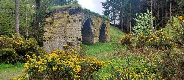
Alnwick Pants
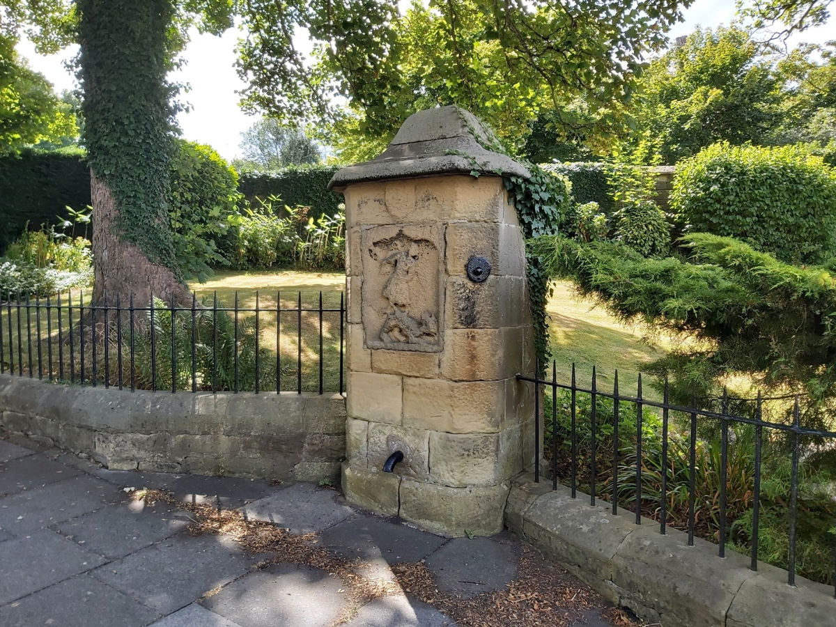
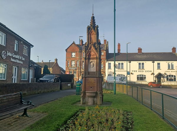
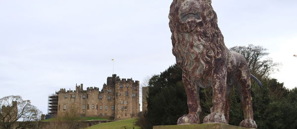
Fountain In Alnwick, Northumberland
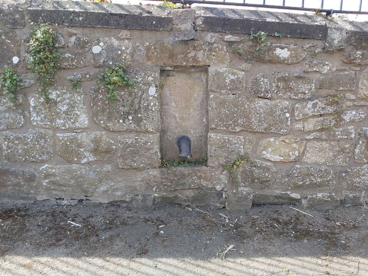
Fountains and water troughs throughout Alnwick that were once used to provide clean water.
I know a lot of you will be reading that headline thinking - why on earth is the Fabulous North talking about trousers in Alnwick! But the pants in this case are public water fountains that were used a while back to get your clean water.
When I was wandering around taking photographs of the pants I was approached by a lovely local lady who asked if I knew what these were for. As I hadn't done my research yet, she kindly divulged the wonderful story of the pants.
To paraphrase, she informed me that during the 18th century, the first Duke of Northumberland had set up home in Alnwick Castle and that the Alnwick population was also growing. As such, lots of water fountains with troughs called pants were installed throughout the town. But during the 19th century, there was a big outbreak of Cholera and the pants were a hot spot, so the Duke (at the time) had to put his hand in his pocket and pipe water direct into people's homes instead.
Some of the pants have been destroyed, moved or replaced, but you can still find plenty of them around, all within walking distance of each other.
Here is a map to show you where they all are and you can easily find them all with a saunter for a few hours.
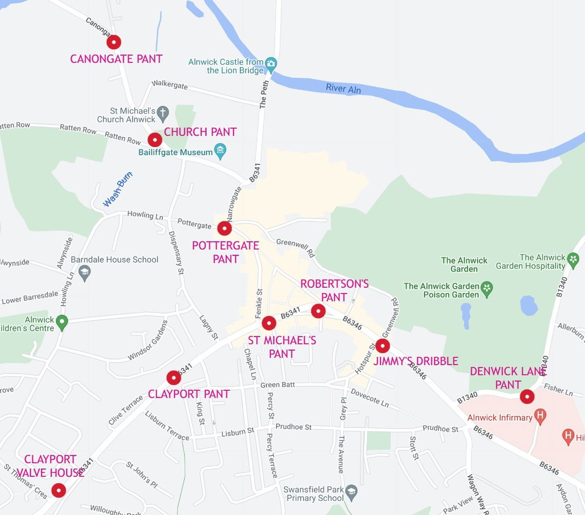
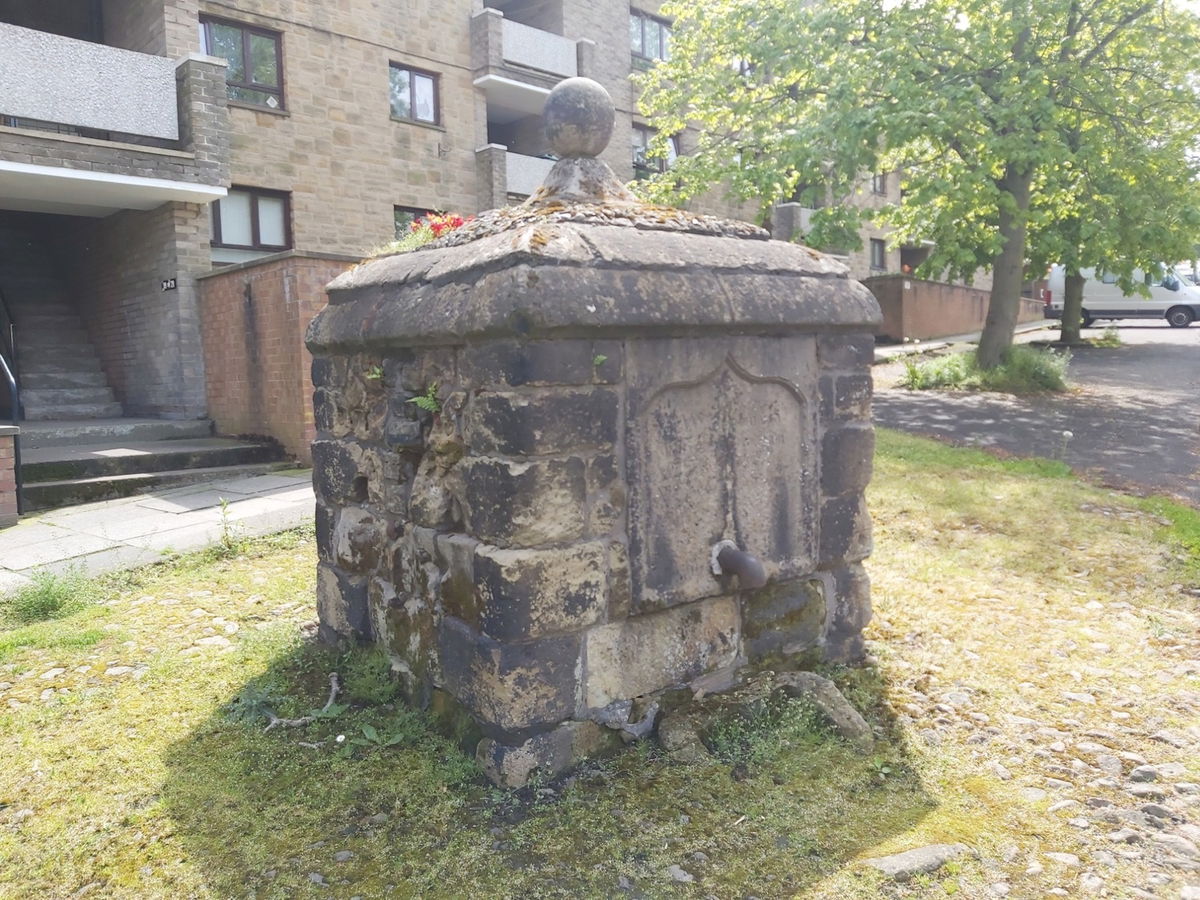
St Michael's Pant
Located halfway towards the west end of the high street this is the second oldest pant, originally being built in 1759 and is also known as the High Pant. The pant is adorned with a statue of St Michael and Dragon, which is the symbol of the town.
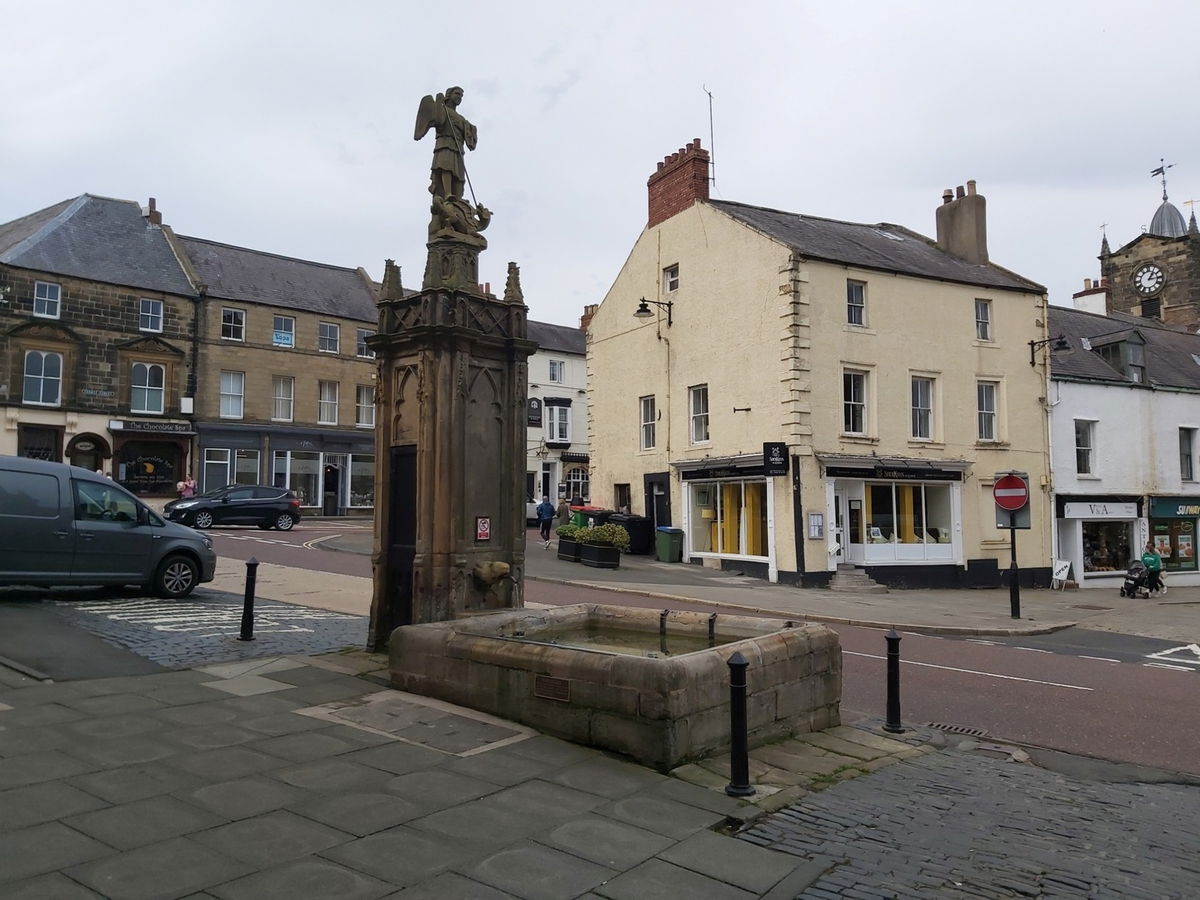

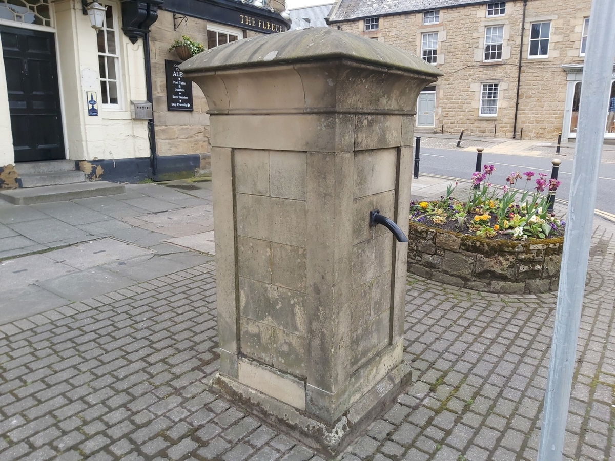
Robertson's Pant
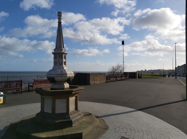
This pant was gifted to Alnwick by Adam Robertson who was a local alderman. In 1891, his wife Nancy laid the foundation stone and it was complete and declared open in June of the same year by Earl Percy. The pant is located halfway along the high street.
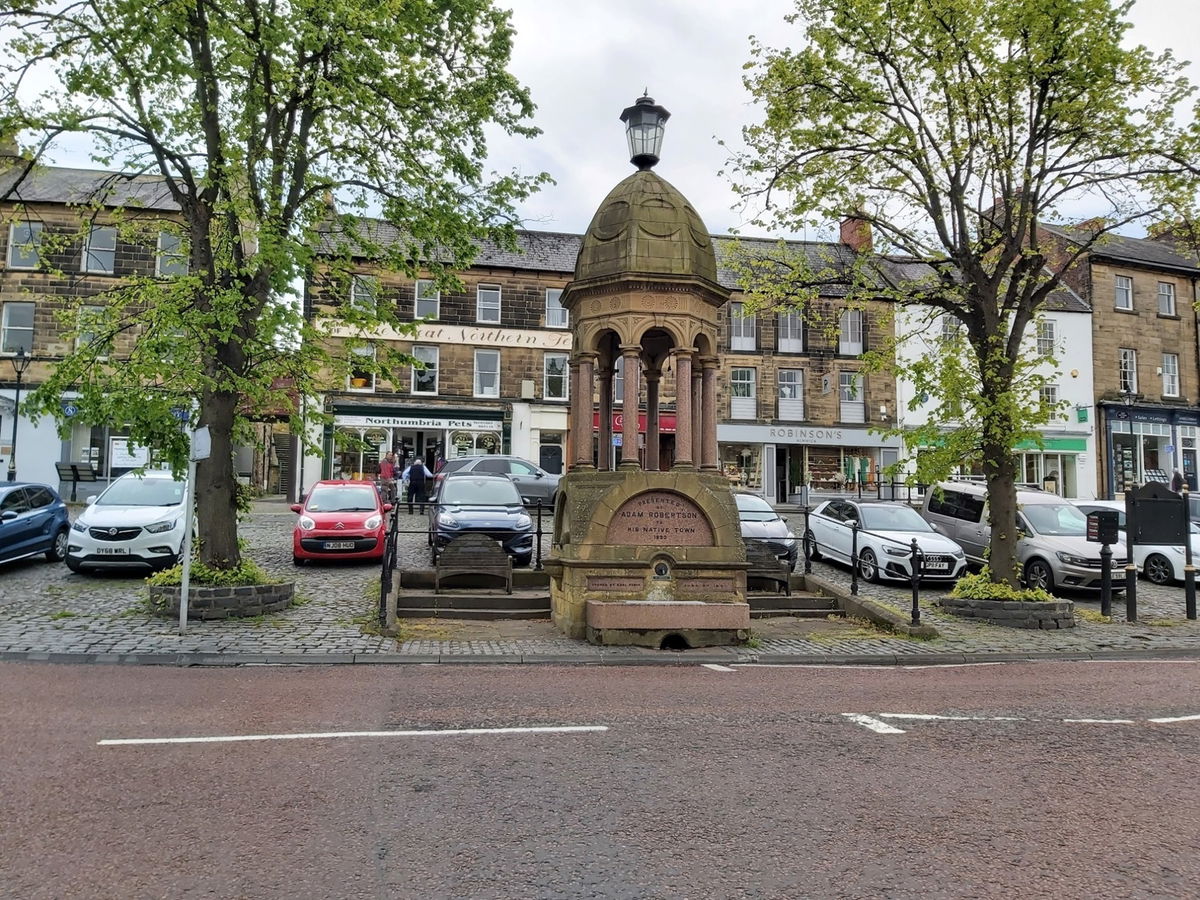
Pottergate Pant
This pant lives at the bottom of Pottergate next to the Harry Hotspur statue and the Dirty Bottles hotel and was built in 1875 replacing a previous pant from 1790. The inscriptions on the pant commemorate William Dickson, who was a local historian, solicitor and founder of the Alnwick and County Bank.
Clayport High Pant
Dated at 1755 this is the oldest pant in Alnwick. Just follow Clayport Street south west until you see it.
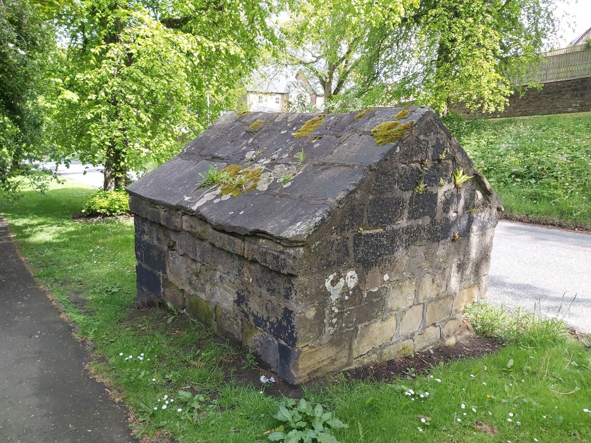
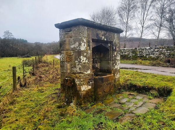
Clayport Valve House
If you continue to follow Clayport Street south west and up the bank then you will find the Valve House. This stone shed contains a control valve used to manage the flow of water and so didn't actually provide water directly to the public.
Jimmy's Dribble
Just east of the Bondgate Tower is the wonderfully named Jimmy's Dribble pant, named as such due to the poor water supply, although it's unknown who Jimmy was. The structure you see today is a reconstruction of an earlier pant, built around 1870 as the original was demolished by a vehicle in 1953, then rebuilt by Alnwick District Council in 1993. The original pant in this location was known as Fleece Pant.
Denwick Lane Pant
If you continue east towards Barter Books then head left up Denwick Lane at the war memorial, then in 50m you will find the Denwick Lane Pant. Originally located in the Bondgate Without area of Alnwick, following the completion of the Tenantry Column it was moved to its present location. The rear door is missing so you have a peep inside.
Church Pant
You will find this pant at the junction of Bailiffgate, Canongate and Ratten Row. It has the town crest of St Michael defeating the dragon.
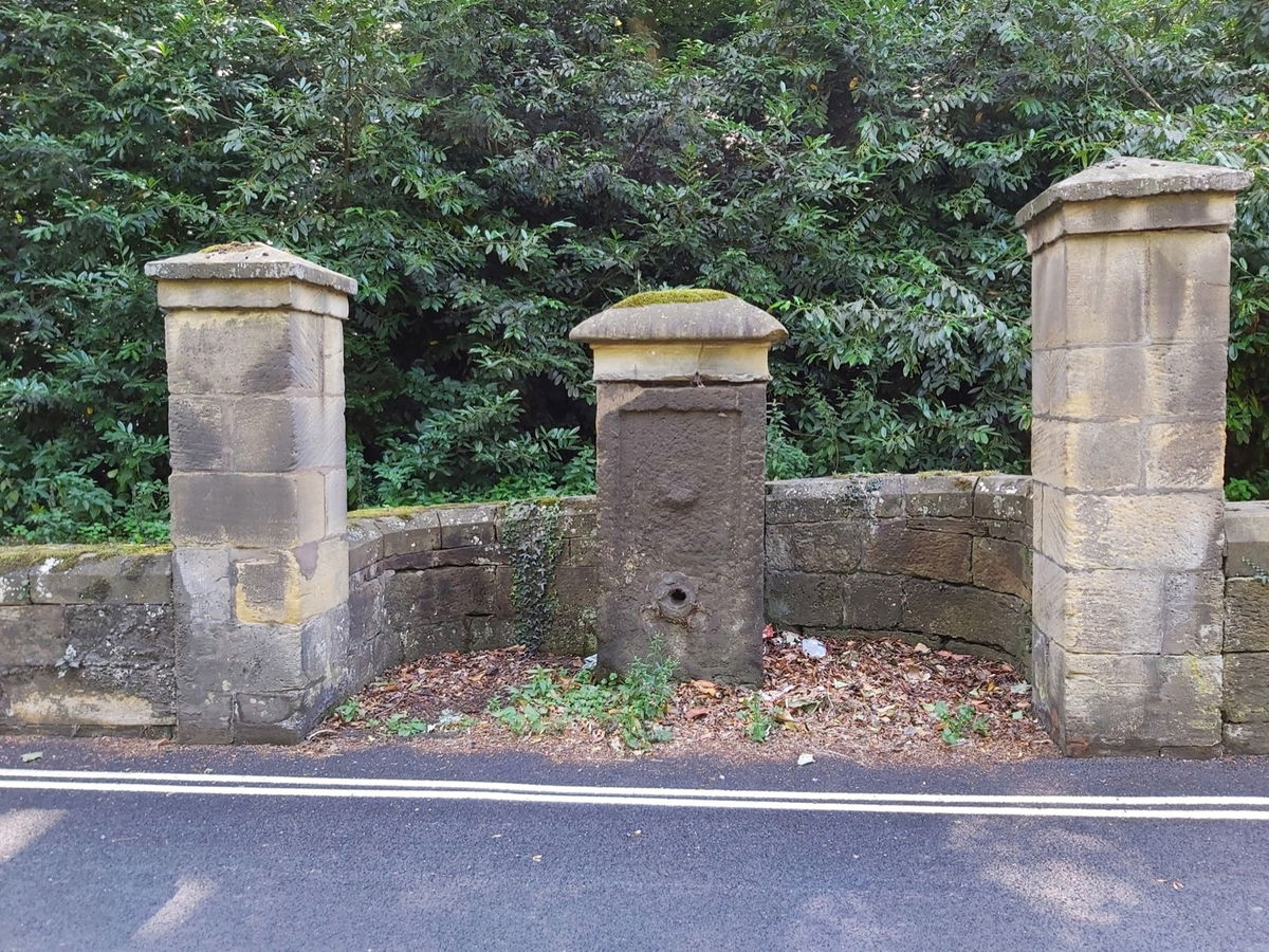
Canongate Pant
Just further on from the Church pant you will find the Canongate pant, set into the wall just before you get to the bridge. According to old maps, there were apparently two pants here.
Other Pants
There were two other pants called Tower Pant located on the corner of Tower Lane and Green Batt Pant at the top of St Michael's Lane, but neither exist anymore.
For more history and information on the pants head over to the Pants Of Alnwick ran by the Alnwick Chamber of Trade and Alnwick Civic Society.
Get 2 points if you have visited this place. Already visited by 155 VIPs.
Login to the VIP area to add places to your bucket list, mark them as visited and more importantly see where you rank on the league table.
How To Find Alnwick Pants
Where To Park For Alnwick Pants?
Lat / Long
55.413176, 55.413176
What three words
Loads of parking throughout Alnwick, but probably the easiest is to park your car in the supermarket car park.
Contributed by Simon Hawkins
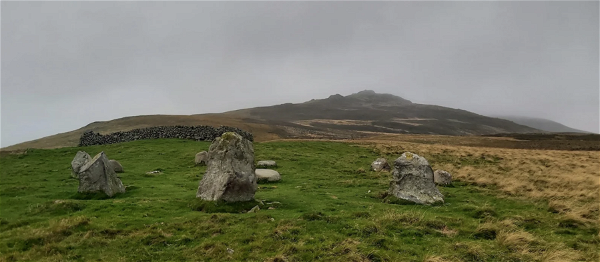
Thanks for checking out this place on the Fabulous North! I do enjoy a wander out in to the countryside trying to find hidden gems that not many people know about. You can't beat a rogue pele tower up a remote hill, a mysterious stone circle or a stunning waterfall secluded in a forest.
More Places from Simon
More Places In Alnwick
Find more fabulous places in Alnwick, Northumberland and if you know of a place we haven't listed, then let us know.
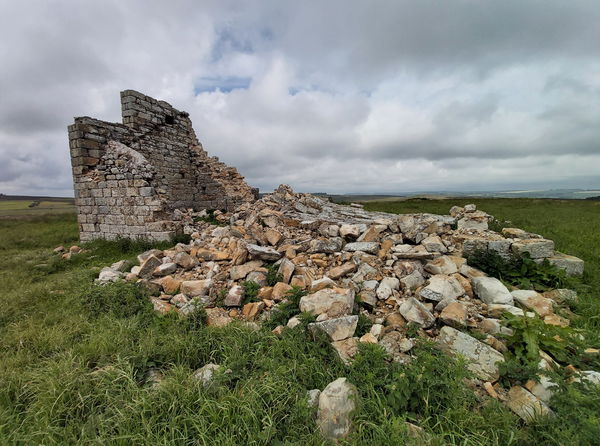
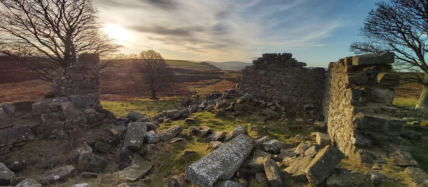
Jenny’s Lantern Folly
Folly Alnwick NorthumberlandA ruin of a folly shaped like a shepherd's hut on the Alnwick moors.
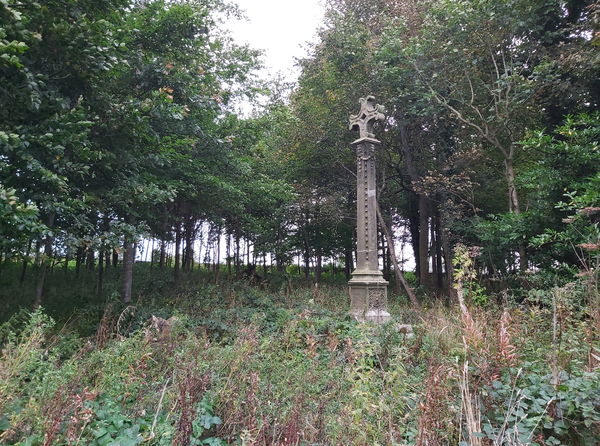
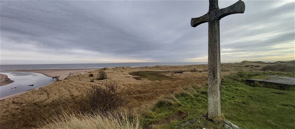
Malcolm III Cross
Statue Alnwick NorthumberlandA stone cross marking where Malcolm III, King Of Scotland was slain at the Battle Of Alnwick.
More Fountains
So this fountain wasn't enough and you want more? Don't worry we have you covered.
Adamson Memorial Drinking Fountain
Fountain Cullercoats Tyne And WearA 19th century fountain dedicated to Bryan Adamson, a lieutenant of the HMS Wasp that was lost at sea.
St Mungo's Well
Fountain Harbottle NorthumberlandA stone pant in Holystone Village named after St Mungo, the patron saint of Glasgow.
Dr Trotter's Memorial
Fountain Bedlington NorthumberlandFountain commemorating Doctor James Trotter, local councillor known as 'Mr Bedlington' during Victorian times.
Find Walks To Alnwick Pants
Find which walks will visit Alnwick Pants and plan your next adventure.

Blast Beach To Easington Pit Cage
9km (6 miles) Seaham County DurhamThis zig-zag walk takes you from Blast Beach at Noses Point Seaham to Easington Pit Cage, then back over Beacon Hill and through Hawthorn Dene. It goes down and up beaches, a viaduct, and a trig point.
Allensford Park
6km (4 miles) Consett County DurhamCircular route starting from Allensford Park, walking along the River Derwent and through The Heaps Country Park, before heading through Balehill Wood.
Cunyan Crags, Langleeford Crags, Hedgehope And Great Standrop
24km (15 miles) Ingram Valley NorthumberlandA hike from Ingram Valley up to Cunyan Crags and then round the back of Hedgehope Hill to the Langleeford crags, before scaling the hill and then on to the Great Standrop.
Walla Crag
9km (6 miles) Keswick CumbriaA nice gentle wander up to Walla Crag in Keswick with spectacular views over Derwent Water.
Wallington House And Gardens
7km (4 miles) Morpeth NorthumberlandA short circular walk around Wallington Hall and the gardens.
Walltown Quarry To Thirlwall Castle
5km (3 miles) Brampton CumbriaA picturesque circular route from Walltown Quarry Country Park, through stunning countryside to Thirlwall Castle and back.
Auchope Cairn And Cheviot Summit From Mounthooly
15km (9 miles) The Cheviots NorthumberlandStarting at Mounthooly, this walk takes us up onto the border ridge, along the top of the Hen Hole before hitting the Cheviot Summit.
Windy Gyle And The Cheviot From Cocklawfoot
23km (14 miles) The Cheviots NorthumberlandA walk up to Windy Gyle, The Cheviot and Auchope Cairn from Cocklawfoot Farm.
Durham Riverside
6km (4 miles) Durham County DurhamA walk following both sides of the River Wear in Durham finding lots of gems including the Durham Cow and the Count's House.
Shaftoe Crags
8km (5 miles) Bolam NorthumberlandA short wander around the spectacular Shaftoe Crags finding a Jubilee Stone, a standing stone and bagging a trig point.
Meggie's Burn And Blyth Coast
6km (4 miles) Blyth NorthumberlandA wander to Meggie's Burn in Blyth and then back along the coast and via the promenade.
Shepherd's Cairn Via Hartside Hill And Brough Law
25km (16 miles) Ingram Valley NorthumberlandFinding the Shepherd's Cairn near Alnham by starting at Ingram and wandering over Hartside Hill, down towards Alnham and then back via Brough Law.

Cullercoats To North Shields
8km (5 miles) Cullercoats Tyne And WearA wander from Cullercoats to Tynemouth and North Shields and then back via the coastal route.
Yearning Law, Border Ridge To Windy Gyle
27km (17 miles) The Cheviots NorthumberlandA wander up Yearning Law to find Yearning Hall, then along the border ridge to Windy Gyle, then back down via Ward Law.
4 Hillocks And A Ridge Walk Outside Durham
7km (4 miles) Durham County DurhamA 7km easy walk covering Shincliffe Pinnock Hill, High Woods, Mountjoy, Maiden Castle, and Whinney Hill on the outskirts of Durham.
The Leas
7km (4 miles) South Shields Tyne And WearA 4km stretch of limestone cliffs, grassland and rocky bays. You can visit Marsden Rock, Souter Lighthouse and Whitburn Point Local Nature Reserve on this wander.
Beadnell Bay To Low Newton
13km (8 miles) Beadnell NorthumberlandA circular walk from Beadnell to Low Newton and back. Fairly easy terrain with well marked paths. Perfect for those who enjoy birdwatching.

Old Durham and 6 Bridges
5km (3 miles) Durham County DurhamA walk along The River Wear and into Old Durham Gardens crossing over 6 bridges.
Stonehaugh Circular
7km (4 miles) Stonehaugh NorthumberlandCircular walk starting from Stonehaugh, passing by The Long Drop and ending with a wander through Wark Forest.
Helm Crag
10km (6 miles) Grasmere CumbriaA short and sweet walk up the stunning Helm Crag in Grasmere, Lake District.
Seaton Carew
7km (4 miles) Hartlepool County DurhamA wander around the seaside resort of Seaton Carew in the Borough of Hartlepool.
Cold Law, Great Moor, Coldburn Hill And Views Over Bizzle Crags
21km (13 miles) The Cheviots NorthumberlandA wander in The Cheviots taking in Cold Law, a few crags then over to Coldburn Hill to get some mega views over Bizzle Crags.
Ben Nevis
16km (10 miles) Fort William ScotlandA brutal climb up Ben Nevis, the tallest mountain in the UK.
Darden Lough
7km (4 miles) Elsdon NorthumberlandA wander across the moors in Hepple to Darden Lough and the Darden Pike trig point.
Brough Law And Ingram Hillforts
14km (9 miles) Ingram Valley NorthumberlandA wander around the hillforts in Ingram Valley including Brough Law.
Urban Artworks In Scarborough
6km (4 miles) Scarborough North YorkshireAn urban walk with steel artwork, stone steps, a castle, a church a lighthouse and sea views.
Northumberland Coastal Challenge Walk
42km (26 miles) Bamburgh NorthumberlandA 42km (26 mile) marathon walk starting at Budle Bay and ending in Alnmouth, ran by Shepherds Walks.
Frosterley Circular
8km (5 miles) Frosterley County DurhamBeautiful walk through the Weardale countryside, passing Bishopley Lime Kilns, the remains of Harehope Gill Lead Mine and some examples of Frosterley marble.
Yeavering Bell And Newton Tors
26km (16 miles) The Cheviots NorthumberlandA wander up in the north Cheviots to Newton Tors, Yeavering Bell and Humbleton Hill including a wonderful encounter with the legendary wild goats of The Cheviots!
Corbridge to Aydon Castle
10km (6 miles) Corbridge NorthumberlandWander from Corbridge village to Aydon Castle via lime kilns and stunning countryside.
Dukesfield Arches and Devil's Water
6km (4 miles) Hexham NorthumberlandLovely wander round the Northumberland countryside, with nods to its industrial past.
Crags Around Hedgehope Hill And Langleeford
18km (11 miles) The Cheviots NorthumberlandA wander to find all the crags near Langleeford including Housey Crags, Long Crags, Tathey Crags, Langlee Crags, Middleton Crags and Steel Crag.
Scale Force from Buttermere
7km (4 miles) Buttermere CumbriaA walk to an impressive 51m waterfall on the south-western banks of Crummock Water.
Buttermere Loop
7km (4 miles) Buttermere CumbriaFairly easy loop around Buttermere lake with stunning scenery all around the route.
Red Pike, High Stile, High Crag And Haystacks
23km (14 miles) Buttermere CumbriaA 23km walk covering four Wainwright Fells, including Haystacks which was Wainwright's favourite.
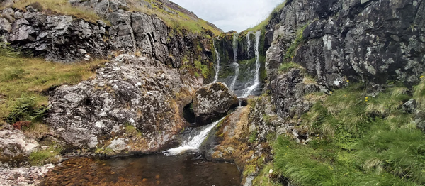
Great Standrop, Cunyan Crags and Linhope Spout
18km (11 miles) Ingram Valley NorthumberlandA wander up to the Great Standrop on Hedgehope Hill via Cunyan Crags and the smaller crags on Dunmoor Hill with a return visit to Linhope Spout.
Marsden Quarry Nature Reserve and Cleadon Hills
5km (3 miles) South Shields Tyne And WearStunning walk through Marsden Quarry up to Cleadon Hills via Cleadon Water Tower and Cleadon Mill. There's lots to see on this walk and plenty of interesting birds for any twitchers.
Tosson Hill
10km (6 miles) Rothbury NorthumberlandA 10km wander up Tosson Hill to bag the trig point.
Bloodybush Edge, Hogdon Law And Weather Cairn
30km (19 miles) The Cheviots NorthumberlandA 30km walk to bag some trig points and chunky hills including Bloodybush Edge, Cushat Law, Hogdon Law and Weather Cairn.
Yeavering Bell
16km (10 miles) The Cheviots NorthumberlandA circular walk starting at Wooler common taking you around Humbleton Hill and across to Yeavering Bell.
Whittle Dene Reservoir Circular
6km (4 miles) Ovingham NorthumberlandA 6km walk around Whittle Dene Reservoirs with stunning views, lime kilns, a bird hide and a wander along the Hadrian's Wall Path.
Simonside and Fontburn Reservoir
15km (9 miles) Rothbury NorthumberlandA 15km hike around the Simonside area visiting Fontburn Reservoir.
Alnwick Riverside And Railways
14km (9 miles) Alnwick NorthumberlandA walk from Alnwick Castle following the river Aln and then back near the old railway.
Hawthorn Woods, Meadow, and Dene
4km (2 miles) Seaham County DurhamDelightful woods, meadows and coastal surprises with mini challenges. Situated near Seaham, County Durham.
Shill Moor And Little Dod
14km (9 miles) Ingram Valley NorthumberlandA wander up to Little Dod then up to the Shill Moor trig point before returning via the valley floor.
Hepburn Moor And Ros Castle
17km (11 miles) Chillingham NorthumberlandA meander from Ros Castle down the west side of Hepburn Moor finding cairns, hillforts, pill boxes, crags and the Blawearie.
Warkworth To Alnmouth
10km (6 miles) Warkworth NorthumberlandA wander from Warkworth to Alnmouth up the coastal path and then a return via the beach visiting St Cuthbert's Cross and Mortuary Chapel on Church Hill.
Seaton Sluice And Holywell Dene
9km (6 miles) Seaton Valley NorthumberlandCircular walk starting from Seaton Sluice, following Holywell Dene to Holywell Pond then onto the waggonways, before returning via the Avenue.
Newburn To Wylam
11km (7 miles) Newburn Tyne And WearA walk along the River Tyne from Newburn to Wylam and then back on the other side.
Berwick Law
1km (1 mile) East Lothian BordersA short walk up to the top of Berwick Law in East Lothian.
Bewick Moor, Cateran Hole, Ros Castle And Blawearie
20km (12 miles) Chillingham NorthumberlandStarting from Eglingham, this route takes your over Bewick Moor to Cateran Hole, a trip up Ros Castle before a visit to the Hepburn Bastle. Then we're back on the moor to the Blawearie Shepherds Hut and some cairns.
Wannie Line
12km (8 miles) Morpeth NorthumberlandA wander on the route of the former Wansbeck or "Wannie Line" railway line that ran from Morpeth to Reedsmouth and Rothbury.
Clennell Street And Shillhope Law
22km (14 miles) The Cheviots NorthumberlandHeading up Clennel Street taking in Shillhope Law and bagging a trig point.
Windy Gyle
19km (12 miles) The Cheviots NorthumberlandA loop taking in Windy Gyle, the border ridge and Murder Cleugh.
Dunmoor Hill And Cunyan Crags
19km (12 miles) The Cheviots NorthumberlandA lovely jaunt up Cunyan Crags then onto Dunmoor Hill in Ingram Valley including Reaveley Hill, a stone circle, Long Crag and Cat Crag.
Helvellyn Via Striding Edge
16km (10 miles) Glenridding CumbriaAn autumnal ascent up Helvellyn via the precarious Striding Edge with Trekking Tom Experiences also taking in Red Tarn, Snake Path, Catstye Cam, Swirral Edge and Birkhouse Moor.
Cheviot and Hedgehope Hill
23km (14 miles) The Cheviots NorthumberlandA wander in the Cheviots bagging seven hills over 500m including Cheviot Summit and Hedgehope Hill, Broadhope Hill, Preston Hill, Scald Hill, Cairn Hill and Comb Fell.
Upper Rothbury And Cartington Hill
21km (13 miles) Rothbury NorthumberlandA wander up on the crags above Rothbury, finding the Rothbury trenches then a trip up Cartington Hill and towards Cartington Castle.
Hen Hole And Cheviot Summit
23km (14 miles) The Cheviots NorthumberlandAn amazing walk sweeping around the back of The Cheviot before ascending up the spectacular Hen Hole and then back down via Scald Hill. Also traversing Cairn Hill, The Cheviot Summit and a visit to Auchope Cairn.
Never Miss A Fabulous Place
If you are afraid of missing out on all the fabulous places we post, or just want to be the first to know, then sign up to the Fabulous North.
Each week we will email you all the brand new places that we visit.
Sign Up To Alerts

Find Us On Facebook
We post all our new places daily on our Facebook Groups page, so join the group today and be notified when we add a new place.
Join Our Facebook GroupAlnwick Pants was listed in Fountain // Northumberland // Alnwick