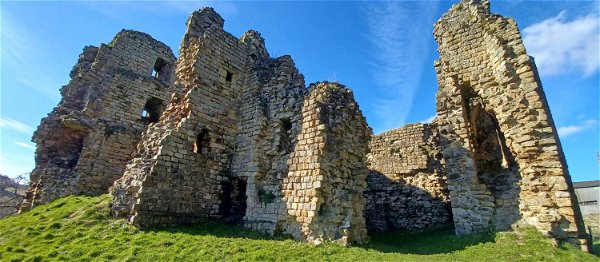
Clifford's Fort
Military In North Shields, Tyne And Wear
A defensive gun battery established near the mouth of the Tyne during the Anglo Dutch Wars in the 17th Century and used during various later conflicts.
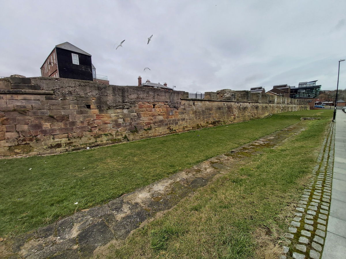
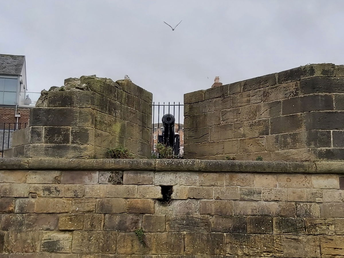
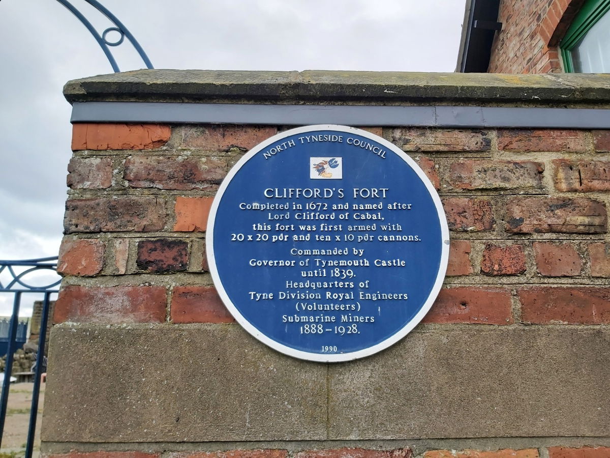
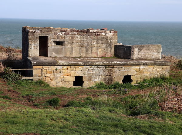
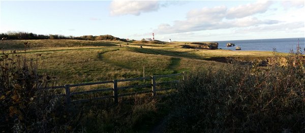
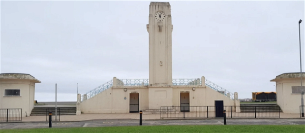
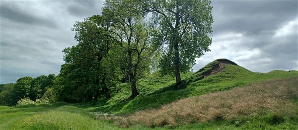
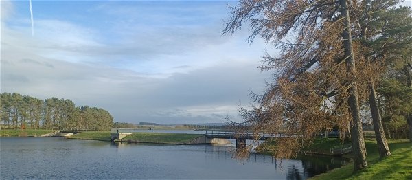
Before the piers were built at the mouth of the River Tyne, it was effectively just a relatively narrow channel between North and South Shields, which could be defended easily with short range artillery. This led to the building of a small fort from gabions by the beginning of the Civil War in 1642. Later that Century, in 1672, as a result of the Anglo Dutch Wars the construction of a more permanent fort, Clifford's Fort (named after Lord Clifford of Chudleigh), was begun. The fort was commissioned by Charles II and comprised polygonal layout based on a design by a Swede, Martin Beckman, who was a renowned military architect. The site was enclosed by a low curtain wall with embrasures (tapered openings) to support the fort's artillery armament which, by 1677, consisted of thirty guns. A dry ditch surrounded the fort while a three storey Keep could be found at the centre. A number of other buildings such as barracks and storerooms also occupied the area within the walls.
This more modern fort, arguably, became more important to the defence of the river than Tynemouth Castle and was always kept in good repair and well-armed. It was a large part of the Country's defence during the Napoleonic Wars and was besieged at one point, though no shots were fired in anger.
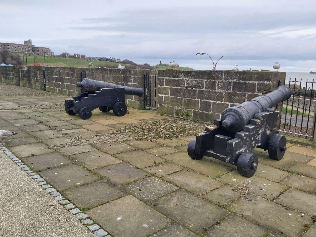
Work began on the two new piers at the entrance to the River Tyne in 1854 and in 1880, due to heavy storms in 1868 which destroyed the half built structures, was well under way to completion. The new piers meant that Clifford's Fort was now too far inland to be useful, added to the inclusion of long range guns at Tynemouth Battery, and soon became obsolete. In 1888 it was re-assigned as the Headquarters of the Tyne Division Royal Engineers (Volunteers). They were responsible for managing the submarine minefield that would have been laid across the River Tyne in times of war. The fort was re-armed in 1895 with two 6-pounder Quick Firing guns installed to counter the threat from Fast Motor Torpedo Boats and these were upgraded to two 12-pounder Quick Firing guns during WWI.
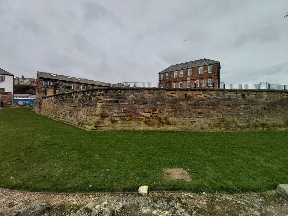
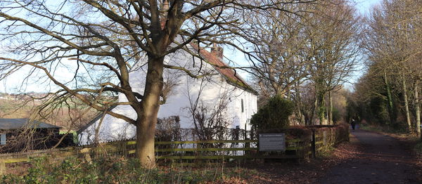
In 1928 Clifford's Fort was decommissioned to be used as a depot and store for local fishermen, though it was brought back into service briefly during WWII, before returning to the use of the fishermen. Today, Clifford's Fort is a Scheduled Monument and the surviving walls are Grade II* Listed while a surviving former 19th Century Barracks building (the Smokehouse) is Grade II Listed. Our photos were taken last year and since then it appears the replica cannons have disappeared, though we have not been able to find out where they have gone. Hopefully they will return soon.
Get 1 point if you have visited this place. Already visited by 74 VIPs.
Login to the VIP area to add places to your bucket list, mark them as visited and more importantly see where you rank on the league table.
How To Find Clifford's Fort
Where Is Clifford's Fort?
Lat / Long
55.009473, -1.433197
What three words
Where To Park For Clifford's Fort?
Lat / Long
55.01101, 55.01101
What three words
Parking is available at the Low Lights Car Park around 100m to the north
Contributed by Andrew Gardner
I love being outdoors, in nature, and experiencing the relaxation it brings. Wandering through the northern countryside seeing unexpected buildings, historic places and occasionally surprised wildlife is one of life's great pleasures.
More Places from Andrew
More Places In North Shields
Find more fabulous places in North Shields, Tyne And Wear and if you know of a place we haven't listed, then let us know.
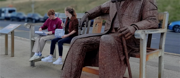
Fiddlers Green Statue
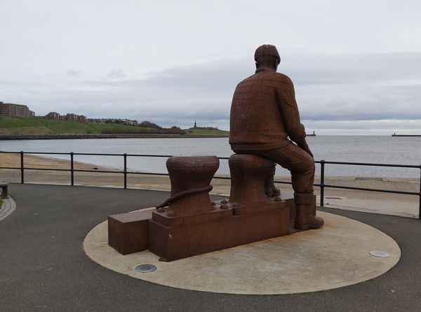
Art North Shields Tyne And WearA metal statue by Ray Lonsdale built as a memorial for fishermen lost at sea from North Shields.
Master Mariners Homes
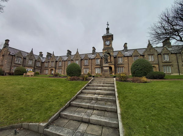
Building North Shields Tyne And WearA Grade II listed building in North Shields built in 1893-94 to provide accommodation for retired and needy seafarers and their wives.
River Tyne Old Buoys
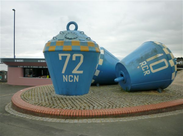
Art North Shields Tyne And WearRedundant marine buoys that are artfully decorated and now sit on the banks of the River Tyne.
More Military
So this military wasn't enough and you want more? Don't worry we have you covered.
Alnmouth Gun Battery
Military Alnmouth NorthumberlandAn old gun battery from the 19th century and reused in WW2.
Flodden Monument And Battlefield
Military Branxton NorthumberlandA monument marking the Battle Of Fodden where the Scottish army of King James IV were heavily defated by the English in a brutal encounter.
Trow Rock Disappearing Gun
Military South Shields Tyne And WearA unique gun that would disappear into its turret to reload, devised during the Crimean War.
Find Walks To Clifford's Fort
Find which walks will visit Clifford's Fort and plan your next adventure.
Allensford Park
6km (4 miles) Consett County DurhamCircular route starting from Allensford Park, walking along the River Derwent and through The Heaps Country Park, before heading through Balehill Wood.
Cunyan Crags, Langleeford Crags, Hedgehope And Great Standrop
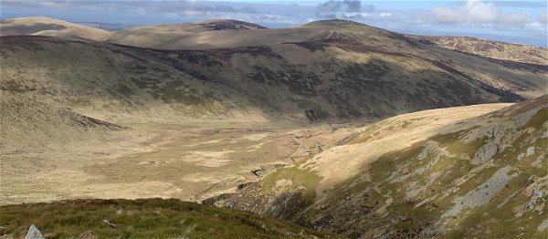
24km (15 miles) Ingram Valley NorthumberlandA hike from Ingram Valley up to Cunyan Crags and then round the back of Hedgehope Hill to the Langleeford crags, before scaling the hill and then on to the Great Standrop.
Walla Crag
9km (6 miles) Keswick CumbriaA nice gentle wander up to Walla Crag in Keswick with spectacular views over Derwent Water.
Walltown Quarry To Thirlwall Castle
5km (3 miles) Brampton CumbriaA picturesque circular route from Walltown Quarry Country Park, through stunning countryside to Thirlwall Castle and back.
Auchope Cairn And Cheviot Summit From Mounthooly
15km (9 miles) The Cheviots NorthumberlandStarting at Mounthooly, this walk takes us up onto the border ridge, along the top of the Hen Hole before hitting the Cheviot Summit.
Windy Gyle And The Cheviot From Cocklawfoot
23km (14 miles) The Cheviots NorthumberlandA walk up to Windy Gyle, The Cheviot and Auchope Cairn from Cocklawfoot Farm.
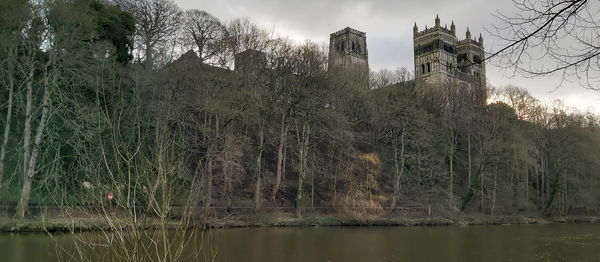
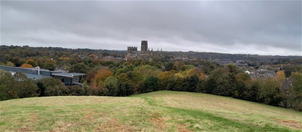
Durham Riverside
6km (4 miles) Durham County DurhamA walk following both sides of the River Wear in Durham.
Shaftoe Crags
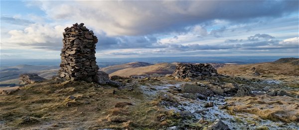
8km (5 miles) Bolam NorthumberlandA short wander around the spectacular Shaftoe Crags finding a Jubilee Stone, a standing stone and bagging a trig point.
Meggie's Burn And Blyth Coast
6km (4 miles) Blyth NorthumberlandA wander to Meggie's Burn in Blyth and then back along the coast and via the promenade.
Shepherd's Cairn Via Hartside Hill And Brough Law
25km (16 miles) Ingram Valley NorthumberlandFinding the Shepherd's Cairn near Alnham by starting at Ingram and wandering over Hartside Hill, down towards Alnham and then back via Brough Law.

Cullercoats To North Shields
8km (5 miles) Cullercoats Tyne And WearA wander from Cullercoats to Tynemouth and North Shields and then back via the coastal route.
Yearning Law, Border Ridge To Windy Gyle
27km (17 miles) The Cheviots NorthumberlandA wander up Yearning Law to find Yearning Hall, then along the border ridge to Windy Gyle, then back down via Ward Law.
4 Hillocks And A Ridge Walk Outside Durham
7km (4 miles) Durham County DurhamA 7km easy walk covering Shincliffe Pinnock Hill, High Woods, Mountjoy, Maiden Castle, and Whinney Hill on the outskirts of Durham.
The Leas
7km (4 miles) South Shields Tyne And WearA 4km stretch of limestone cliffs, grassland and rocky bays. You can visit Marsden Rock, Souter Lighthouse and Whitburn Point Local Nature Reserve on this wander.
Beadnell Bay to Low Newton
13km (8 miles) Beadnell NorthumberlandA circular walk from Beadnell to Low Newton and back. Fairly easy terrain with well marked paths. Perfect for those who enjoy birdwatching.

Old Durham and 6 Bridges
5km (3 miles) Durham County DurhamA walk along The River Wear and into Old Durham Gardens crossing over 6 bridges.
Stonehaugh Circular
7km (4 miles) Stonehaugh NorthumberlandCircular walk starting from Stonehaugh, passing by The Long Drop and ending with a wander through Wark Forest.
Helm Crag
10km (6 miles) Grasmere CumbriaA short and sweet walk up the stunning Helm Crag in Grasmere, Lake District.
Seaton Carew
7km (4 miles) Hartlepool County DurhamA wander around the seaside resort of Seaton Carew in the Borough of Hartlepool.
Cold Law, Great Moor, Coldburn Hill And Views Over Bizzle Crags
21km (13 miles) The Cheviots NorthumberlandA wander in The Cheviots taking in Cold Law, a few crags then over to Coldburn Hill to get some mega views over Bizzle Crags.
Ben Nevis
16km (10 miles) Fort William ScotlandA brutal climb up Ben Nevis, the tallest mountain in the UK.
Darden Lough
7km (4 miles) Elsdon NorthumberlandA wander across the moors in Hepple to Darden Lough and the Darden Pike trig point.
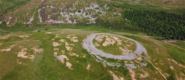
Brough Law And Ingram Hillforts
14km (9 miles) Ingram Valley NorthumberlandA wander around the hillforts in Ingram Valley including Brough Law.
Urban Artworks In Scarborough
6km (4 miles) Scarborough North YorkshireAn urban walk with steel artwork, stone steps, a castle, a church a lighthouse and sea views.
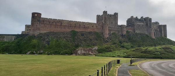
Coastal Challenge Walk
42km (26 miles) Bamburgh NorthumberlandA 42km (26 mile) marathon walk starting at Budle Bay and ending in Alnmouth, ran by Shepherds Walks.
Frosterley Circular
8km (5 miles) Frosterley County DurhamBeautiful walk through the Weardale countryside, passing Bishopley Lime Kilns, the remains of Harehope Gill Lead Mine and some examples of Frosterley marble.
Yeavering Bell And Newton Tors
26km (16 miles) The Cheviots NorthumberlandA wander up in the north Cheviots to Newton Tors, Yeavering Bell and Humbleton Hill including a wonderful encounter with the legendary wild goats of The Cheviots!
Corbridge to Aydon Castle
10km (6 miles) Corbridge NorthumberlandWander from Corbridge village to Aydon Castle via lime kilns and stunning countryside.
Dukesfield Arches and Devil's Water
6km (4 miles) Hexham NorthumberlandLovely wander round the Northumberland countryside, with nods to its industrial past.
A Compelling Cabal Of Crags
18km (11 miles) The Cheviots NorthumberlandA wander to find all the crags near Langleeford including Housey Crags, Long Crags, Tathey Crags, Langlee Crags, Middleton Crags and Steel Crag.
Scale Force from Buttermere
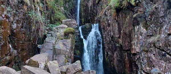
7km (4 miles) Buttermere CumbriaImpressive 51m waterfall on the south-western banks of Crummock Water.
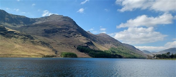
Buttermere Loop
7km (4 miles) Buttermere CumbriaFairly easy loop around Buttermere lake with stunning scenery all around the route.
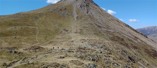
Red Pike, High Stile, High Crag and Haystacks
23km (14 miles) Buttermere Cumbria23km walk covering 4 Wainwright Fells, including Wainwright's favourite, Haystacks.
Great Standrop, Cunyan Crags and Linhope Spout
18km (11 miles) Ingram Valley NorthumberlandA wander up to the Great Standrop on Hedgehope Hill via Cunyan Crags and the smaller crags on Dunmoor Hill with a return visit to Linhope Spout.
Marsden Quarry Nature Reserve and Cleadon Hills
5km (3 miles) South Shields Tyne And WearStunning walk through Marsden Quarry up to Cleadon Hills via Cleadon Water Tower and Cleadon Mill. There's lots to see on this walk and plenty of interesting birds for any twitchers.
Tosson Hill
10km (6 miles) Rothbury NorthumberlandA 10km wander up Tosson Hill to bag the trig point.
Bloodybush Edge, Hogdon Law And Weather Cairn
30km (19 miles) The Cheviots NorthumberlandA 30km walk to bag some trig points and chunky hills including Bloodybush Edge, Cushat Law, Hogdon Law and Weather Cairn.
Yeavering Bell
16km (10 miles) The Cheviots NorthumberlandA circular walk starting at Wooler common taking you around Humbleton Hill and across to Yeavering Bell.
Whittle Dene Reservoir Circular
6km (4 miles) Ovingham NorthumberlandA 6km walk around Whittle Dene Reservoirs with stunning views, lime kilns, a bird hide and a wander along the Hadrian's Wall Path.
Simonside and Fontburn Reservoir
15km (9 miles) Rothbury NorthumberlandA 15km hike around the Simonside area visiting Fontburn Reservoir.
Alnwick Riverside And Railways
14km (9 miles) Alnwick NorthumberlandA walk from Alnwick Castle following the river Aln and then back near the old railway.
Hawthorn Woods, Meadow, and Dene
4km (2 miles) Seaham County DurhamDelightful woods, meadows and coastal surprises with mini challenges. Situated near Seaham, County Durham.
Shill Moor And Little Dod
14km (9 miles) Ingram Valley NorthumberlandA wander up to Little Dod then up to the Shill Moor trig point before returning via the valley floor.
Hepburn Moor And Ros Castle
17km (11 miles) Chillingham NorthumberlandA meander from Ros Castle down the west side of Hepburn Moor finding cairns, hillforts, pill boxes, crags and the Blawearie.
Warkworth To Alnmouth
10km (6 miles) Warkworth NorthumberlandA wander from Warkworth to Alnmouth up the coastal path and then a return via the beach visiting St Cuthburts Cross and Mortuary Chapel on Church Hill.
Seaton Sluice And Holywell Dene
9km (6 miles) Seaton Valley NorthumberlandCircular walk starting from Seaton Sluice, following Holywell Dene to Holywell Pond then onto the waggonways, before returning via the Avenue.
Newburn To Wylam
11km (7 miles) Newburn Tyne And WearA walk along the River Tyne from Newburn to Wylam and then back on the other side.
Berwick Law
1km (1 mile) East Lothian BordersA short walk up to the top of Berwick Law in East Lothian.
Bewick Moor, Cateran Hole, Ros Castle And Blawearie
20km (12 miles) Chillingham NorthumberlandStarting from Eglingham, this route takes your over Bewick Moor to Cateran Hole, a trip up Ros Castle before a visit to the Hepburn Bastle. Then we're back on the moor to the Blawearie Shepherds Hut and some cairns.
Wannie Line
12km (8 miles) Morpeth NorthumberlandA wander on the route of the former Wansbeck or "Wannie Line" railway line that ran from Morpeth to Reedsmouth and Rothbury.
Clennell Street And Shillhope Law
22km (14 miles) The Cheviots NorthumberlandHeading up Clennel Street taking in Shillhope Law and bagging a trig point.
Windy Gyle
19km (12 miles) The Cheviots NorthumberlandA loop taking in Windy Gyle, the border ridge and Murder Cleugh.
Dunmoor Hill And Cunyan Crags
19km (12 miles) The Cheviots NorthumberlandA lovely jaunt up Cunyan Crags then onto Dunmoor Hill in Ingram Valley including Reaveley Hill, a stone circle, Long Crag and Cat Crag.
Helvellyn Via Striding Edge
16km (10 miles) Glenridding CumbriaAn autumnal ascent up Helvellyn via the precarious Striding Edge with Trekking Tom Experiences also taking in Red Tarn, Snake Path, Catstye Cam, Swirral Edge and Birkhouse Moor.
Cheviot and Hedgehope Hill
23km (14 miles) The Cheviots NorthumberlandA wander in the Cheviots bagging seven hills over 500m including Cheviot Summit and Hedgehope Hill, Broadhope Hill, Preston Hill, Scald Hill, Cairn Hill and Comb Fell.
Upper Rothbury And Cartington Hill
21km (13 miles) Rothbury NorthumberlandA wander up on the crags above Rothbury, finding the Rothbury trenches then a trip up Cartington Hill and towards Cartington Castle.
Hen Hole And Cheviot Summit
23km (14 miles) The Cheviots NorthumberlandAn amazing walk sweeping around the back of The Cheviot before ascending up the spectacular Hen Hole and then back down via Scald Hill. Also traversing Cairn Hill, The Cheviot Summit and a visit to Auchope Cairn.
Never Miss A Fabulous Place
If you are afraid of missing out on all the fabulous places we post, or just want to be the first to know, then sign up to the Fabulous North.
Each week we will email you all the brand new places that we visit.
Sign Up To Alerts

Find Us On Facebook
We post all our new places daily on our Facebook Groups page, so join the group today and be notified when we add a new place.
Join Our Facebook GroupClifford's Fort was listed in Military // Tyne And Wear // North Shields