Great Polish Map Of Scotland
Landmark In Peebles, Scotland
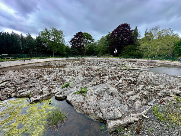
A three dimensional map of Scotland complete with Highlands and islands and a viewing platform in the grounds of The Barony Hotel near Peebles.
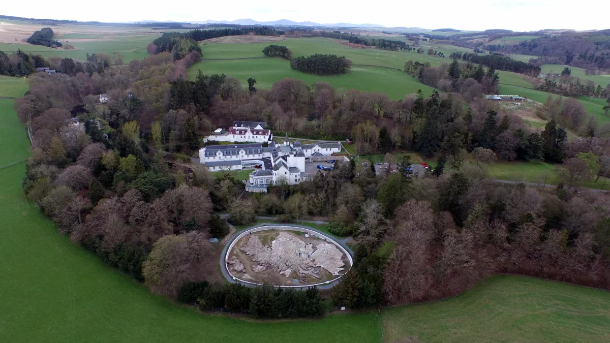
Image by Madras9096, via Wikimedia Commons. Licensed under CC BY-SA 4.0
Peregrinating around Peebles we stopped to take stock in Eddleston in the shadow of a castle.
We were drawn to a map inside our map, that was telling us there was another map just feet away; not folded paper or an app for a map; a huge concrete map with the whole of Scotland squished into it! This is the Great Polish Map of Scotland.
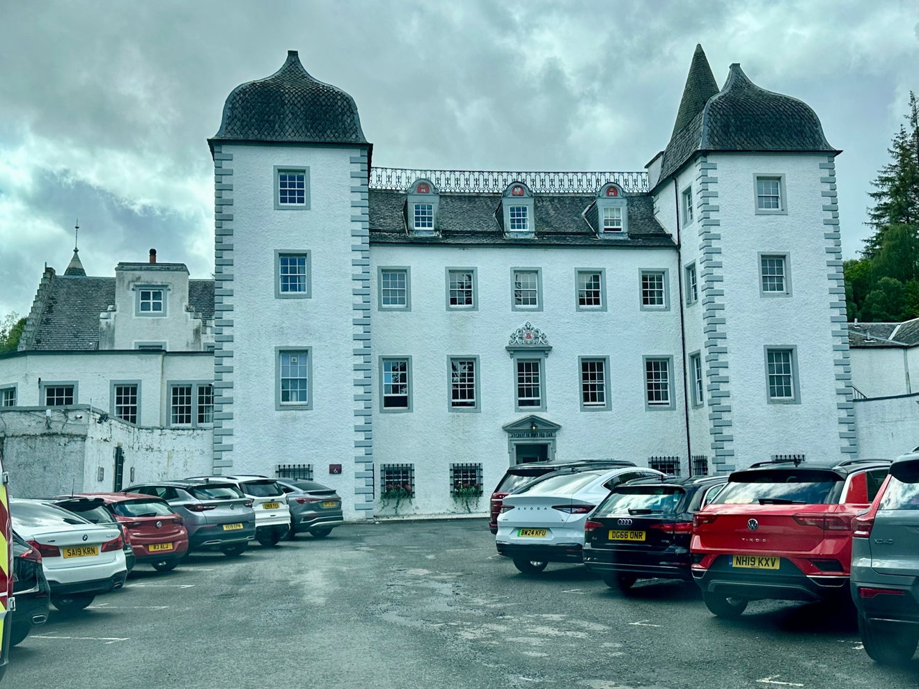
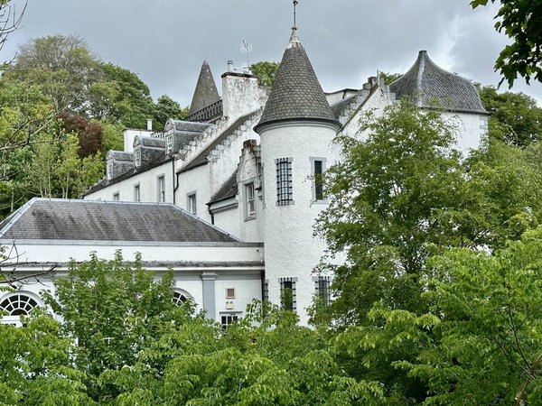
On day of many weathers, we were already drawn to the interesting architecture of Barony Castle. There has been a building here since the 1500s, a peel tower, defensible and bold to keep out any nebbing Border Rievers that would raise their heads from England. At one time, we'd have perhaps been hanged from the nearby Gallows Law for trespassing.
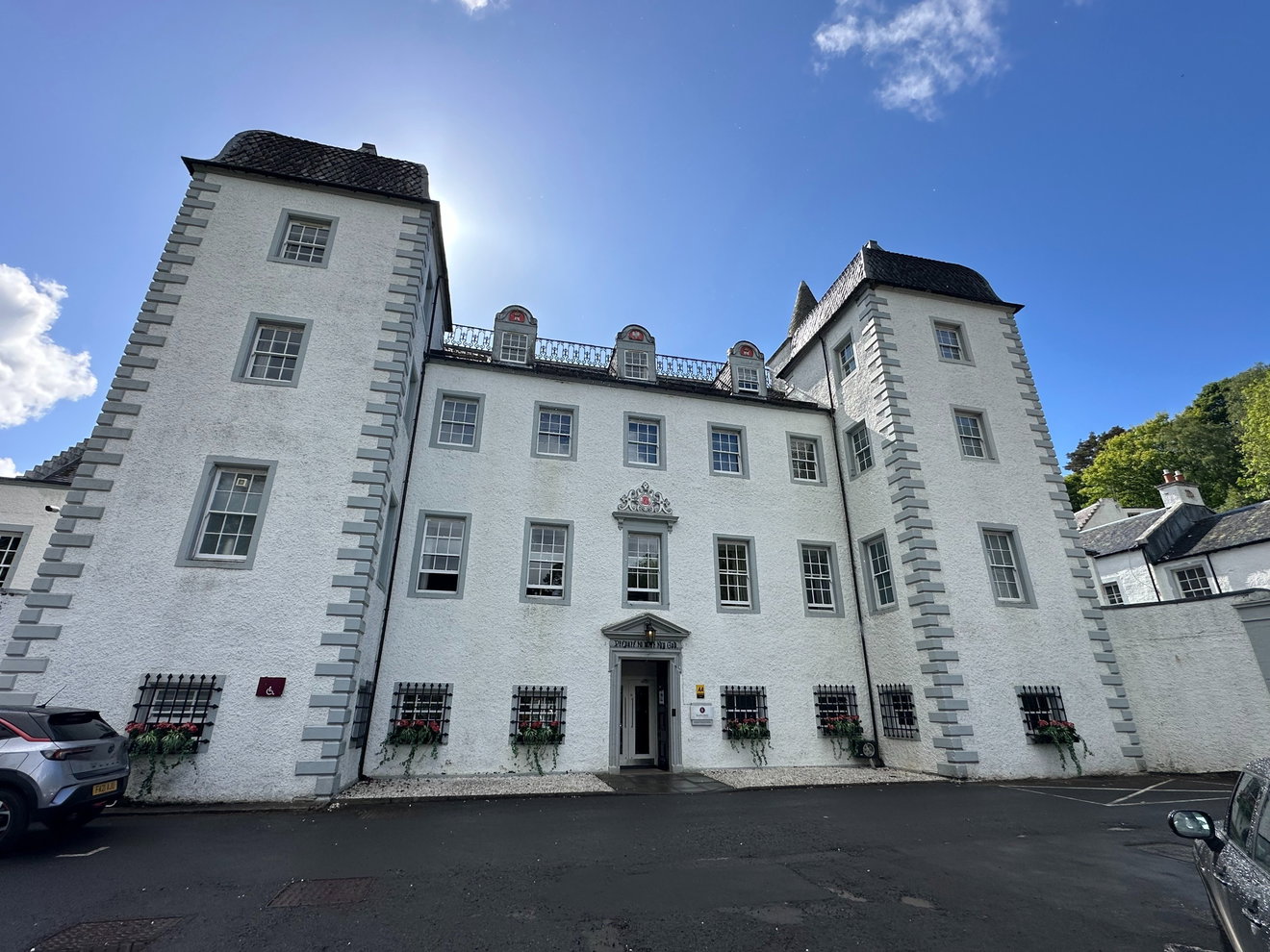
The castle, originally known as Darnhall, has seen many changes over the centuries. In the early 1700s, it was given a grand glow-up and fashioned into the French Jacobean façade that we see here today. We loved the ogee bell cast roofs, the fishtail slates and the clean white walls.
Intrigued by the mention of maps, we set off to explore. Following signs around the side of the castle, we tramped off in our muddy boots, binoculars ahoy and turned a corner, right into the throws of sequins, satin, tartan and fake tan! A couple we're tying a knot in the castle grounds, but there were no marriage diversion signs, so we'd just bouled up in the middle of it, looking pale and unkilted! Good job we'd left the dogs in the car! We smiled politely and sidled out sideways, trying not to look underdressed and uninvited! Booted but not suited!
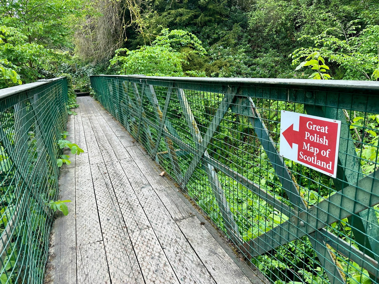
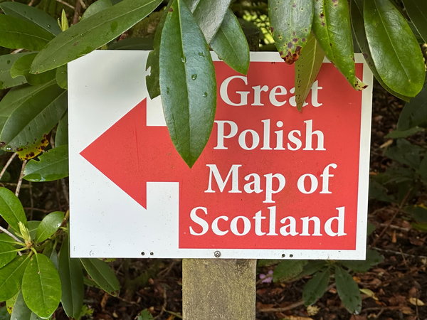
Crossing a little suspension bridge that wibbled under the weight of two hurrying humans, we scurried away, following the signs that confidently told us we were heading to The Great Polish Map of Scotland.
During the Second World War, Barony Castle served as the headquarters of the 1st Polish Armoured Division and later as the Polish Army Staff College, when Polish soldiers were responsible for protecting a large swathe of coastal land in Fife from attack from German-occupied Norway.
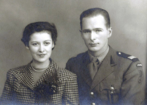
Around the same time, a young Sergeant in the same division, Jan Tomasik, had been stationed in Galashiels and treated at the Peel Hospital by a young nurse for wounds sustained in battle. Here, the love story with Scotland begins. Tomasik married the nurse who cared for him, and he and Catherine lived a happy life together when he left the army and started life as a veteran on a £45.00 pay out from the British Government. As generous as this was, the government wouldn't allow him to pick up his old trade of bricklaying, so he worked in hotels, odd jobbing, fixing up broken bits, sweeping floors. He worked hard for up to twenty hours a day, paying off his debts, never owing anyone a penny, and saving hard to buy a place for him and Catherine. This picture from the Mapascotland website shows the young couple together.
Fast forward several years of grit and graft, Tomasik had become renowned in the Scottish cities' hospitality and entertainment industry, owning hotels and theatres and even being part of the team that managed the young Billy Connolly.
This time, the place that Jan and Catherine had bought was Barony Castle, which was by now derelict and in a bad state of disrepair. Over the decades, Jan Tomasik had made a name for himself restoring failing Scottish hotels. This time, his task was enormous. He did all of the brickwork restoration himself. And where his building skills really took a turn for the unusual were in creating The Great Polish Map of Scotland.
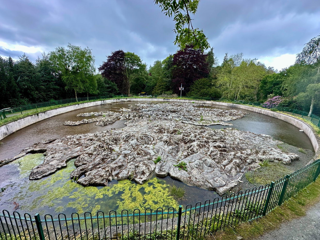
Once over the bridge and away from the wedding, we found a curious mass of concrete, intricately shaped into all the places we've been on holiday over the years, from the grand body of land itself to the tiny, lesser-known Highlands and Islands.
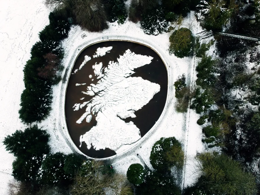
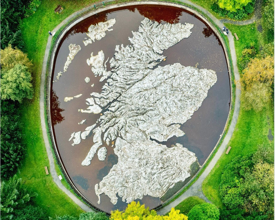
Here it is in all it's snowed on glory from an image from Novemberscot. So impressive from above.
Started in 1974, this was to become the largest outdoor relief map in the world! It was built over five summers under the guidance of cartographer Kazimierz Trafas and aided by Tomasik and his son in law, alongside the hotel maintenance man Bob. Each year, a troupe of Polish exchange students would visit and chip in, and bit by bit, the Polish Map grew each year and took shape.
Tomasik and Trafas wanted the map to show Scotland off in all its glory to hotel guests. They hoped it would be a huge tourist attraction.
I shall die, but I shall leave my map as a gift to the Scottish people to thank them for the hospitality they showed the Poles when it was needed
Jan Tomasik
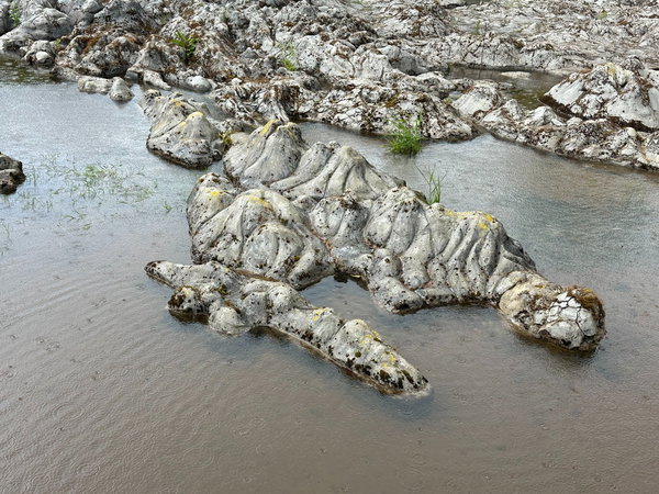
The first year, the outline of the map was laid in bricks. The land was measured out in detail, and every year after, the difficult job of shaping up the land in concrete continued. Mountain heights were emphasised and exaggerated to show distinction, and in 1976 the land was painted.
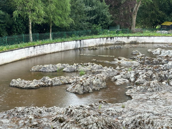
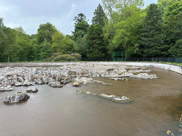
Water was piped down from a nearby burn to recreate the seas, lochs and some of the more significant rivers.
Photos don't really do it justice, and to experience the best views of it, you need to be up high. There is a viewing tower to climb, where you can get a better, fuller perspective of the land from above.
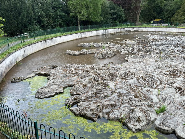
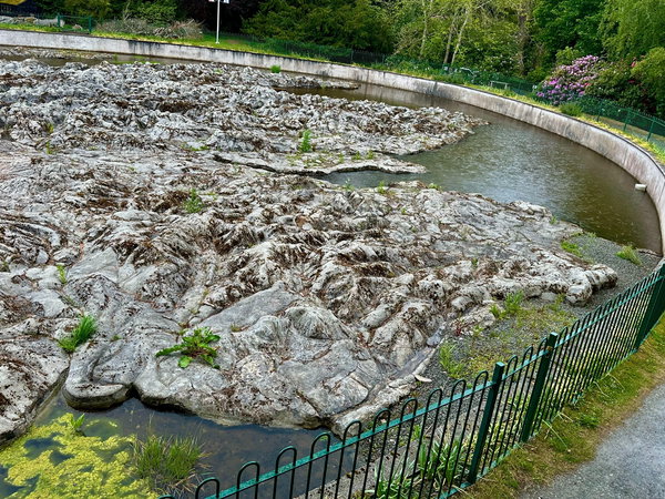
If you're familiar with Scotland, it's a marvel to wonder at, and to link journeys made and mountains crossed. It's perfect for locating cities and the divisions of land. It shows the Highlands in all their glory, and where they tumble down and the land links under the sea.
The map is housed in an oval pool 142 meters long. It is 50 meters by 40 meters and covers an area of 1590 square meters. It's the largest three dimensional physical representation of a country and the largest relief map anywhere in the world! That's what ambitious thinking does for you!
The map became forgotten about and fell into a state of real disrepair, from frost and overgrown foliage. It had, in some ways, lost its place on its own map. Gone from sight and overgrown, Professor Trafas came back to the map in 1994 when he'd discussed its significance at a gathering of town planners attending a meeting about the European Union. This revealed a new interest in the map, giving it a second life. A volunteer group was formed called Mapa Scotland, which renovated and restored the work of Trafas and Tomasik, bringing it back to the geographical glory and genius we see today.
The map's making and restoration have been a connecting feature for people from Scotland and Poland for over 50 years. It is now a category B listed building.
It's a most unusual attraction, but it has a great impact on the eye and is squirrelled away behind neatly made beds, hot tubs, and weddings. It would be easy to miss if you didn't follow the arrows, which encourage you to enter a world within a world. Stay a while and climb the ladder to the viewing platform and see Scotland through the eyes of an eagle!
Thanks to Paul Watt Photography for this stunning aerial view of The Polish Map of Scotland
Get 3 points if you have visited this place. Already visited by 3 VIPs.
Login to the VIP area to add places to your bucket list, mark them as visited and more importantly see where you rank on the league table.
How To Find Great Polish Map Of Scotland
Where Is Great Polish Map Of Scotland?
Lat / Long
55.712003, -3.2166231
What three words
Where To Park For Great Polish Map Of Scotland?
Lat / Long
55.712837, -3.2164863
What three words
We parked in the Barony Castle Hotel car park and walked the short signposted walk to the map.
Contributed by Jos Forester-Melville
Highland loving human. Thalassophile. I love a good smile. Happiest heading for the hills with my pickup filled with kids and dogs! Working four days, we enjoy a Fridate, and usually spend it scouting out new scenery. I love a gated track, a bit of off roading and if it involves a full ford, well, that gets extra points! I go nowhere without a flask and binoculars, and love the small things in life that make it big…Goldcrests, dry stone walls, Deadman’s fingers, blackberries and quality clouds.
More Places from Jos
More Places In Peebles
Find more fabulous places in Peebles, Scotland and if you know of a place we haven't listed, then let us know.

Neidpath Tunnel
Tunnel Peebles ScotlandNeidpath Tunnel is a disused 550-metre railway tunnel near Peebles, built in 1864 on the Caledonian Railway’s Symington to Peebles branch line.
More Landmarks
So this landmark wasn't enough and you want more? Don't worry we have you covered.
Easington Colliery
Landmark Peterlee County DurhamA town with a nature reserve, memorial garden, cemetry and a reconstructed miners pit cage, celebrating the times of mining in Easington Colliery.

Anstruther War Memorial
Landmark Fife ScotlandA large tower shaped landmark that sits on the edge of a golf course overlooking the firth of forth.
Steetley Pier
Landmark Hartlepool County DurhamA 2,000 foot long pier built in the 1960's to pipe sea water for the magnesia treatment works.
Never Miss A Fabulous Place
If you are afraid of missing out on all the fabulous places we post, or just want to be the first to know, then sign up to the Fabulous North.
Each week we will email you all the brand new places that we visit.
Sign Up To Alerts

Find Us On Facebook
We post all our new places daily on our Facebook Groups page, so join the group today and be notified when we add a new place.
Join Our Facebook Group