Muggleswick Grange
Building In Consett, County Durham
A spectacular medieval ruin, in Muggleswick near Consett, built during the mid 1200s which was home to a farm, a chapel, a grange and a dairy, which belonged to the Prior of Durham.

Muggleswick Grange was a happy accidental find! We were marvelling over the Old Engine House at Shildon, tucked away up a higgledy-piggledy road in Blanchland, and read about Muggleswick Grange being another consolidated building, part of the 'Living North Pennines Project'. So, we added it to the day's To Do list!

Crossing the countryside between Blanchland and Edmundbyers it was a day of dramatic skies and wide moorland views. We are fortunate to have all this just a stone's throw away in most directions from where we live.
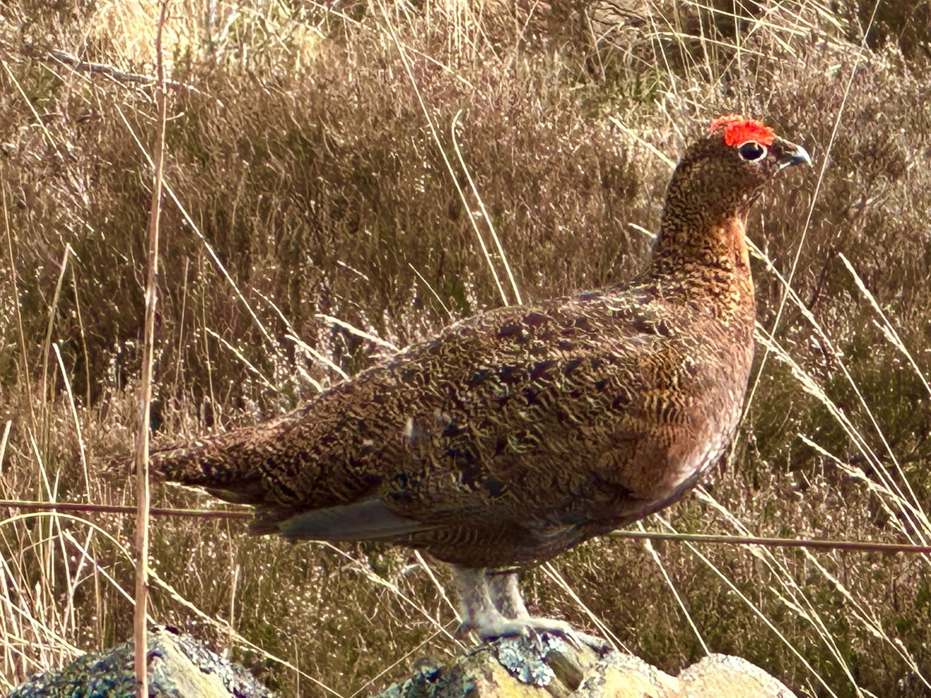
And March is optimum time to wind down your window or walk amidst the moors to hear the calls of returning curlew, lapwing, golden plover and red grouse with their familiar 'Go back, go back, go back' call. We were even treated to the close quarters' acrobatics of a heart-shaped faced crepuscular barn owl, watching us, watching it!
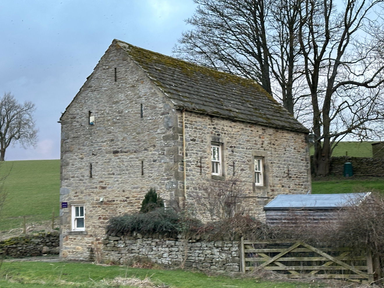
Heading down a gated lane and passing through the tightly packed Priory Farmstead, we noted the late 18th century barn with distinctive arrow slit vents. Barns around the Northumberland/Durham are ten a penny, but this one was distinctive, adding to the air of investigative mystery here at Muggleswick, and probably built with stone plundered from the Grange over the centuries.
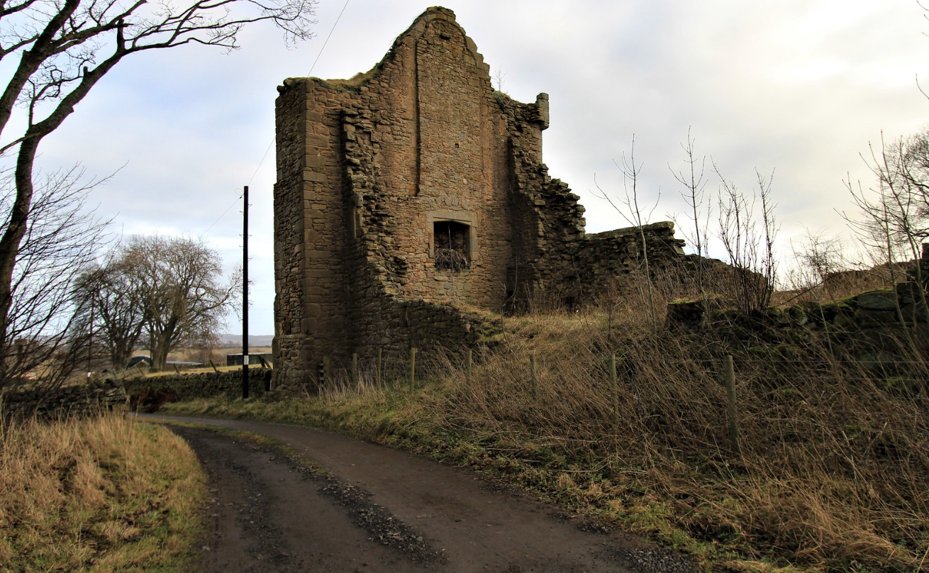
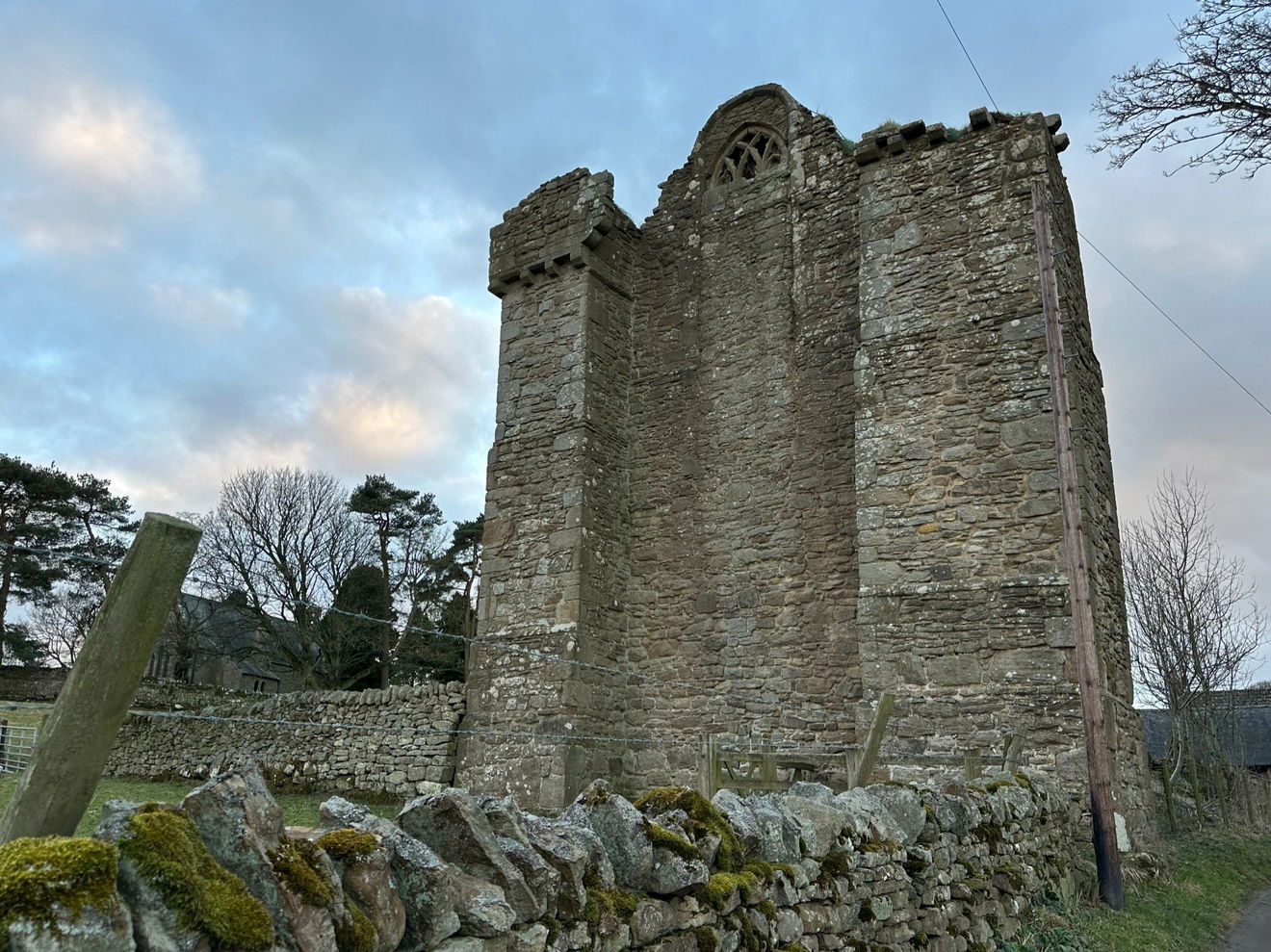
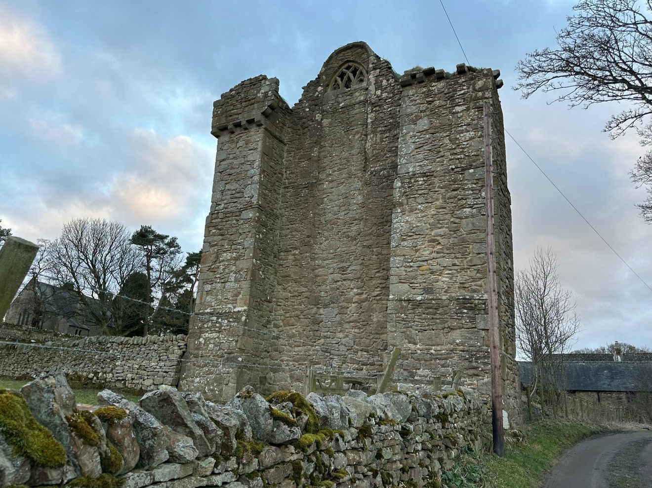
Then on through an open gate to the imposing vision of Muggleswick Grange, now a towering roadside ruin. The significance of this building is hard to measure at first glance. Its features are few and far between. It stands, incongruous amidst agricultural buildings and farm houses, but you can tell it's something special.
The word Grange is of French origin and comes from the Latin word granica, in French graunge, which means a granary.
Built for the prior of Durham in the mid 1200s, the structure of the grange would have been much bigger and would have originally stood in the grounds of parkland. A grange was a farm which was owned and worked by the monastic community, hence the modern name of Priory Farm. It would have provided food and materials for the nearby monastic house, and what was left would have been sold at market to raise funds for those living at the monastery.
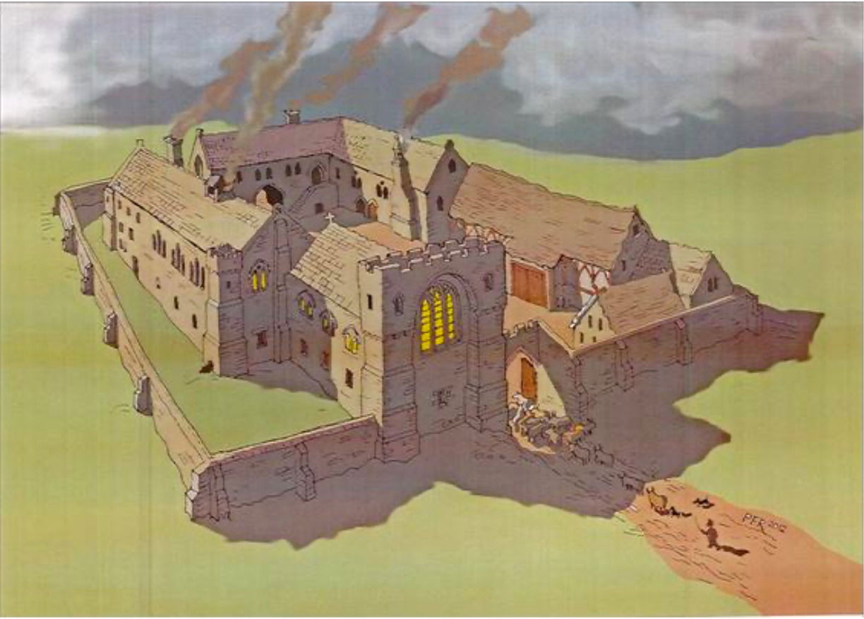
This illustration from Altogether Archaeology's Muggleswick Grange Excavation Project Design shows the building would have been more extensive with one 1464 document recording evidence of a great hall with a chapel, a farm, a dairy and great stocks of cattle, calves, oxen, sheep, pigs and lambs. The Bolden Book or the Boldon Buke was a huge survey done in 1183 to assist with the administration of aaaaaallllllllll of the lands, goods and chattels of the Bishop of Durham, similar to the Doomsday Book.
People in these places were ordered to pay tax to the Bishop of Durham and not directly to The King. It was the first survey north of the Tees and Muggleswick was recorded then as Muglingwyc. Other post conquest documents refer to it as Moclyngeswyk, Muklingwyk, and Myglkynwyc, all seem like the long words that teachers used to put on the blackboard on rainy playtimes where you had to see how many smaller words out of one longer word!
The Boldon Book reveals that the head monk of Durham Cathedral would have farmed extensive lands here on the territory originally owned by the Bishop of Durham, but handed down to the Prior who exchanged it for land and the Manor of Hardwick near Castle Eden. 160 acres of land here were granted a license by the Bishop to use to cultivate and farm, and so, Muggleswick Grange grew into a thriving community where in 1229, a document refers to a 'domum magnam' - a large house having been constructed probably of timber.
Then by the 1260s, documents show a larger stone building having been erected as a place of worship for the monks. It is the ruins of this great building that are still visible today.
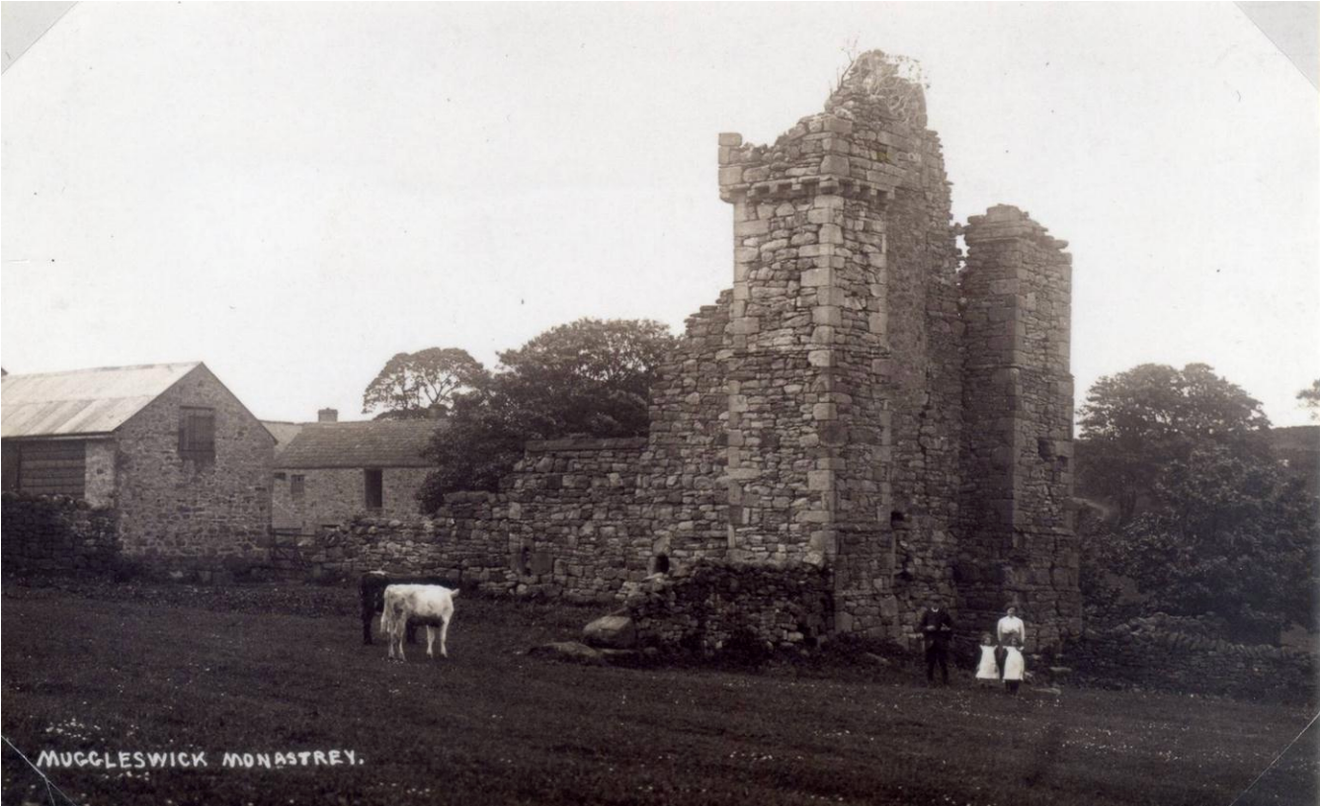
This image from Altogether Archaeology's Muggleswick Grange Excavation Project Design shows the Grange as it would have looked around the year 1900.
Largely all that is left is the west gable wall. The wall would have belonged to the chapel, and looking up, we could see the remains of a small 15th century religious looking window, which looked to have been blocked up by a chimney flue and built over during the centuries.
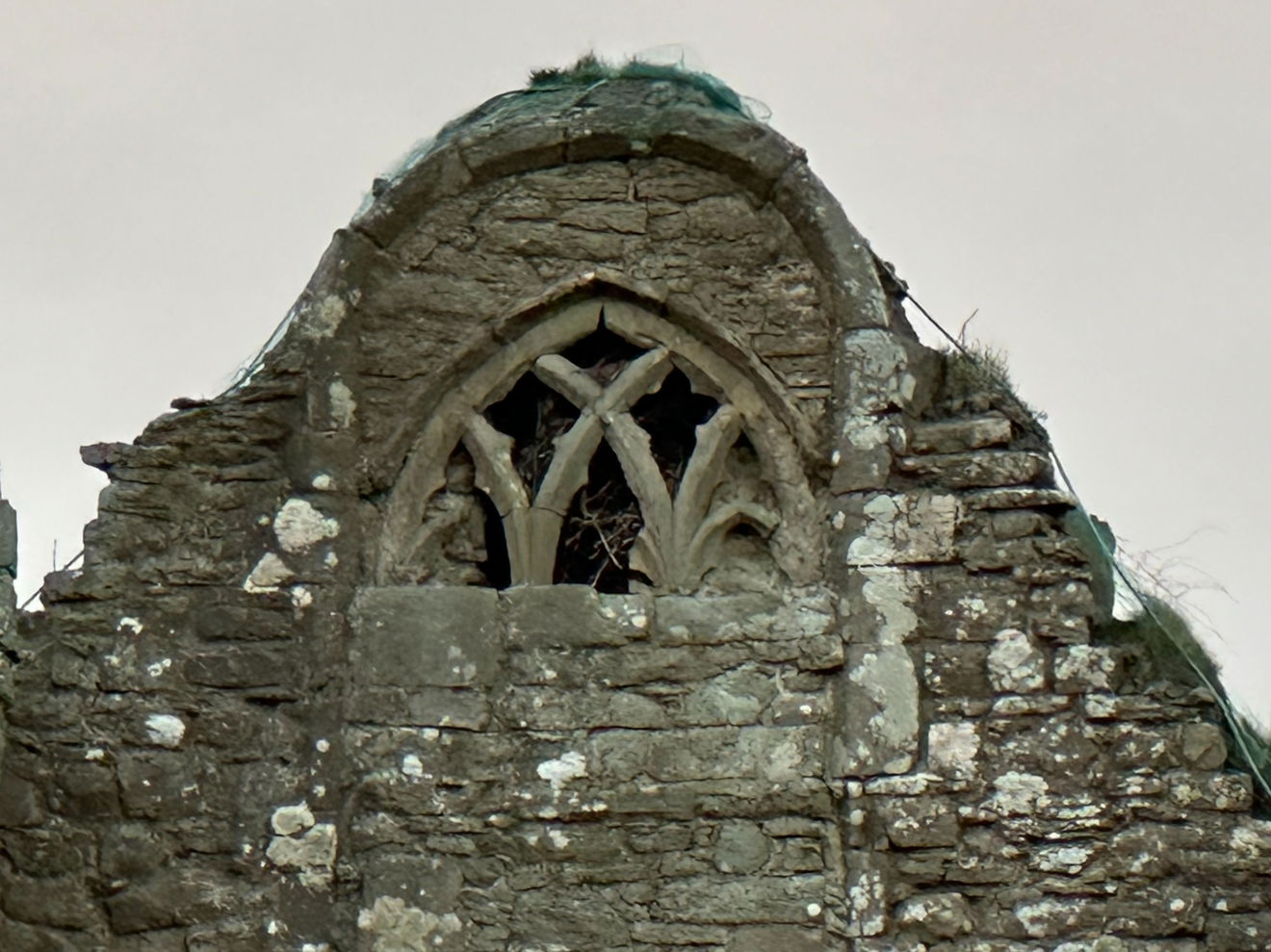
You can see the corresponding fireplace on the other side of the gable, now home to a rook's nest. A corvid des-res! Look at the fancy intersecting stone tracery work. I wonder what the window would have looked like in all its glassy resplendence.
It's in an unusual setting, coming down off the bracken covered hills opposite Edmundbyers. It would have been quite a sight in the middle of nowhere.
So significant is the overall aesthetic of Muggleswick Grange that Northern Powergrid have committed to taking the overhead power cables underground to help preserve the overall vista of the ruin and conserve its status as a conservation area.

The main remains of the building are essentially two rectangular mega buttresses protruding from the main body of the building. It's suggested that the Grange potentially stood two or three stories high, and these were probably functional in keeping the whole shebang upright.
The Eastern gable is largely intact and is 15.5 meters high...it's a long way up from the bottom! We could see sturdy projecting turrets, unfussy in design with machicolations in between the corbels. These little pokey holes would have been used to pour hot oil, boiling water, hot sand or quicklime through, or to throw stones, or to aim arrows through to the baddies below.
But it's perhaps the bits we can't see and which are all underground that hold the most significance. Investigations into the archaeology of the site took place in the 1890s and further work in the early 2000s, where each stone was drawn by hand to record its positioning. In this dig, the cobbled floors of stables were revealed and a number of significant carved architectural stones. Trenches were dug which revealed details of the much larger structure measuring 10.7 meters by 40.5 meters.
Remains of monastic granges from this era are scarce, so these remains at Muggleswick hold great significance as examples of a genre and time long gone with minimal record.
The light was failing and there was a church calling to be explored, in the distance, so a return to Muggleswick Grange is back on the To Do list. Always more to see. Always more to learn.
The Grange is a Grade I listed building.
Get 4 points if you have visited this place. Already visited by 20 VIPs.
Login to the VIP area to add places to your bucket list, mark them as visited and more importantly see where you rank on the league table.
How To Find Muggleswick Grange
Where Is Muggleswick Grange?
Lat / Long
54.845098, -1.932157
What three words
Where To Park For Muggleswick Grange?
Lat / Long
54.844154, -1.936797
What three words
We parked at the end of the track and walked along the lane a short way to the ruin.
Contributed by Jos Forester-Melville
Highland loving human. Thalassophile. I love a good smile. Happiest heading for the hills with my pickup filled with kids and dogs! Working four days, we enjoy a Fridate, and usually spend it scouting out new scenery. I love a gated track, a bit of off roading and if it involves a full ford, well, that gets extra points! I go nowhere without a flask and binoculars, and love the small things in life that make it big…Goldcrests, dry stone walls, Deadman’s fingers, blackberries and quality clouds.
More Places from Jos
More Places In Consett
Find more fabulous places in Consett, County Durham and if you know of a place we haven't listed, then let us know.
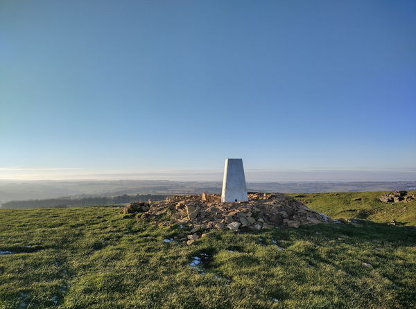
Humber Hill Trig Point
Trig Point Consett County DurhamThe Humber Hill trig point is sitting in a field west of Lanchester (270m) near Consett.
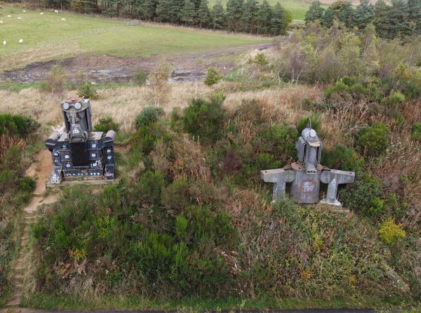
Old Transformers
Art Consett County DurhamStatues of the Ironmaster and Coal Miner made from obselete components representing the legacy of the local steelworks.
St Andrew's Church And Hopper Mausoleum
Religious Place Consett County DurhamAn atmospheric Anglican church and mausoleum abandoned in the 1970s.
More Buildings
So this building wasn't enough and you want more? Don't worry we have you covered.

King's Oven
Building Corbridge NorthumberlandA bread oven introduced in 1310 to the people of Corbridge by King John and used for over 500 years.

Saltaire Model Village
Building Bradford West YorkshireA Victorian model village near Shipley in Bradford, West Yorkshire, built by Sir Titus Salt for his mill workers and now a UNESCO World Heritage Site.

Durham Town Hall
Building Durham County DurhamA splendid feast of medieval lookalike architectural delights, and other things.
Never Miss A Fabulous Place
If you are afraid of missing out on all the fabulous places we post, or just want to be the first to know, then sign up to the Fabulous North.
Each week we will email you all the brand new places that we visit.
Sign Up To Alerts

Find Us On Facebook
We post all our new places daily on our Facebook Groups page, so join the group today and be notified when we add a new place.
Join Our Facebook GroupMuggleswick Grange was listed in Building // County Durham // Consett