Shoreswood Farm Radar Tower
Building In Norham, Northumberland
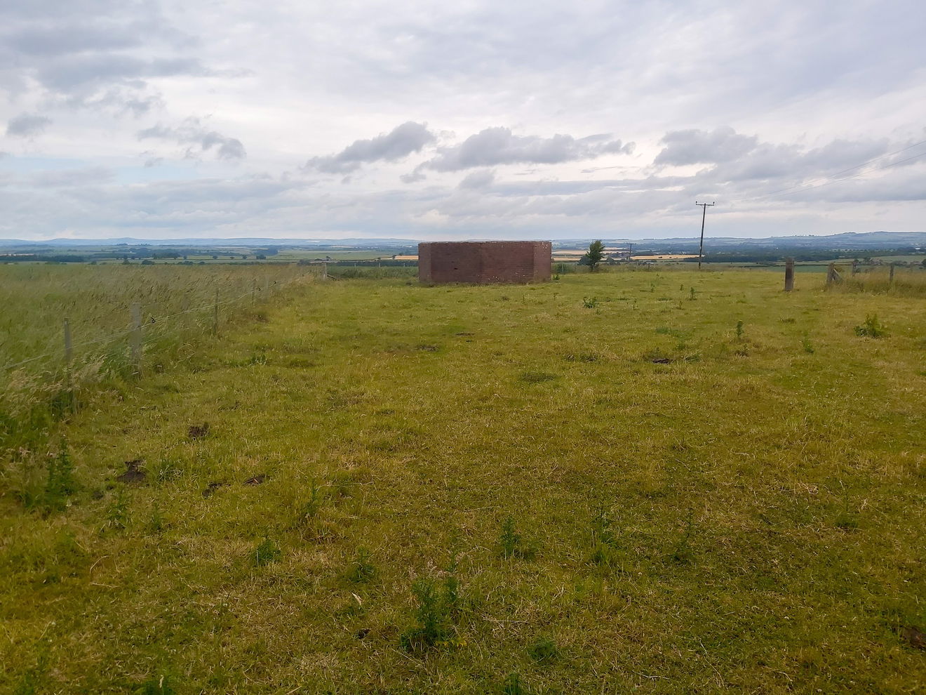
A Second World War radar tower at Shoreswood Farm, built as part of Britain’s early warning system and one of the few surviving examples in Northumberland.
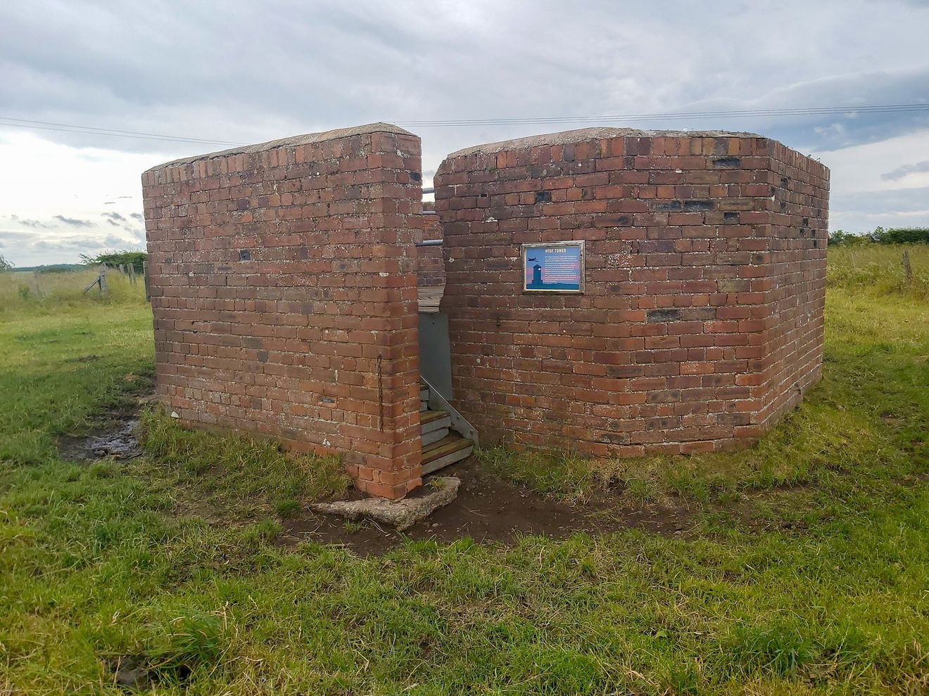
When finding places to visit for the Fabulous North, we have usually scanned maps, done research and created a meticulous plan of action for the day. But sometimes we have the delight of happening upon a new place out of the blue. We were just pootling around the Norham area and decided to go and bag the Shoreswood Trig Point, but as we were passing we noticed this curious structure in the field and a sign telling us this was the Shoreswood Farm Radar Tower.
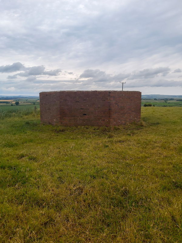
The Shoreswood Farm Radar Tower was a High Frequency Direction Finding (HFDF) tower, often called 'Huff Duff' and was operated in the early 1940s during the Second World War. What we see here today is just the brick octagonal base, but a three storey wooden tower would have stood on top of it.
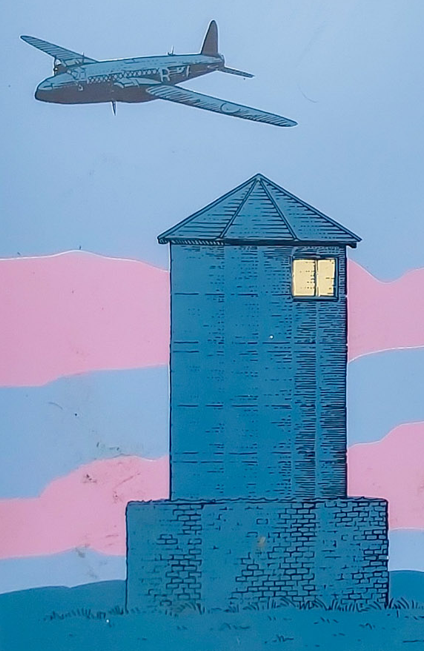
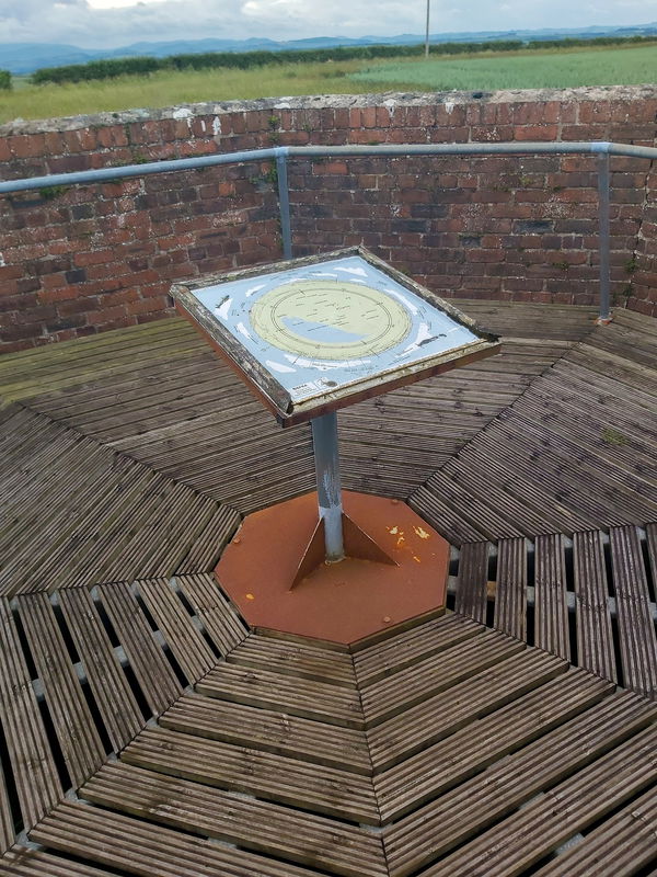
Photo taken from the information board
What Was The Shoreswood Farm Radar Tower Used For?
The purpose of the tower was to help lost RAF fighters and bombers find their way home. But this tower couldn't work alone and was part of a wider wartime aircraft navigation and radio tracking network across the NE and Britain.
Construction Of The Tower
The structure consisted of an octagonal brick base (which you see today) and a three storey wooden tower above it. The tower was made entirely of wood specifically to avoid electromagnetic interference with the radio equipment. Obviously the elevation of the tower also improved signal reception and accuracy.
How It Worked
Now let's get into the science. The RAF aircraft would have transmitted radio signals on pre-arranged HF frequencies (3 MHz to 30 MHz radio spectrum). High frequency was used as it can travel very long distances, well beyond the line of sight.
An operator would sit in the tower and listen through headphones to incoming aircraft transmissions. In the upper floor of the the tower would have been a directional aerial and this was connected to a goniometer (direction measuring instrument) located in the base.
- The operator rotated or adjusted the directional aerial.
- Signal strength changed depending on the aerial's orientation.
- The strongest signal indicated the bearing (direction) of the aircraft.
- That bearing was calculated and recorded.
- The result was radioed to other HFDF towers, typically about four miles apart.
- Bearings from multiple towers were combined.
- Using triangulation, operators calculated the aircraft's actual position.
- The aircraft could then be guided safely back to base.
- This was effectively an early analogue positioning system decades before GPS.
Radio Network
Now the Shoreswood Farm Radar Tower couldn't work alone. It needed other local radio towers to help triangulate positions which would have been positioned around 4 miles apart. As these were secret and dismantled after the war, and then most likely reclaimed by the farmland, then it's rare to find one like this.
There are radio stations at Craster and also a large radio tower was once at Creswell too.
Why We No Longer Need Them
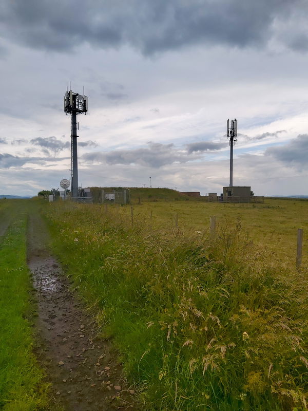
After the war and as technology became more advanced, HFDF towers were replaced by advanced radar coverage, ground controlled interception systems, electronic navigation aids, satellite navigation (GPS) and modern air traffic control systems. Aircraft no longer rely on HF radio bearings for navigation.
Right next to Shoreswood Farm Radar Tower are examples of this modern technology!
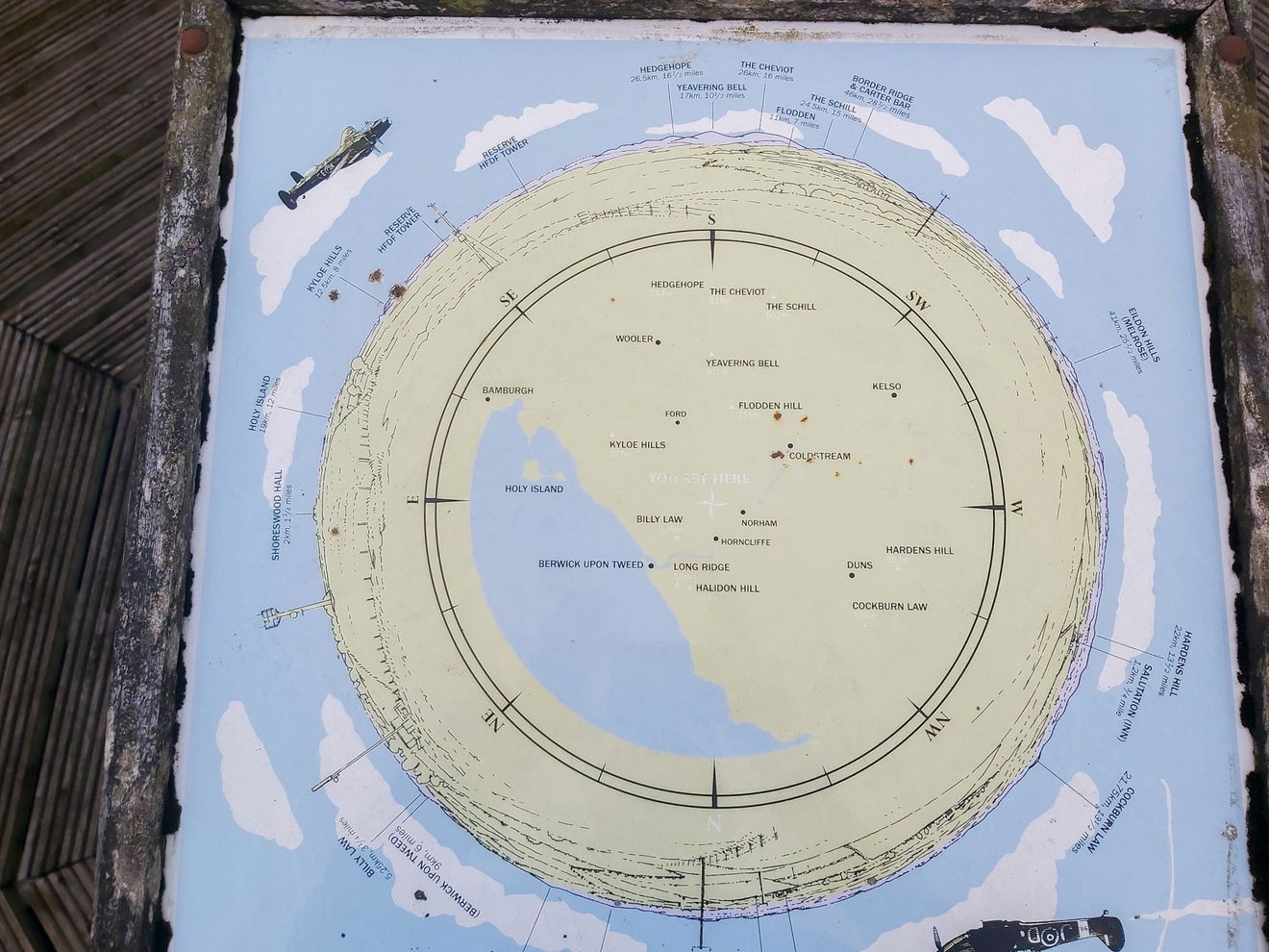
And if you do visit the Shoreswood Farm Radar Tower and trig point, then you will also be treated to wonderful views over the Cheviot Hills!

Get 3 points if you have visited this place. Already visited by 6 VIPs.
Login to the VIP area to add places to your bucket list, mark them as visited and more importantly see where you rank on the league table.
How To Find Shoreswood Farm Radar Tower
Where Is Shoreswood Farm Radar Tower?
Lat / Long
55.71026, -2.103999
What three words
Where To Park For Shoreswood Farm Radar Tower?
Lat / Long
55.711877, -2.099353
What three words
Park in the layby in front of the cottages.
Contributed by Simon Hawkins
Thanks for checking out this place on the Fabulous North! I do enjoy a wander out in to the countryside trying to find hidden gems that not many people know about. You can't beat a rogue pele tower up a remote hill, a mysterious stone circle or a stunning waterfall secluded in a forest.
More Places from Simon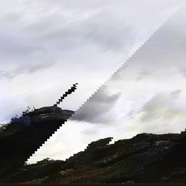
More Places In Norham
Find more fabulous places in Norham, Northumberland and if you know of a place we haven't listed, then let us know.

Norham Village Cross
Landmark Norham NorthumberlandA medieval base with Victorian shaft surmounted by a salmon-shaped weather vane, marking the centre of Norham village life.

Norham Castle
Castle Norham NorthumberlandA 12th century castle that saw plenty of action during the wars between England and Scotland.
More Buildings
So this building wasn't enough and you want more? Don't worry we have you covered.
Auckland Castle Deer House
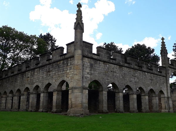
Building Bishop Auckland County DurhamThe deer house is a rare and well preserved example of Gothic Revival architecture built in 1760.
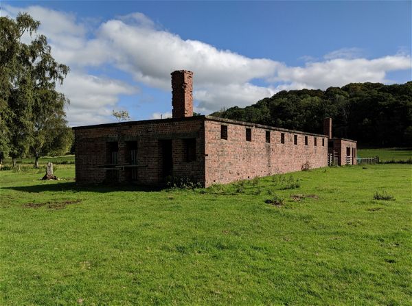
Featherstone Park Prisoner of War Camp
Building Haltwhistle NorthumberlandA former POW camp located behind Featherstone Castle for Italian and German prisoners of war.

Blackett Level
Building Allendale NorthumberlandA grade II drainage portal with a rustic tally house which was used to explore and drain ground in Allendale for mining.
Never Miss A Fabulous Place
If you are afraid of missing out on all the fabulous places we post, or just want to be the first to know, then sign up to the Fabulous North.
Each week we will email you all the brand new places that we visit.
Sign Up To Alerts

Find Us On Facebook
We post all our new places daily on our Facebook Groups page, so join the group today and be notified when we add a new place.
Join Our Facebook GroupShoreswood Farm Radar Tower was listed in Building // Northumberland // Norham