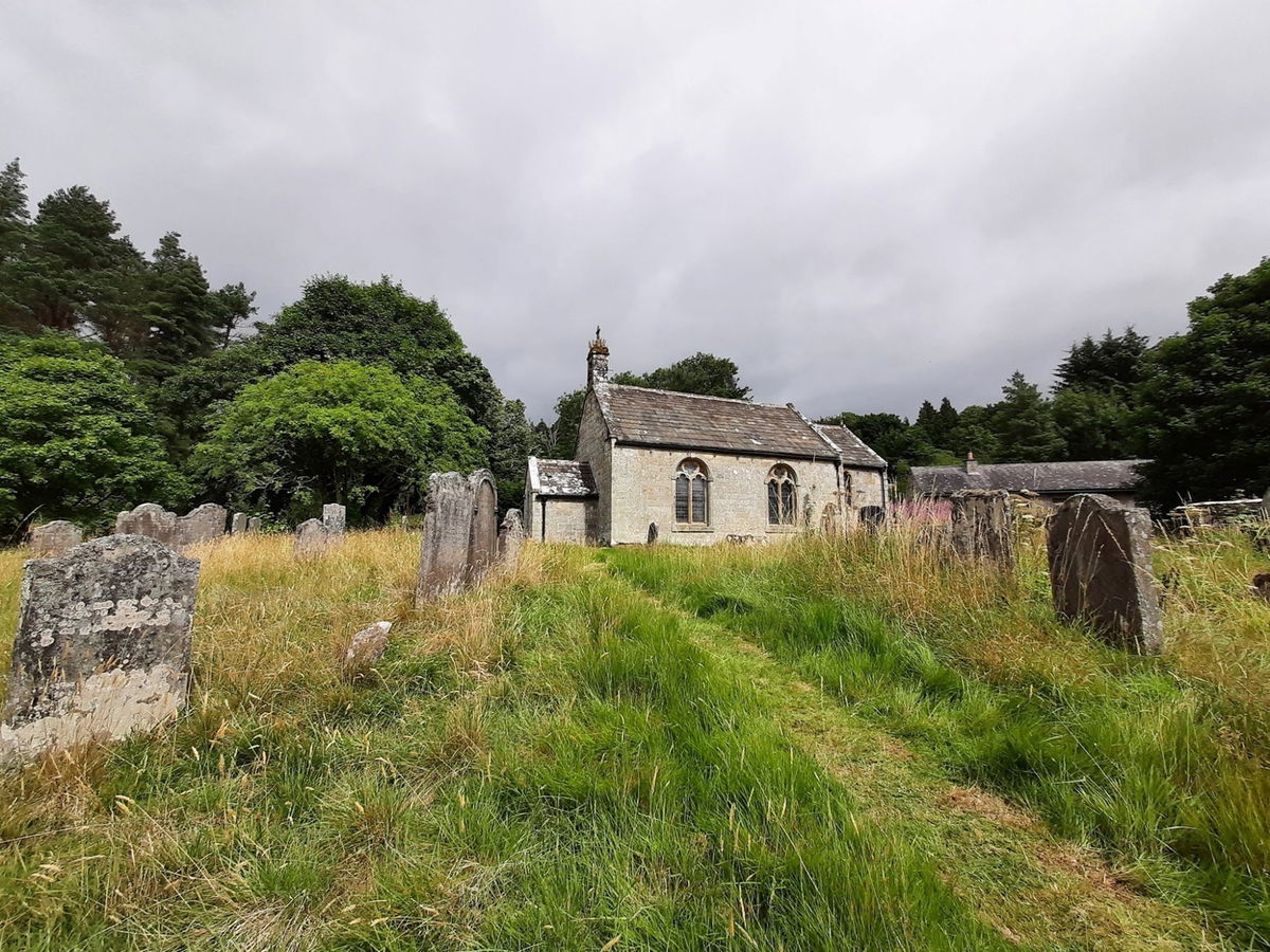
St Francis of Assisi Church Byrness
Religious Place In Byrness, Northumberland
An 18th century church which was partly rebuilt in 1884. It has a window which commemorates those who died during the construction of the nearby Catcleugh Reservoir.
Love this place? Become its champion with a short message, memory, dedication, or local business mention and share your connection to somewhere special.
Support the Fabulous North and champion this place for:
Usually £10
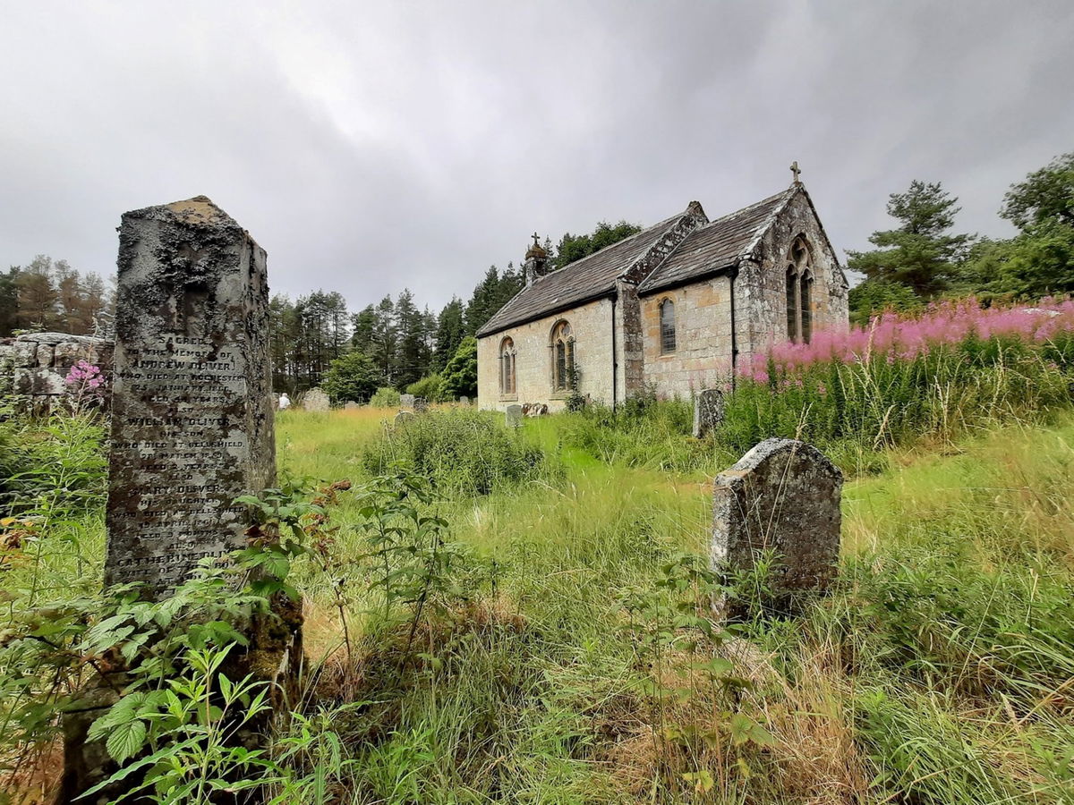
St Francis of Assisi Church in Byrness, the last village on the A68 before Scotland.
The village is small original being just a few farms and the church before a forestry village was built in the 1950s. Byrness gets its name from a modern spelling of Berrenes, Birriniss and Buryness. It means "a place of burial".
The cemetery outdates the church as people were buried here in the 18th century instead of travelling to Elsdon. One of the oldest graves dated 1687. The church was built in 1786 and the chancel was rebuilt in 1884.
The Revd L Dutens was largely responsible for the work and paying for it. It was built as a chapel-of-ease before becoming separate parish. In 1940 it united with Horsley and lost its parish status.
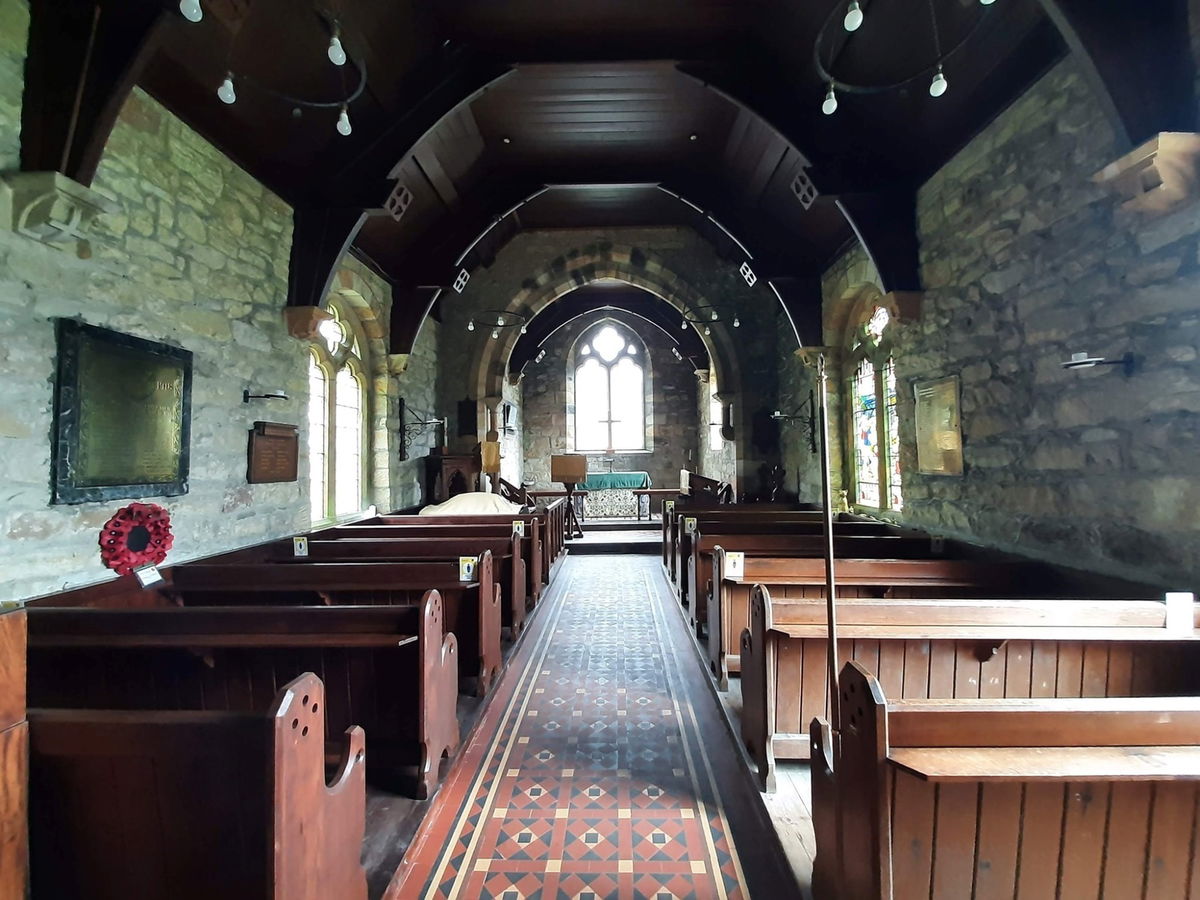
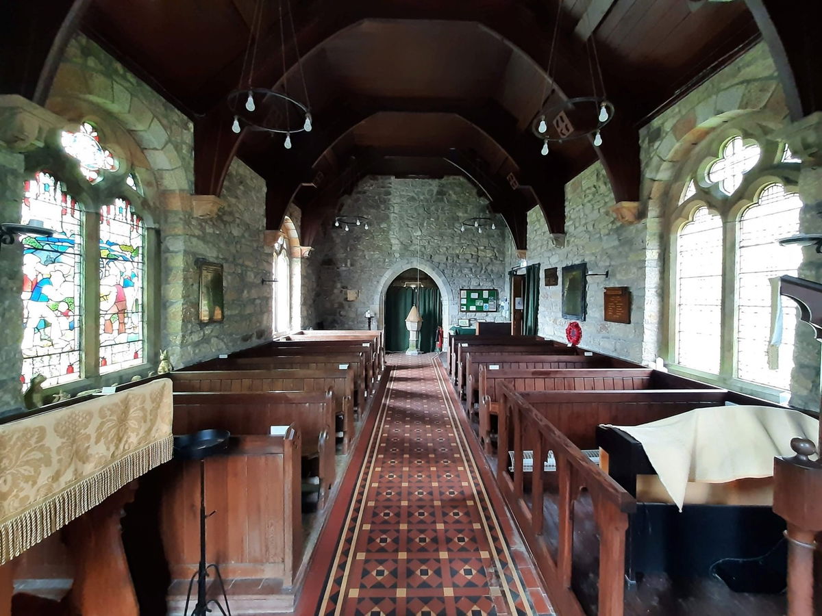
Inside though, is a real gem. Between 1884 and 1905, the congregation grew with the building of Catcleugh Reservoir just down the road. The workers lived in wooden huts in a temporary village but used the church for weddings, christening and funerals which is recorded in the census of the time.

64 people died during construction although only 3 were because of a work related accident. Some are buried in the cemetery. In 1903 the workers paid for a memorial window to be put in the church. It is significant as one of the few windows in a church that doesn't show a scene of religion.
It also contains a narrow gauge railway. Next to it is a plaque with the names on of those who died but 5 are missing as they died after the plaque was made.
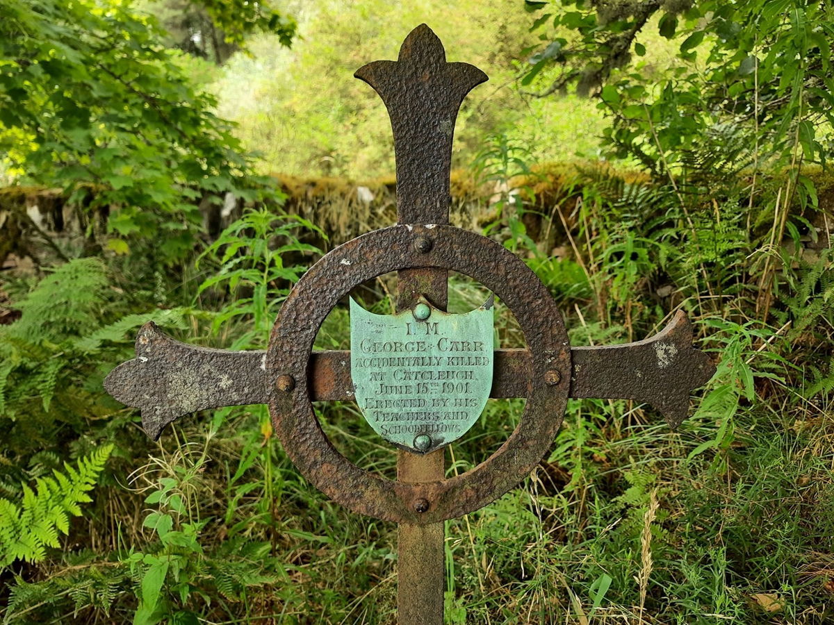
In the cemetery near the church is the grave of young George Carr. He died when he fell between a moving train during the reservoir construction. His grave marker was paid for by his fellow school children and teacher.
The church is open daily with a guide book available as well as a few information boards. There is parking outside the church with footpaths including the Pennine Way.
Get 3 points if you have visited this place. Already visited by 37 VIPs.
Login to bag this placeHow To Find St Francis Of Assisi Church Byrness
Where Is St Francis Of Assisi Church Byrness?
Show Place On Google MapsLat / Long
55.314562, -2.362699
What three words
Where To Park For St Francis Of Assisi Church Byrness?
There is a small amount of parking just outside of the church.
Contributed by Ashley Lightfoot
I love history, exploring churches, castles and ruins with my camera in tow. I am a member of English Heritage. Northumberland is my second home and any chance I get, I'm up there with my Dad, who volunteers with the national park, discovering a little something with a story behind it. The rest of my time, I'm just a simple greenkeeper!
More Places from Ashley
More Places In Byrness
Find more fabulous places in Byrness, Northumberland and if you know of a place we haven't listed, then let us know.

Echo Crags
Crag, Rock And Cairn Byrness NorthumberlandA standstone semi-circular escarpment located above Catcleugh Reservoir near Byrness.

Dour Hill Trig Point
Trig Point Byrness NorthumberlandThis is the trig point for Dour Hill (415m) near Byrness.

Ellis Crag Trig Point
Trig Point Byrness NorthumberlandThis is the trig point for Ellis Crag (498m) near Byrness.
More Religious Places
So this religious place wasn't enough and you want more? Don't worry we have you covered.

St Peter's Church Heysham
Religious Place Heysham LancashireA Church near St Patrick's Chapel, with a number of Viking artefacts in its grounds and within the Church itself.


St Martins Priory
Religious Place Richmond North YorkshireRuins of a 12th century Benedictine priory, close to the banks of the River Swale.
Never Miss A Fabulous Place
If you are afraid of missing out on all the fabulous places we post, or just want to be the first to know, then sign up to the Fabulous North.
Each week we will email you all the brand new places that we visit.
Sign Up To Alerts

Find Us On Facebook
We post all our new places daily on our Facebook Groups page, so join the group today and be notified when we add a new place.
Join Our Facebook GroupSt Francis Of Assisi Church Byrness was listed in Religious Place // Northumberland // Byrness