Castle Eden Dene (West Side ) Walk
Peterlee, County Durham
A walk in the wild west side of Castle Eden Dene and across 8 bridges.
Distance - 7km (4 miles)
Ascent - 342m
Duration - Approx 2 hours
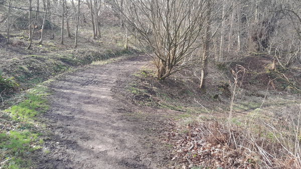
Terrain - Muddy paths in wet weather. Some inclines.
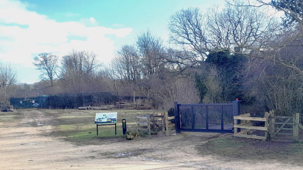
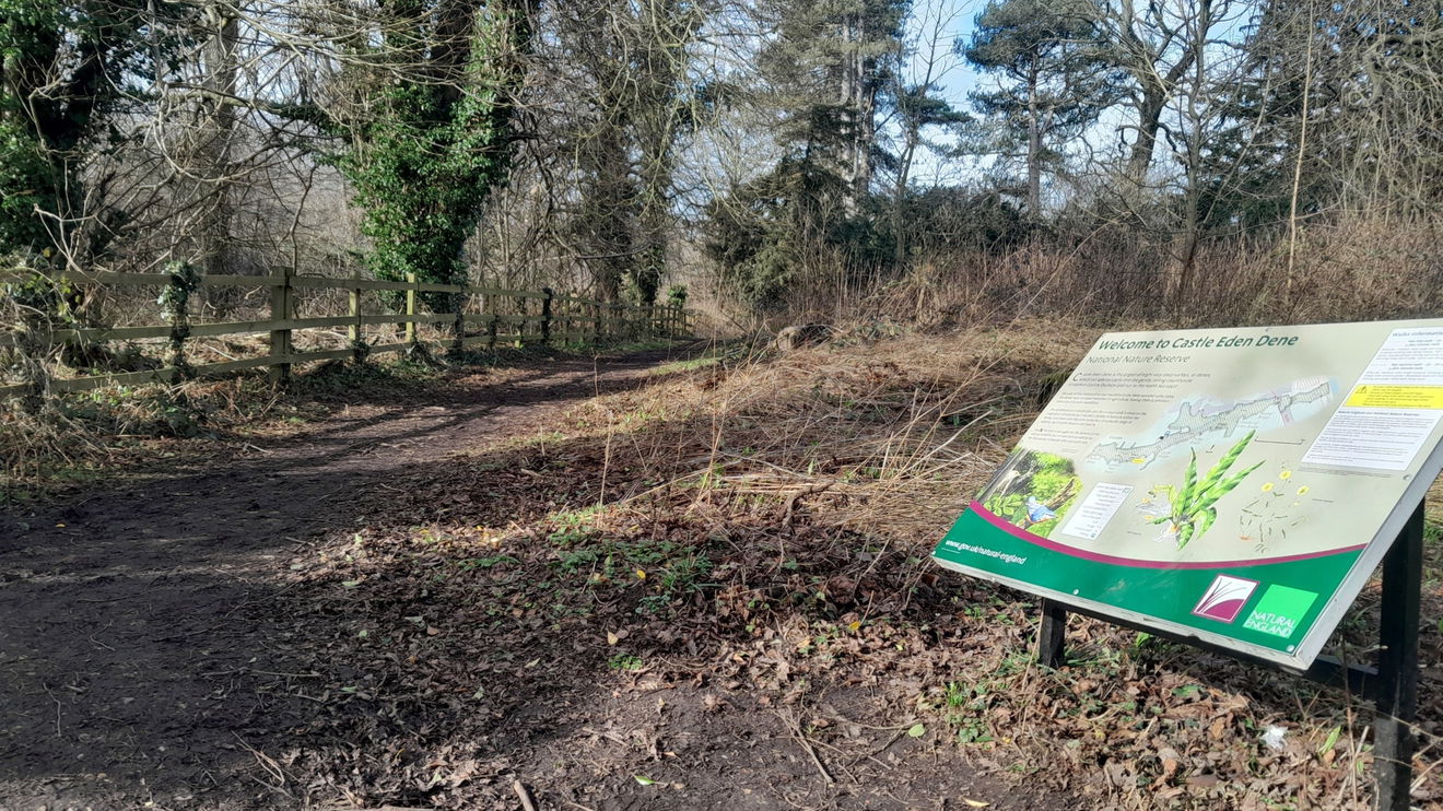
Parking - Parking at Cafe and toilets Natural England Stanhope Chase. View Parking Map
View Route On OS Map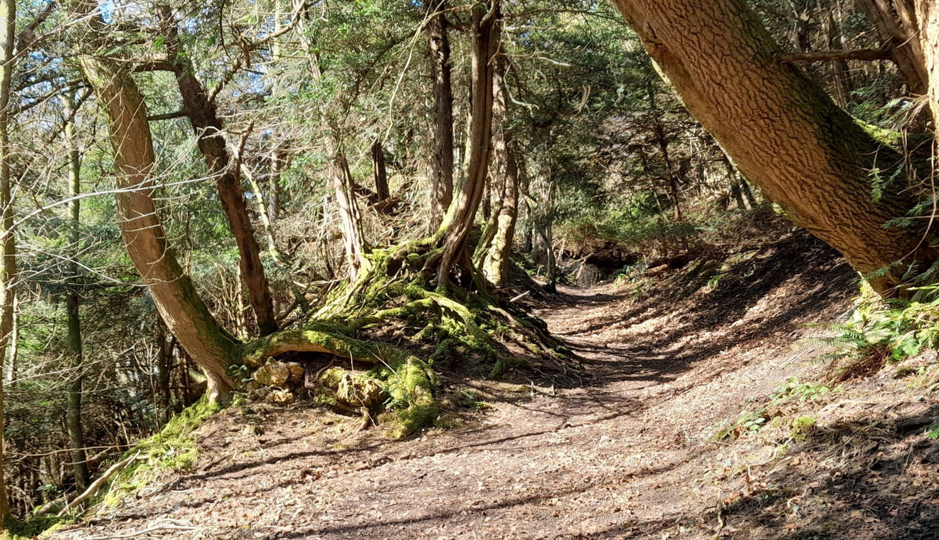
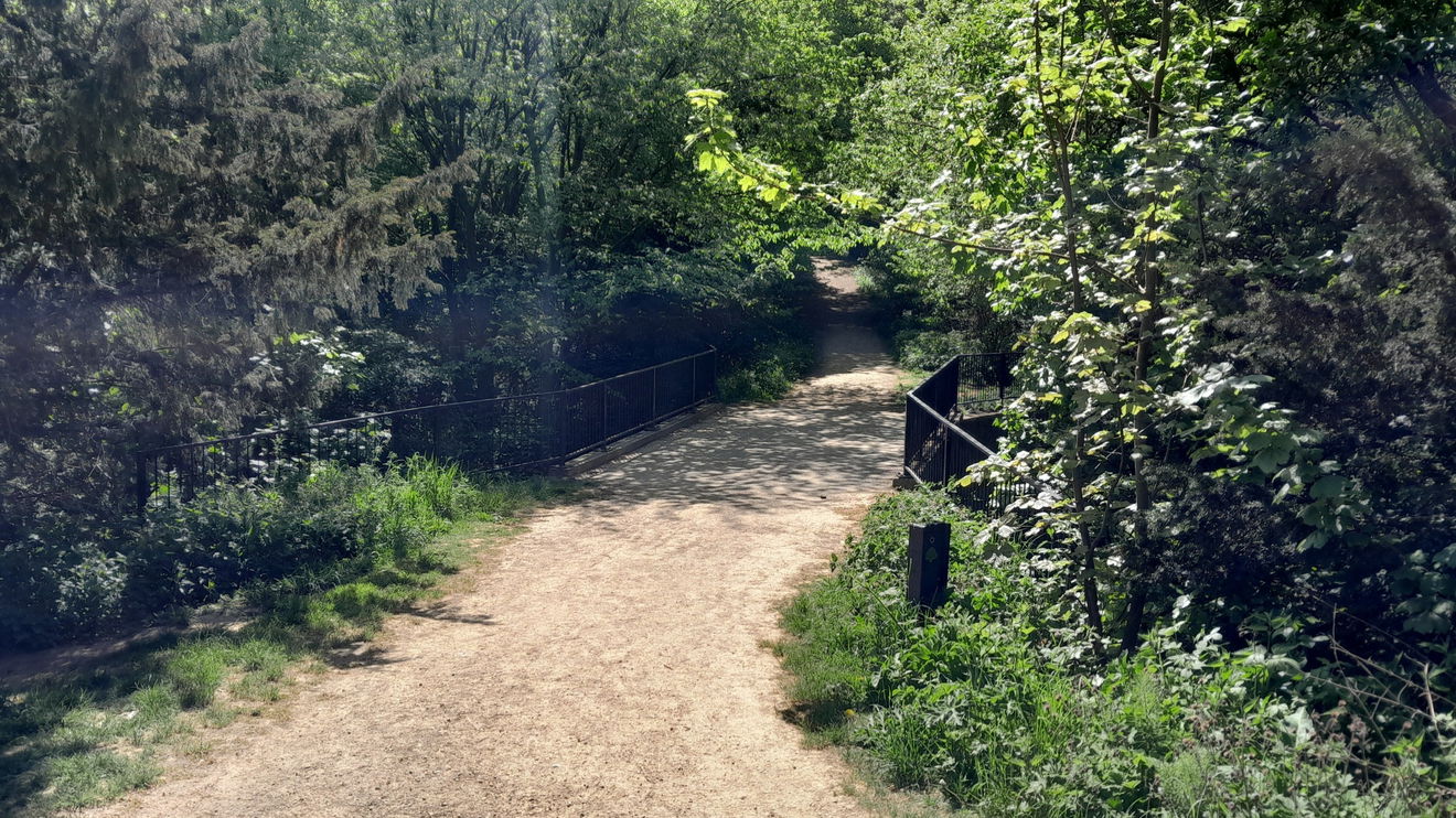
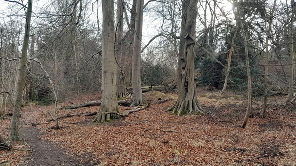
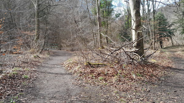
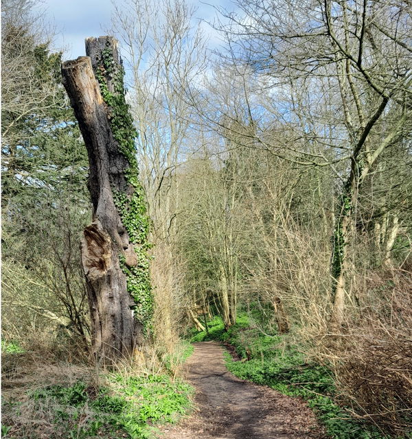
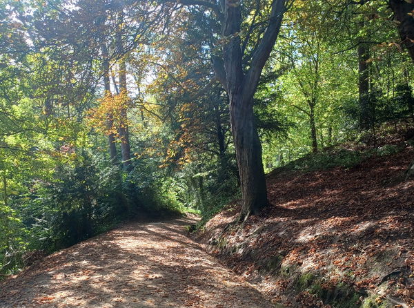
On this walk in Castle Eden Dene, we will explore the west area where you will cross 8 of the 16 bridges, some of which you will cross twice. I suggest sturdy slip-resistant boots, binoculars, and a few boiled sweets (Cough Candy is my go-to sweety). As a novice, being aware of my orientationhelped me know which side of the dene I was on.
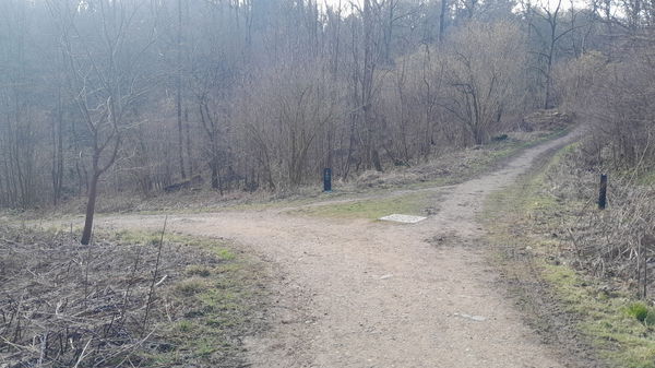
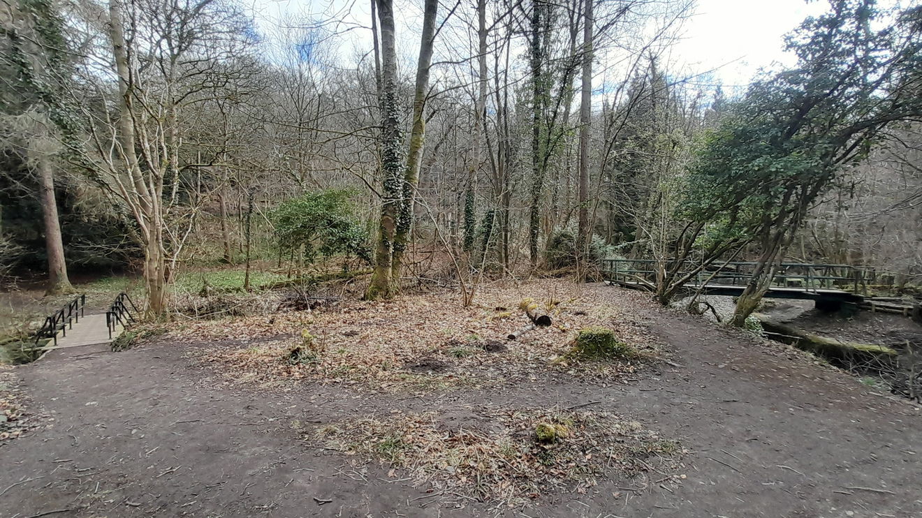
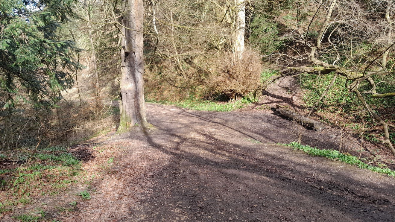
Once you have found theentrance to the dene, you have a pleasant downhillstroll and then take the second left.
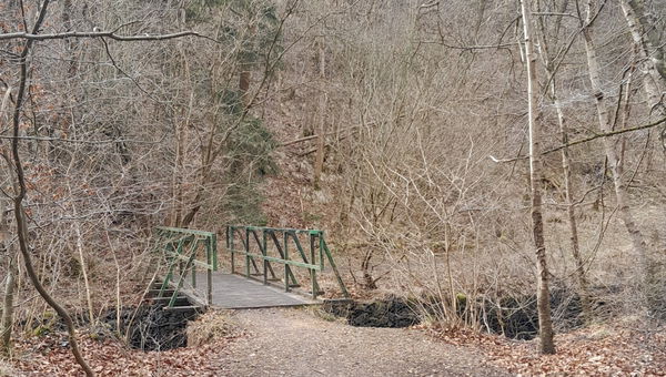
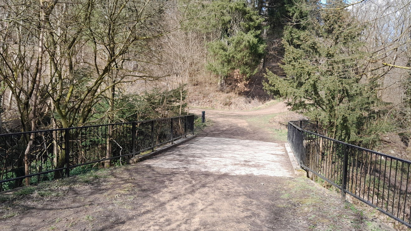
Then you go further downhill and across Castle Bridge, over Castle Eden Burn.
Take the left path and wander between the Castle grounds and Priest Gill, a tributary of Eden Burn.
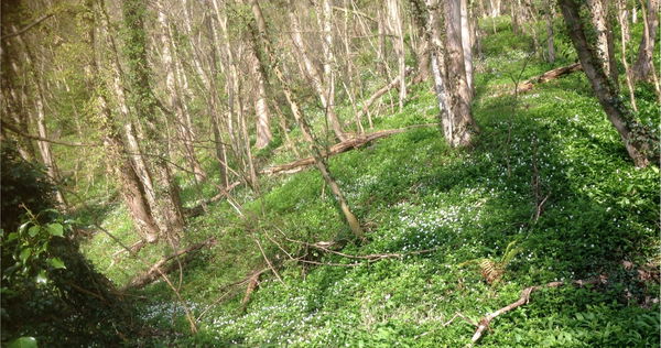
Wild Garlic is abundant throughout the dene in spring. At the end of this path, turn left onto a tarmac road.
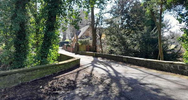
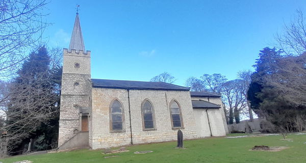
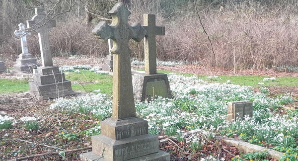
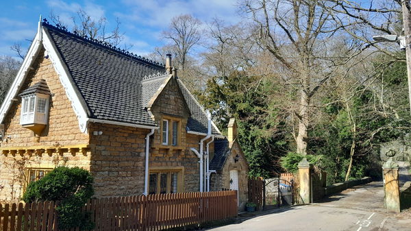
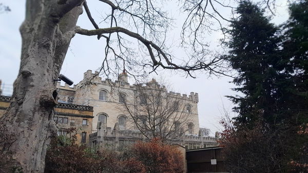
You will go over aroad bridge and can look back at the beck. It would be rude not to pop along and look at the churchyard of St. James, which is through the gates and is on your left. The churchyard is a British classic, especially with snowdrops in February.
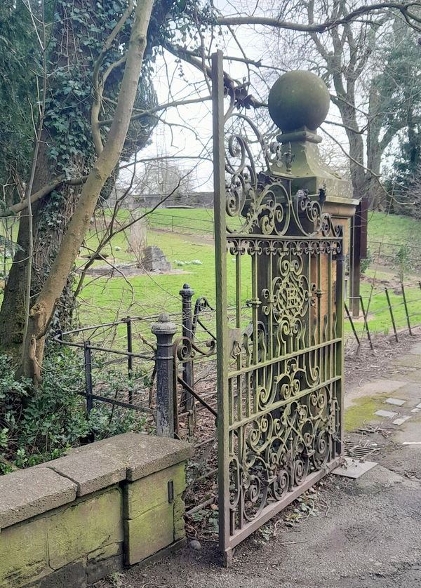
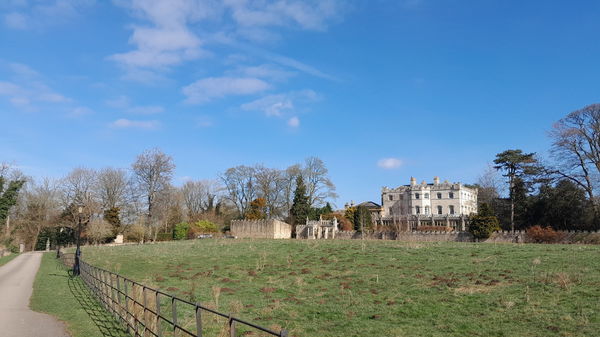
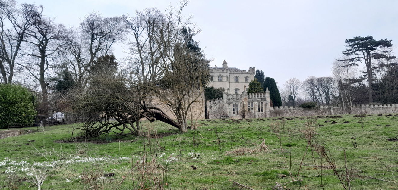
Then it's back through the gates after admiring the Lodge (former gatehouse) and up the tarmac drive of the Castle. On your right is where there was a medieval village. Various artifacts have been found, but there is nothing to see here now.
Here is a bit of local history.
In 1150, Robert de Brus II (1138 to 194) granted the monks of St Cuthbert a chapel on these lands. There was a medieval village in the field to the south of the Castle.
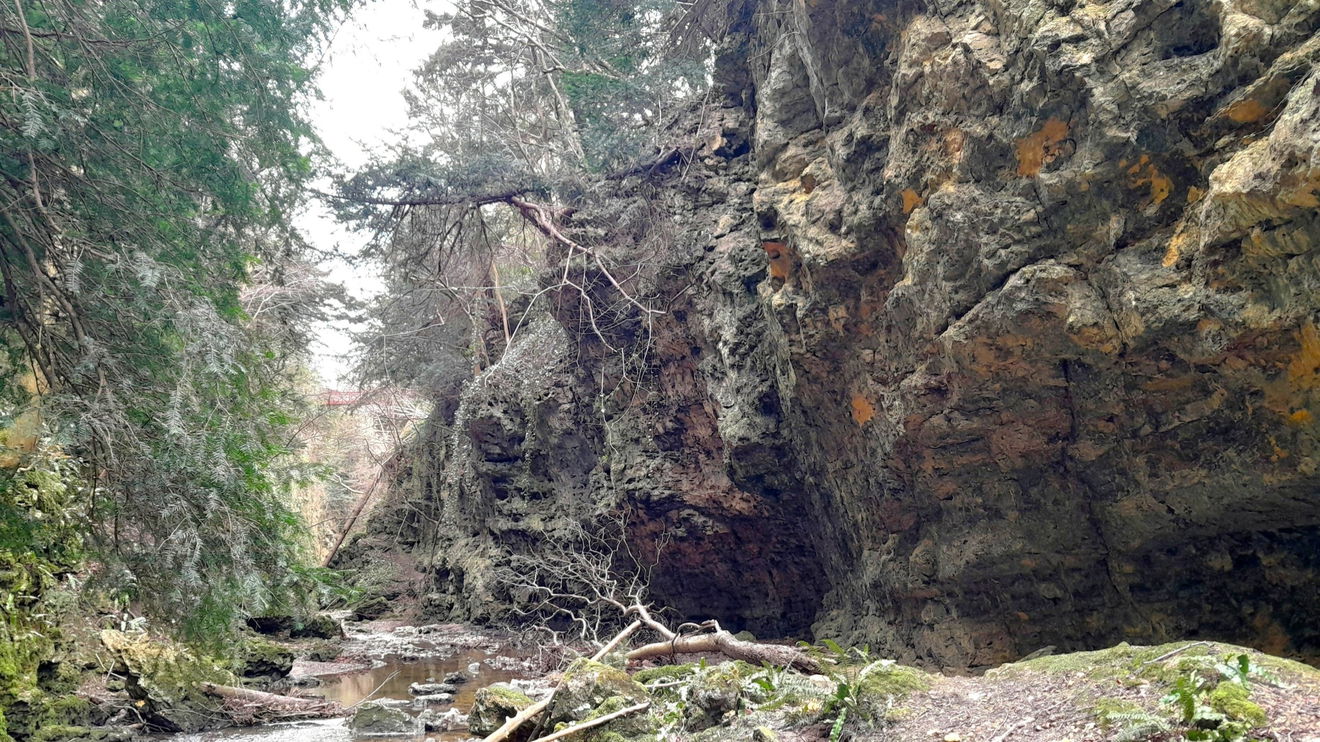
The Burdon Family purchased the manor house now called the 'Castle', and the dene in 1758, which they developed into a Victorian pleasure park, and the public paid to visit. Bridges, waterfalls, and weirs enhanced the sylvan charm. They even had a few adrenaline-filled features like the steep stone steps cut into the side near Gunner's Bridge. An 1861 map shows it as Charley's Ladder, an 1890s map as Bruce's Ladder and now known as Jacob's Ladder, as the climb back up the 100-foot drop must have been like rising to heaven.
The Burdon family nurtured the place for nearly 200 years.
Hedley Mason tells us of three specific trees that were planted by the Burdon family.
When you walk towards the castle and go through the second gate, there is a Beach tree. This tree was planted in the very early 20th century by the Burdons. They planted 3 trees deliberately in memory of their son, who was killed in an airplane crash. The beach tree is at the north gate. A Yew tree is directly behind the south side of the castle, and an Oak tree is on the grounds in the west, close to the church. Beach. Oak. Yew. The capital of each letter of each tree spells BOY. Each tree has a time capsule underneath, put there by the Burdons when the saplings were planted. I think this info may come from the book Rowland Burdon's 'North Country Gentle Folk', but I am sure it is in Elizabeth Anne Burdon's book 'Before My Time and Since.
Hedley Mason
Pass what were gates, which the pillars are now Grade II listed. The Castle is currently a holiday let, and it must be fun to stay in such a grand place. I took a sneaky closer look.
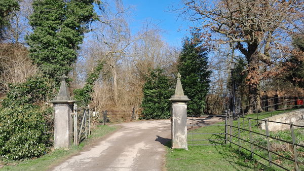
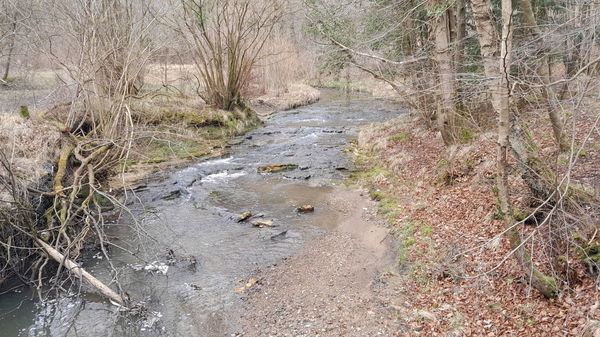
Go through the kissing gates, and head left/west. You can listen and watch Eden Burnand or wildlife. I was delighted by a Song Thrush.
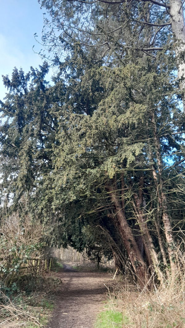
The yew tree Taxus Baccata is common here. Some say it could be from Saxon times, who gave the name Yoden to the area, meaning Valley Of Yew. There is plenty of folklore about them, from warding off evil spirits to the toxicity.
The Celts will also have been familiar with the toxicity of the tree's needles in particular. This may have further contributed to its connections with death. Shakespeare was familiar with these qualities when he had Macbeth concoct a poisonous brew. The deadly drink included “slips of yew, silvered in the moon's eclipse.
Trees for Life
After about 250 metres on your right (it is hard to spot), there's a downhill footpath to take, and this is Beeches Grove.
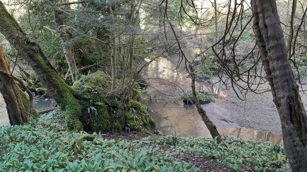
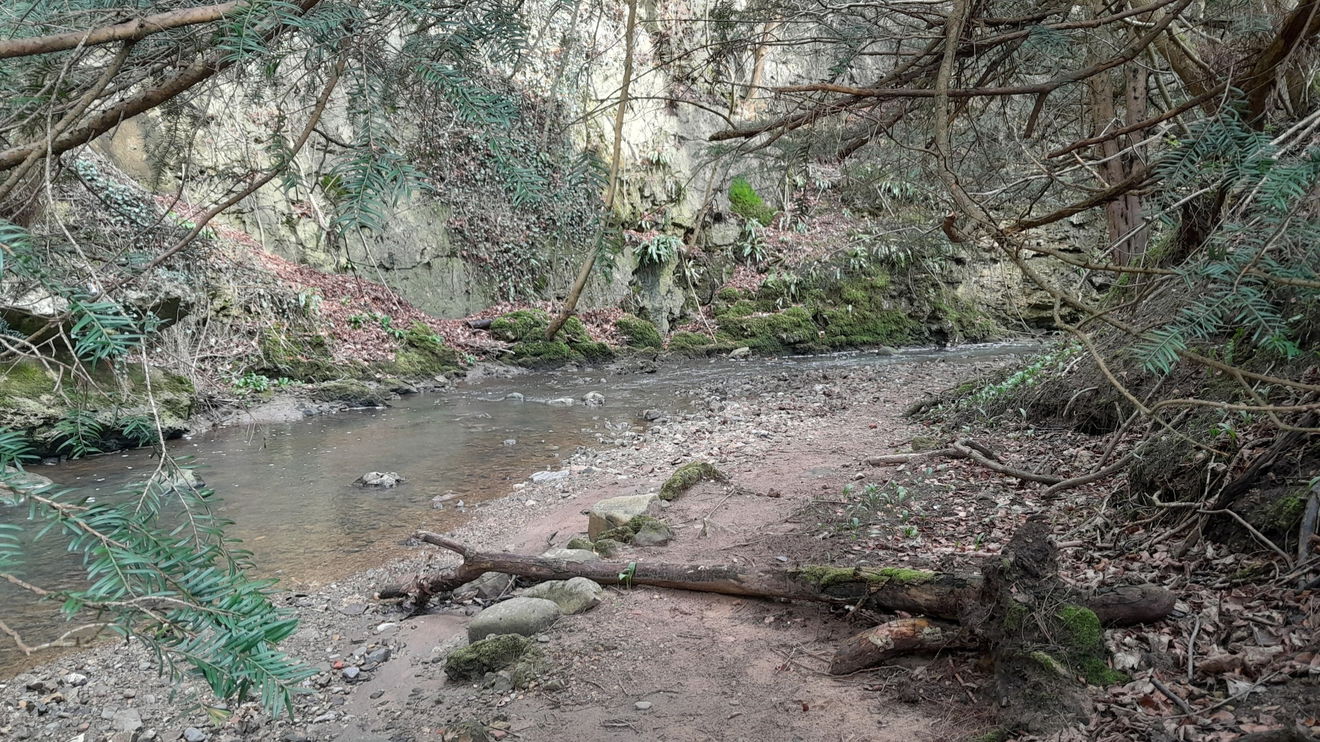
You can see down to the burn. Keep going to the left, so the burn is on your right.
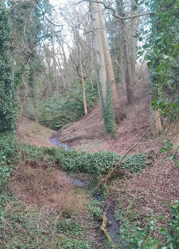
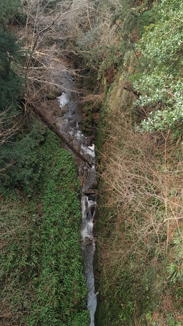
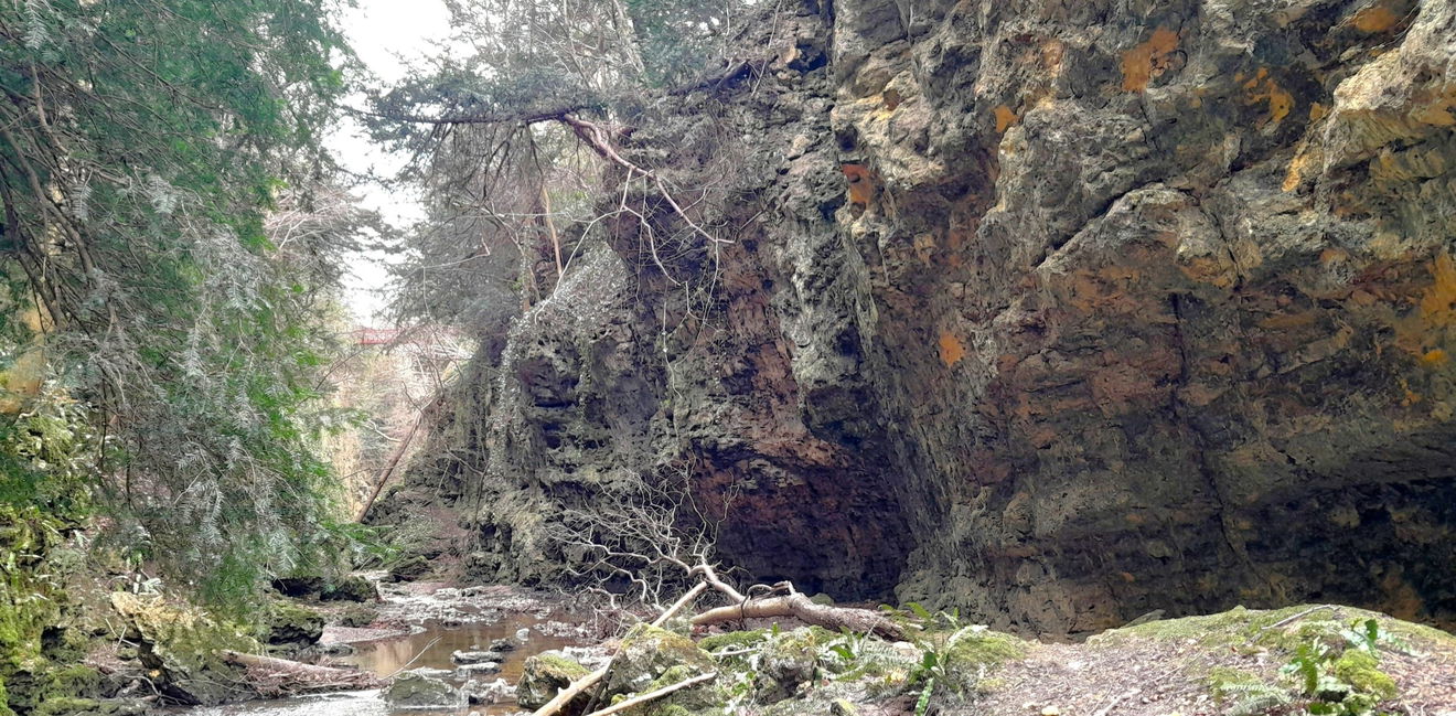
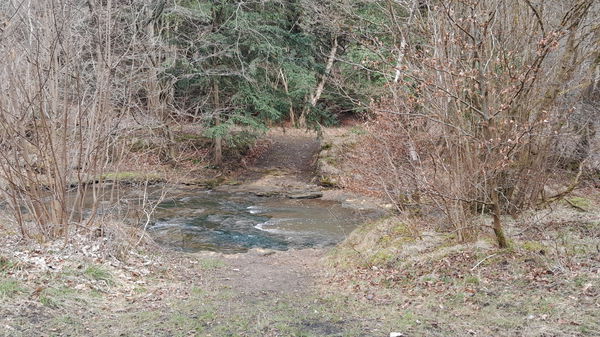
You'll see some moss-covered trees in Eden Burn. Follow the path to Devil's Bridge with the burn on your right.
I was not sure but checked my research and the Devil's Bridge was in the gorge of Jacob's ladder; a very dangerous area and also said to be a place of sacrifice and prisoner exchange.
Hedley Mason
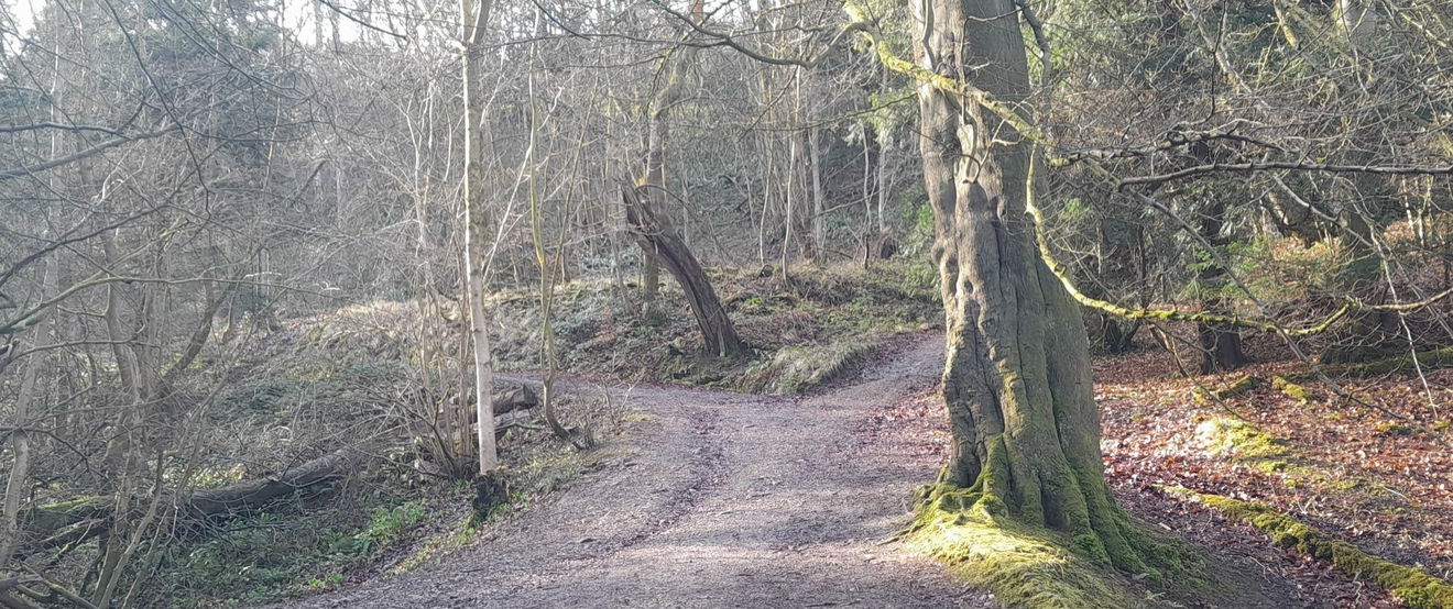
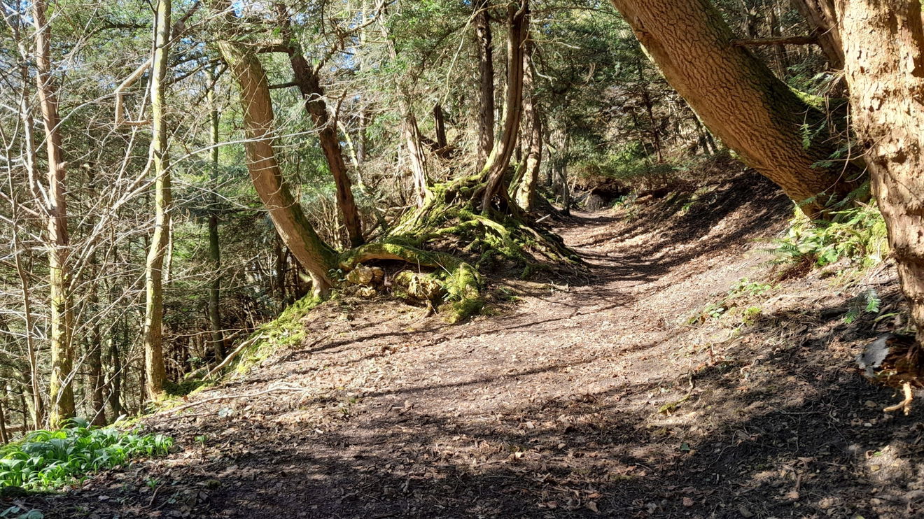
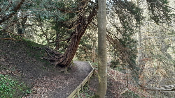
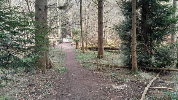
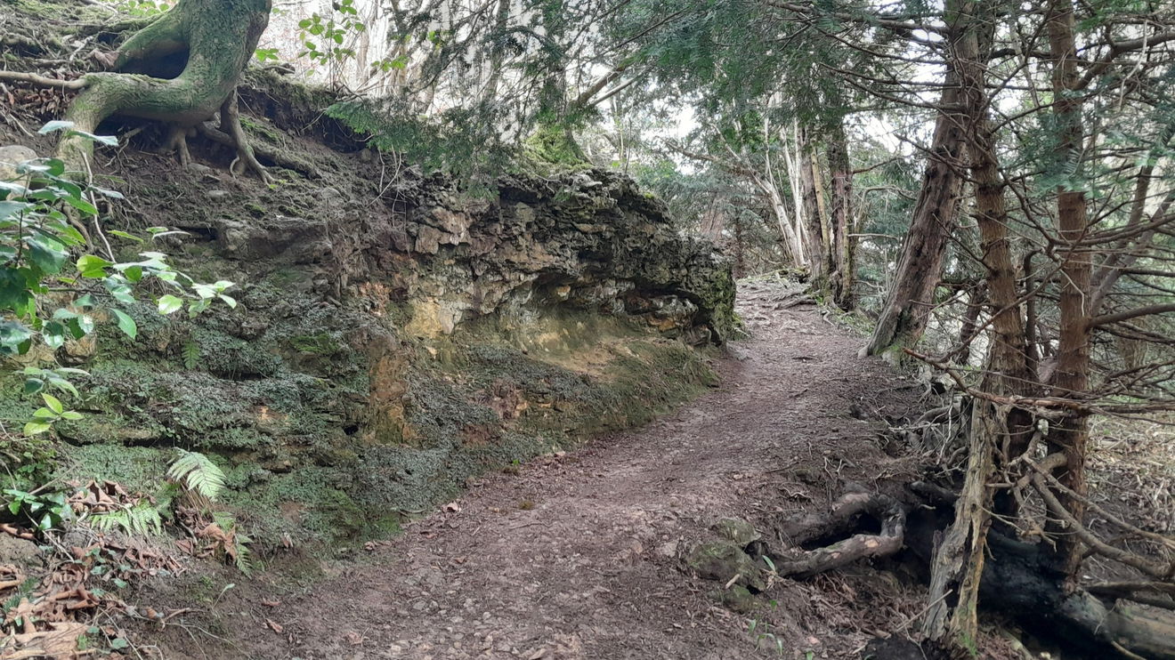
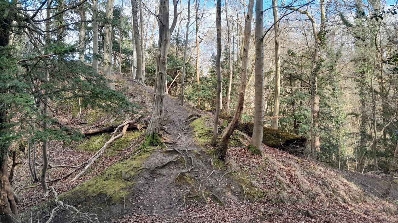
After crossing the black Devil's Bridge and surmising if the Magnesian Limestone is the Devil's scar, head left/west. This uphill stretch will keep you honest. There are some bewitching tree roots, and be careful walking on the edge of the precipice. I heard a diurnal Tawny Owl to add to the ambience.
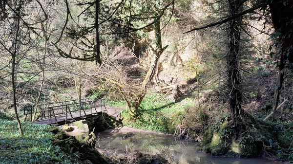
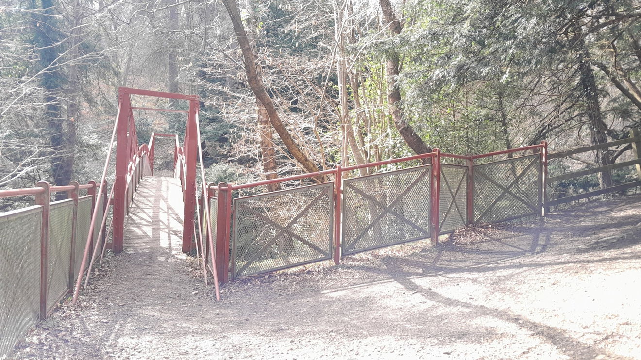
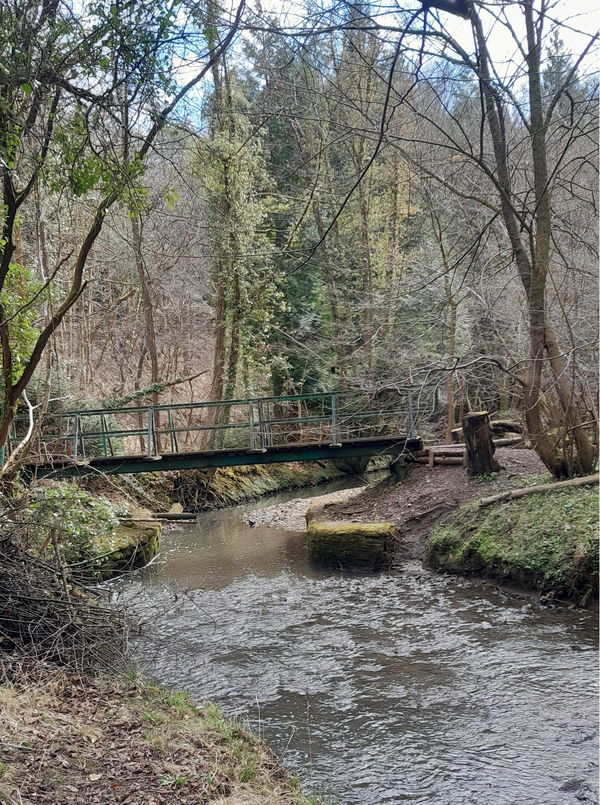
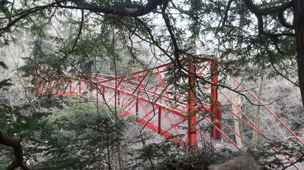
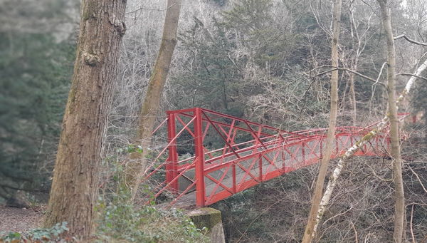
Ignore any paths on your right, and go left, heading for Gunners Bridge, an impressive bridge with a spectacular view down and up the 100-foot gorge. The Rev. John Burdon (1811 to 1893) commissioned it from a company in Hartlepool, which fabricated and installed it around 1877.
In 2009, Gunner's Bridge was renovated due to corrosion in the ironwork. The techniques used were pioneered in the Cragside iron bridge restoration. It was painted red when previously it was green. So if you see photos of the bridge and it is green, you know this is before 2009 and not another bridge!
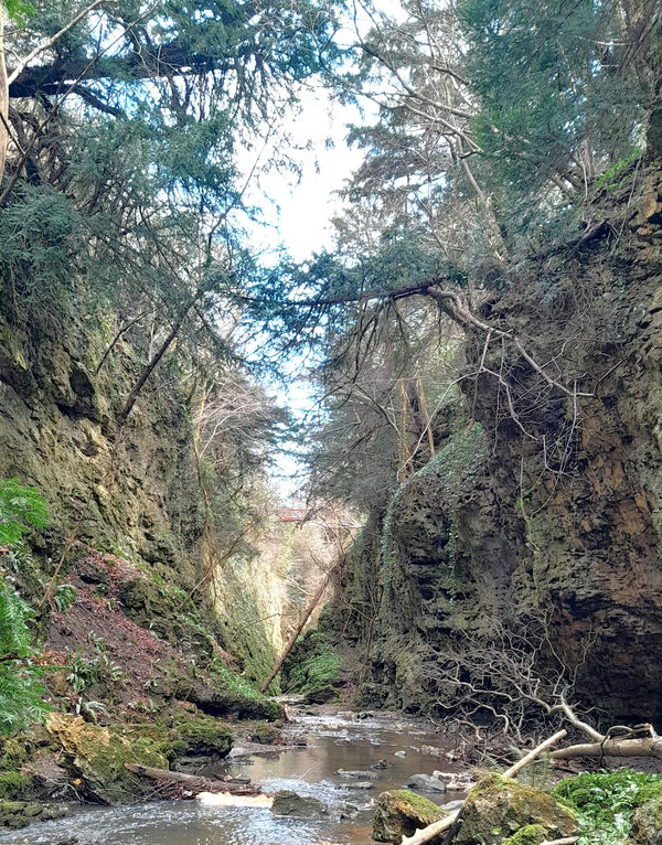
Castle Eden Dene is a National Nature Reserve and a Site of Special Scientific Interest. This is Britain's largest and best-preserved gorge, or, as it is said in the northeast, dene. This is partly due to the depth of the dene being around 100 feet, the same as the statue in Rio de Janeiro, Christ the Redeemer.
Head right/west after Gunners Bridge. Look out for overhanging trees. Some you can conk your block on! I know, I did it twice!
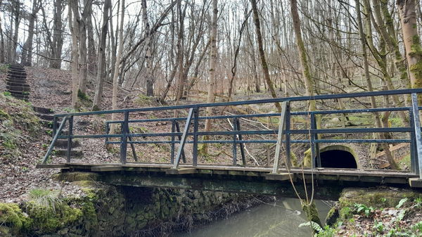
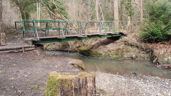
As you come to the Burn again, there is a black bridge, but before going over it, stay on the south side, and take a mystic walk alongside the Burn, you get to marvel at the beetling Magnesian Limestone and a glimpse of the red Gunners Bridge from below.
There is a myth that the Devil and his helper Gunner gathered rocks to 'build' Durham Cathedral using soft rock so the cathedral would collapse. Gunner was told not to look back at the Devil, but upon hearing what he thought was the sea crashing, he did. The Devil, being a hot head, threw a rock at Gunner, and the myth says that Gunner lays under said rock. Hedley Mason explains this is not as strange as it sounds, as the burn can fill up with water rapidly.
Head back to the black bridge.
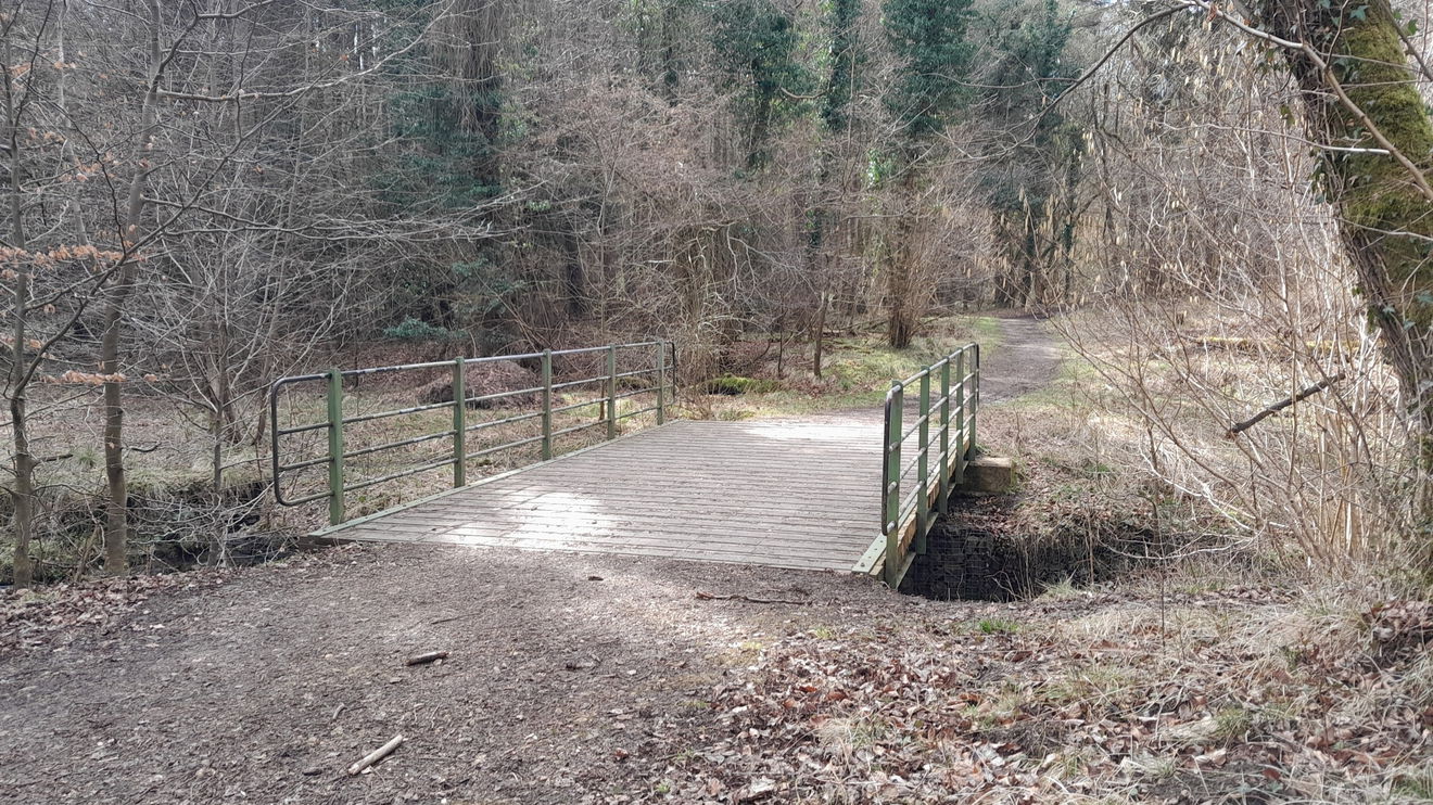
Cross the black bridge to the north side of the burn and up the steps going ahead/left/west. You should spot Green Bridge #1, which we will be crossing that later.
We will cross Green Bridge #2 instead which you can just spot when you see a fork. Take the left fork, hop over this bridge, and follow the track passing an old ford across the burn.
Now to the wide Churchill Bridge, I'd say no cigar though for beauty. I saw Dippers busy collecting nesting material.
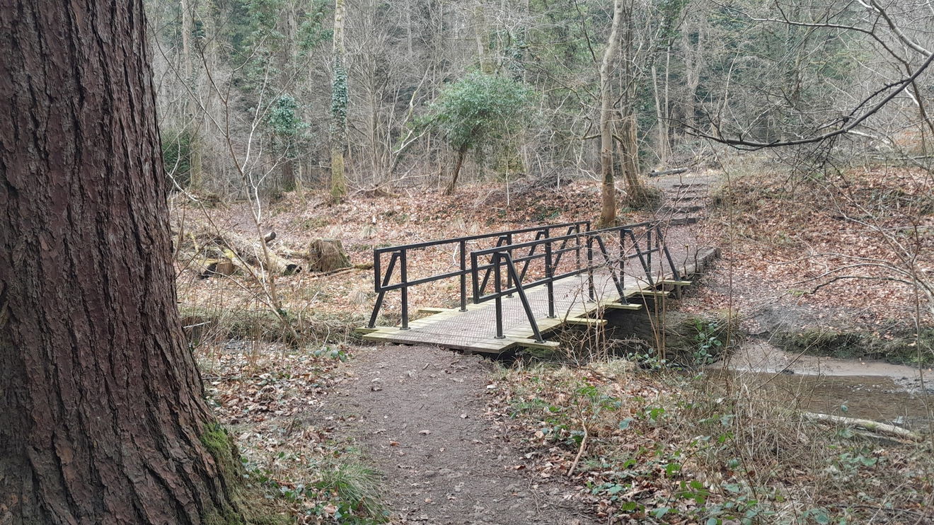
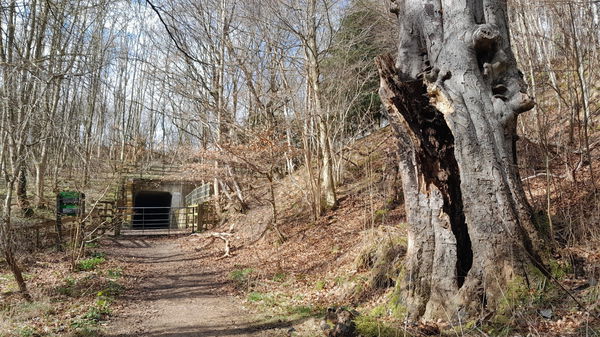
Keep walking, you can hear the roar of the A19 and spot a tunnel that goes underneath it. Turn left before this down some steps, and over Green Bridge #3. Then it is up, up and away.
At the top head back east/left. This bit is quite level and runs along the top of the dene. Don't be tempted to take the first left path, continue and cross over a beck (pipework) then head left and you will come back to Green Bridge #1. Cross over and head left. You cross over your tracks as this is where the Black Bridge is.
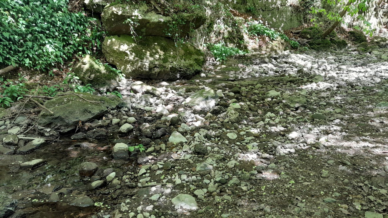
Now head up over to the right on the north side of the dene heading east. Notice the Magnesian limestone, which dates back over 250 million years to the Permian period and was part of the Zechstein Sea.
Continue through what is called the Trossachs, and back over Gunners Bridge and this time turn left/east.
There is much harts tongue fernin the dene. A chap I met on a walk told me it is also known as Christ's Hair fern. As a child, his school would visit this dene and the teacher showed the children that when the fern is stripped, it has dark hair.

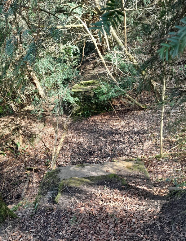
There are remains of an old bridge that features on an 1861 map. It also marks 'The Black Bull Swallow Hole' which has been elusive to me on my visits, and is a fascinating piece of geology. It is where the burn disappears as it is 'swallowed up' by the Magnesian Limestone to reappear further along. This occurs in several places.
We pass the turning we took going down to the Beech Grove and are now on the walk back to The Castle.

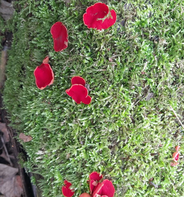
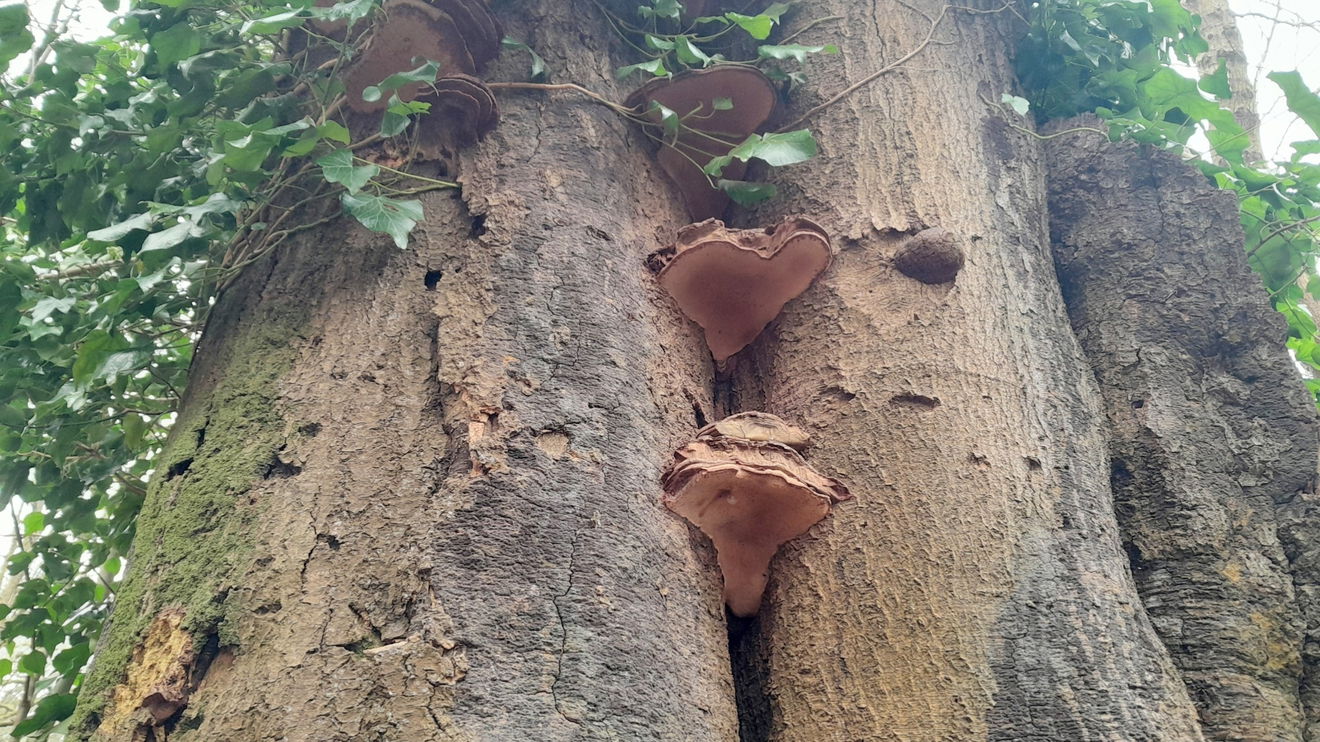
We travel pass the Castle and down the incline. There is fungithroughout the dene and I saw some Red Elf Cap, which is so aptly named. Look out for Hoof Fungus too.
Hoof fungus was once used to carry fire embers by the ancients. They would carry it using bark twine like a small handbag with a small ember inside. Also good as a fire lighter tinder. First known portable lighter.
Hedley Mason
There's a mound that people have been up, if you are curious go and have a look.
Head to the left which may look familiar as we came this way at the start of the walk.
Back over Castle Bridge and it's all uphill back to the Lodge.
Castle Eden Dene is approximately 4 miles from the coast to the A19. In the 500 acres, there are 12 miles of footpaths and this walk is on the west side using the Oakside Dene Lodge as the base. It has toilets and a café with a wide range of hot and cold food.
Natural England manages the Lodge. Please use a map and I found GPS Castle Eden Dene 4 best. Natural England has an app and a map, which may be useful if you get lost or disoriented. The route I have created took several attempts to master. You may prefer to follow the Yew tree or Red Squirrel Trails. Spoiler alert: There are no Red Squirrels here, they disappeared 20 or so years ago. However not all the paths you see on certain maps are available. My rough rule on my walk is if you see a bridge, you cross it!
This walk has a few sharp slopes, such is the nature of a dene and it is certainly a beauty. Castle Eden Dene has the largest area of our beloved Indigenous deciduous trees in the northeast. Oak, Beech and Yew are common, less so Wych Elm. A dene is a ravine/gorge where a burn/stream flows through the bottom where they run east/west from/to the North Sea. There is plenty of wildlife to spot or hear with Buzzards, Sparrowhawks, Woodpeckers, Nuthatches, and deer.
You deserve a cuppa now in the cafe.
My thanks go to local historian and geologist Hedley Mason for his explanations and folklore, which were passed down to him as he has lived in the area all his life.
Where to Park For Castle Eden Dene (West Side)
Where To Park For Castle Eden Dene (West Side)?
What three words
Parking at Cafe and toilets Natural England Stanhope Chase.
Contributed by Rosalind Parker
Thank you for reading. I hope it sparks your interest. It’s always a pleasure to get out and explore, whatever the weather. I enjoy uncovering little snippets of information, especially when they’re obscure, amusing, or meaningful. All photos were taken on a mobile phone.
More Walks from Rosalind
More Places In Peterlee
Find more fabulous places in Peterlee, County Durham and if you know of a place we haven't listed, then let us know.
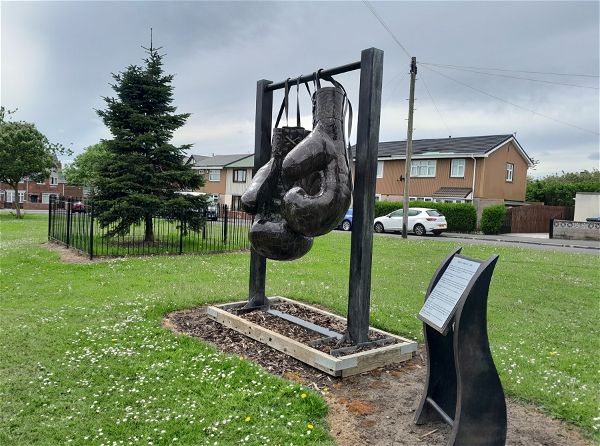
Boxing Gloves
Art Peterlee County DurhamSix foot pair of boxing gloves commemorating the achievements of Maurice Cullen.

Durham Angel
Statue Peterlee County DurhamDesigned by local sculpturer Ray Lonsdale, this statue 'Horns' could be the Angel Of Durham.
Castle Eden Dene
Landscape Peterlee County Durham221 hectares of woodland, grassland and paths leading to the beautiful Durham coast.

Find Us On Facebook
We post all our new places daily on our Facebook Groups page, so join the group today and be notified when we add a new place.
Join Our Facebook Group