Old Law Beacons On Guile Point
Lighthouse In Holy Island, Northumberland
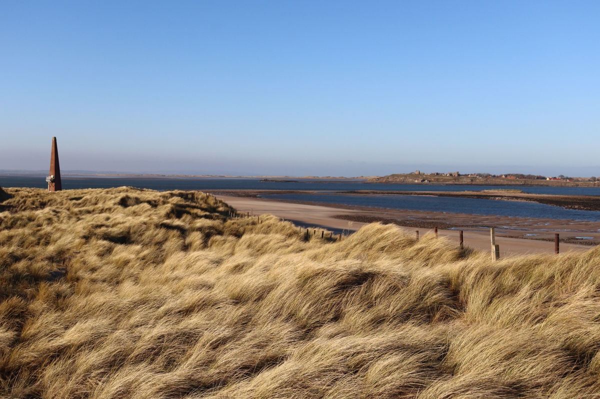
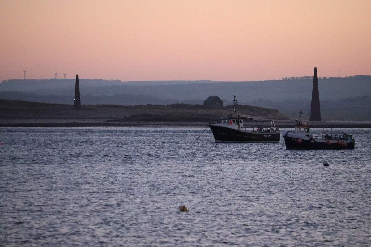
Two obelisk navigation beacons that when lined up would direct you into Holy Island harbour.
Love this place? Become its champion with a short message, memory, dedication, or local business mention and share your connection to somewhere special.
Support the Fabulous North and champion this place for:
Usually £10

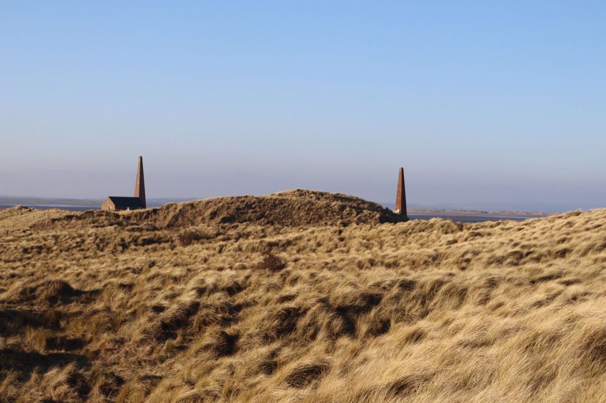
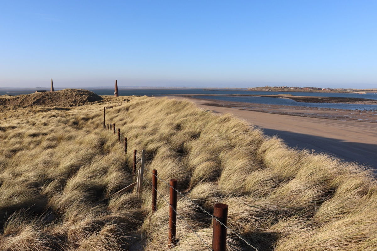
If you have visited Holy Island and looked out over the harbour, then no doubt you will have noticed two obelisks on the beach opposite.
These are the Old Law Beacons on Guile Point and similar to the Emmanuel Head Daymark on the north of the island, they were a navigational aid for boats entering the estuary.
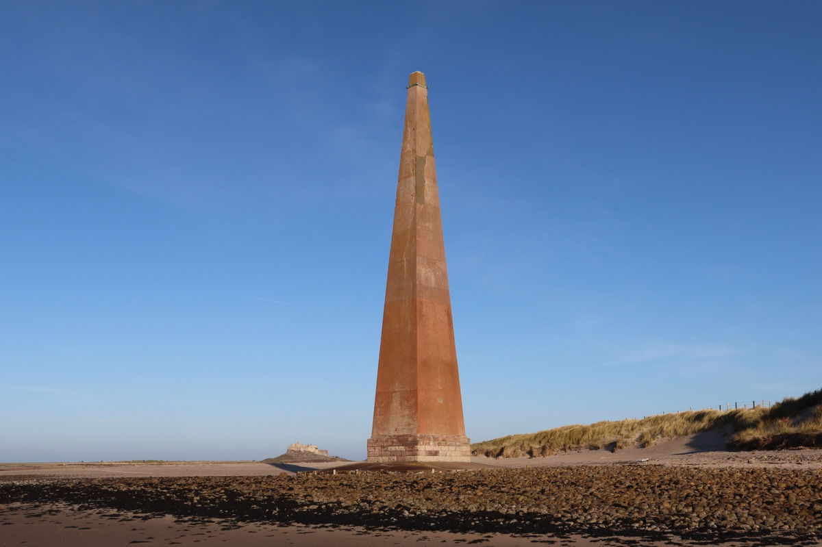
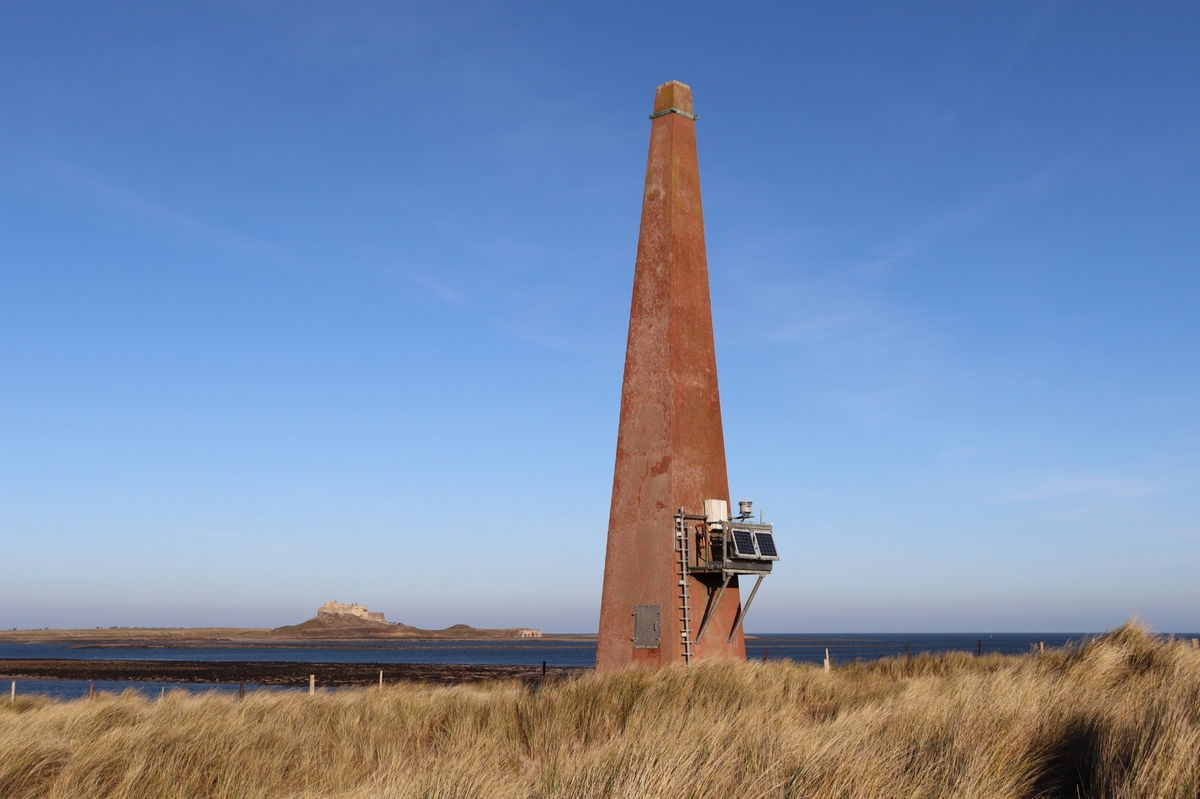
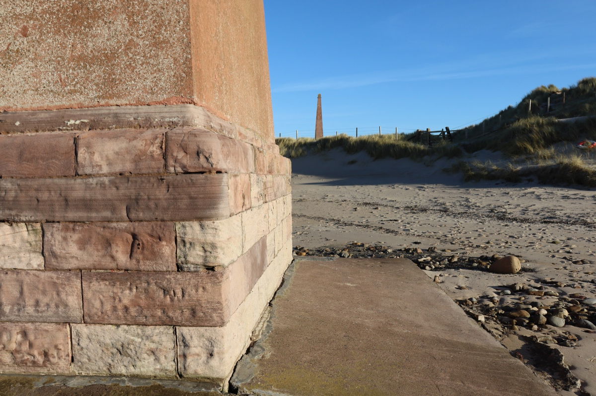
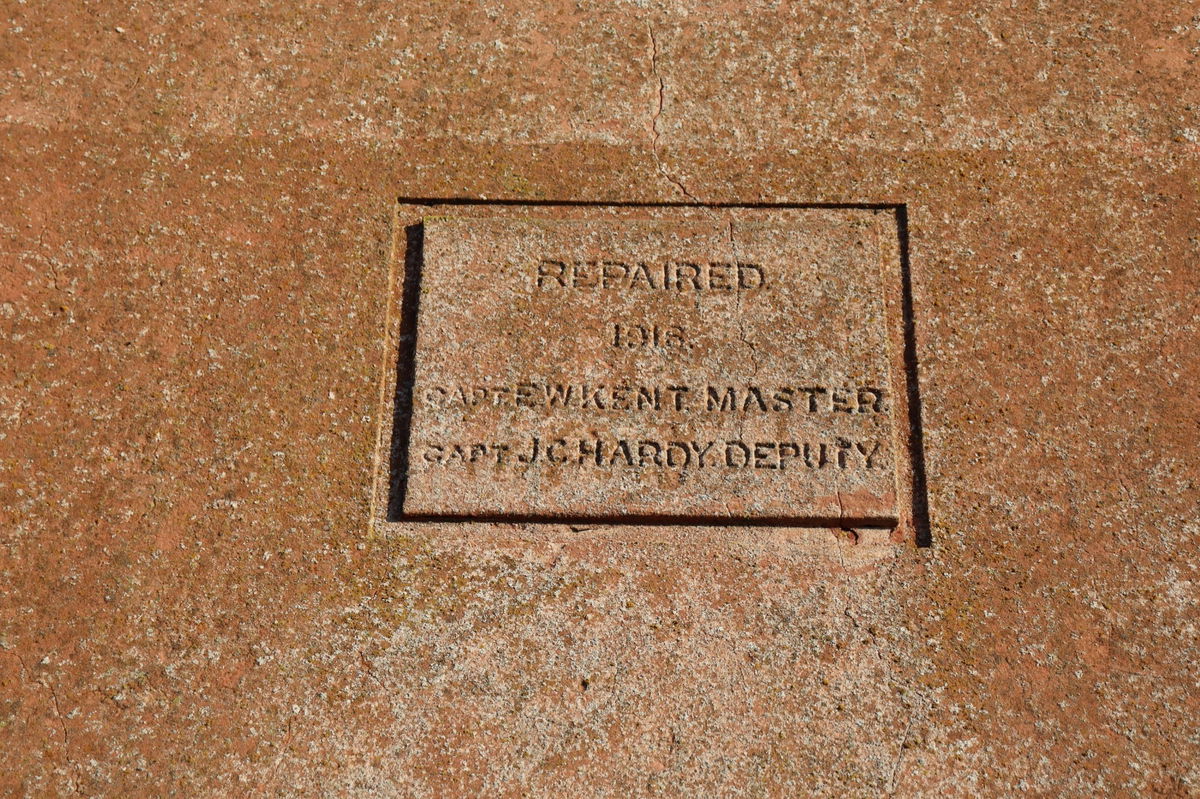
They were designed by Newcastle architect John Dobson, famous for many buildings in including Eldon Square and Central Station. The 21 metre tall beacons were to be used solely during the day as it was considered too dangerous to enter the harbour at night.
Although they look solid stone, then are actually wooden with a stone cladding on the outside. They were built in 1826 by Trinity House, who continue to manage lighthouses and navigational aids in the UK.
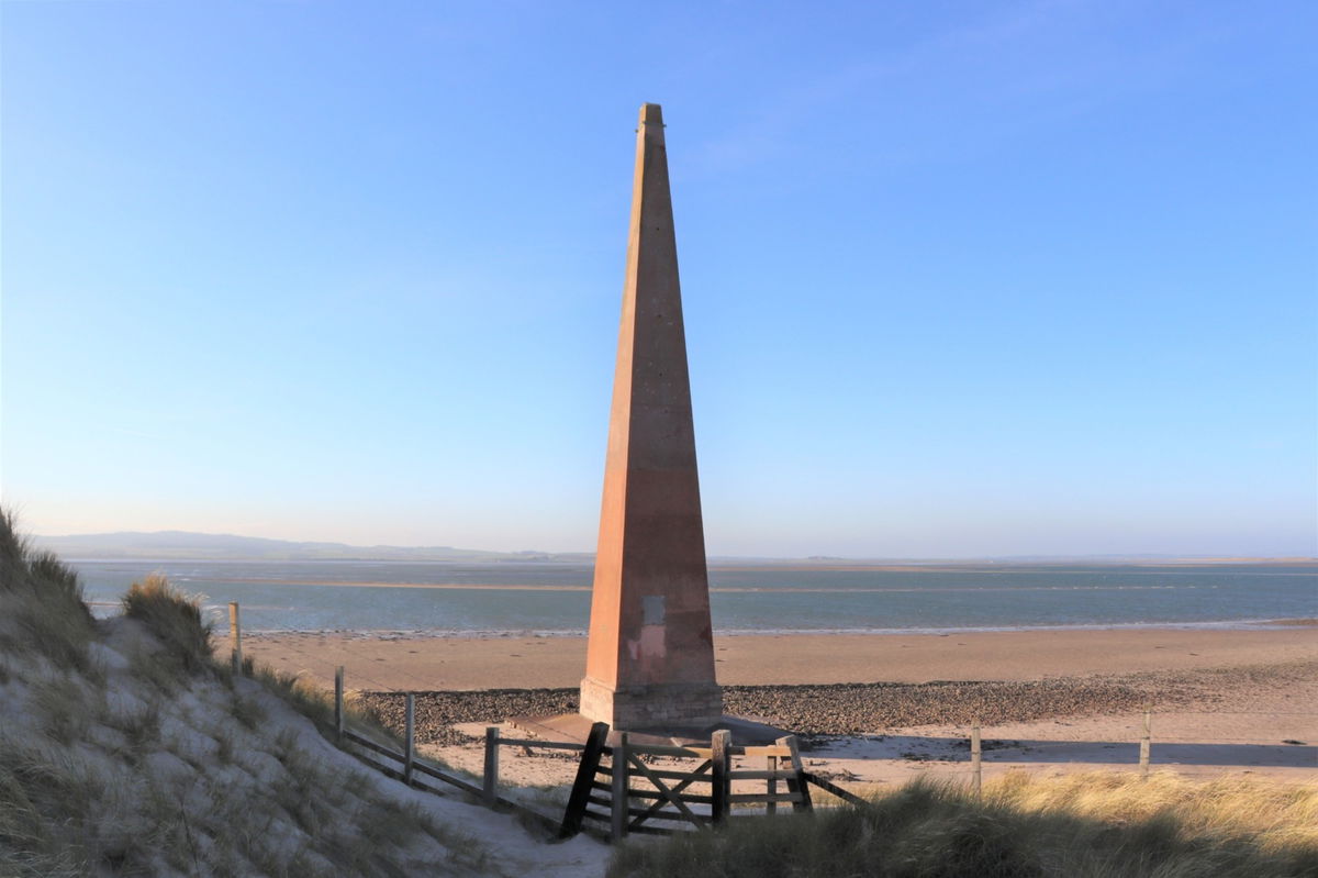
The way they worked is that a vessel entering the harbour would line up the two beacons on a bearing of 260° and then turn sharply northward as they approached the tip of the sandy spit on the south side of the entrance to Holy Island Harbour.
In 1992, solar panels lights were added to the east column to illuminate the channel at night.
We haven't managed to visit this one ourself, however our Fabulous North friend Chris Welch kindly supplied us all of these amazing photographs.


Although here is one photograph we took of them from our visit to Holy Island.

NOTE: Please be aware to avoid visiting the beacons in the summer months as the beach immediately to the south of the obelisks is an important haul out area for the Grey seals. So walking along the beach during the summer can disturb them. There are also Little Terns nest on the small islet to the east and are a protected species. RSPB Wardens are normally present then.
Thanks to Active 4 Seasons for this information.
Get 4 points if you have visited this place. Already visited by 114 VIPs.
Login to bag this placeHow To Find Old Law Beacons On Guile Point
Where Is Old Law Beacons On Guile Point?
Lat / Long
55.65819, -1.793267
What three words
Where To Park For Old Law Beacons On Guile Point?
Lat / Long
55.626361, -1.792885
What three words
You can park at the side of the road in Belford.
Contributed by Simon Hawkins
Thanks for checking out this place on the Fabulous North! I do enjoy a wander out in to the countryside trying to find hidden gems that not many people know about. You can't beat a rogue pele tower up a remote hill, a mysterious stone circle or a stunning waterfall secluded in a forest.
More Places from Simon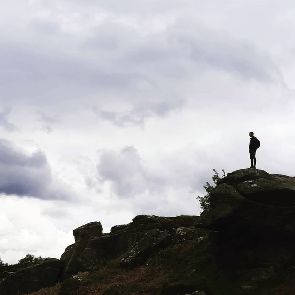
More Places In Holy Island
Find more fabulous places in Holy Island, Northumberland and if you know of a place we haven't listed, then let us know.

Osborne's Fort
Tower Holy Island NorthumberlandA ruined fort tower on the opposite side of the harbour to Lindisfarne Castle on Holy Island.

Castle Point Lime Kiln
Lime Kiln Holy Island NorthumberlandProbably the largest lime kiln in Northumberland sitting next to Lindisfarne Castle on Holy Island.

Lindisfarne Gospel Garden
Garden Holy Island NorthumberlandGarden inspired by the Lindisfarne Gospels, opened in 2004.
More Lighthouses
So this lighthouse wasn't enough and you want more? Don't worry we have you covered.

High And Low Lights Of North Shields
Lighthouse North Shields Tyne And WearDecommissioned leading lights in North Shields.

Souter Lighthouse
Lighthouse Whitburn Tyne And WearBuilt in the 1870s, it was the first lighthouse in the world to be designed and built specifically to use alternating electric current.

St Mary's Lighthouse
Lighthouse Whitley Bay Tyne And WearA lighthouse on a small tidal island just north of Whitley Bay. It is linked to the mainland by a short concrete causeway which is submerged at high tide.
Never Miss A Fabulous Place
If you are afraid of missing out on all the fabulous places we post, or just want to be the first to know, then sign up to the Fabulous North.
Each week we will email you all the brand new places that we visit.
Sign Up To Alerts

Find Us On Facebook
We post all our new places daily on our Facebook Groups page, so join the group today and be notified when we add a new place.
Join Our Facebook GroupOld Law Beacons On Guile Point was listed in Lighthouse // Northumberland // Holy Island