High Moorsley Weather Radar Station
Landmark In Houghton-le-Spring, Tyne And Wear
A distinguished weather radar station that can be seen for miles.
Love this place? Become its champion with a short message, memory, dedication, or local business mention and share your connection to somewhere special.
Support the Fabulous North and champion this place for:
Usually £10
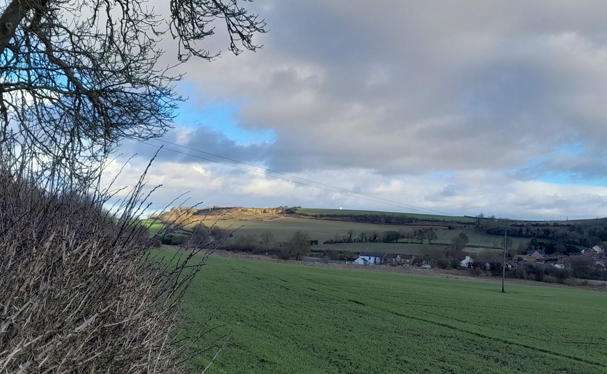
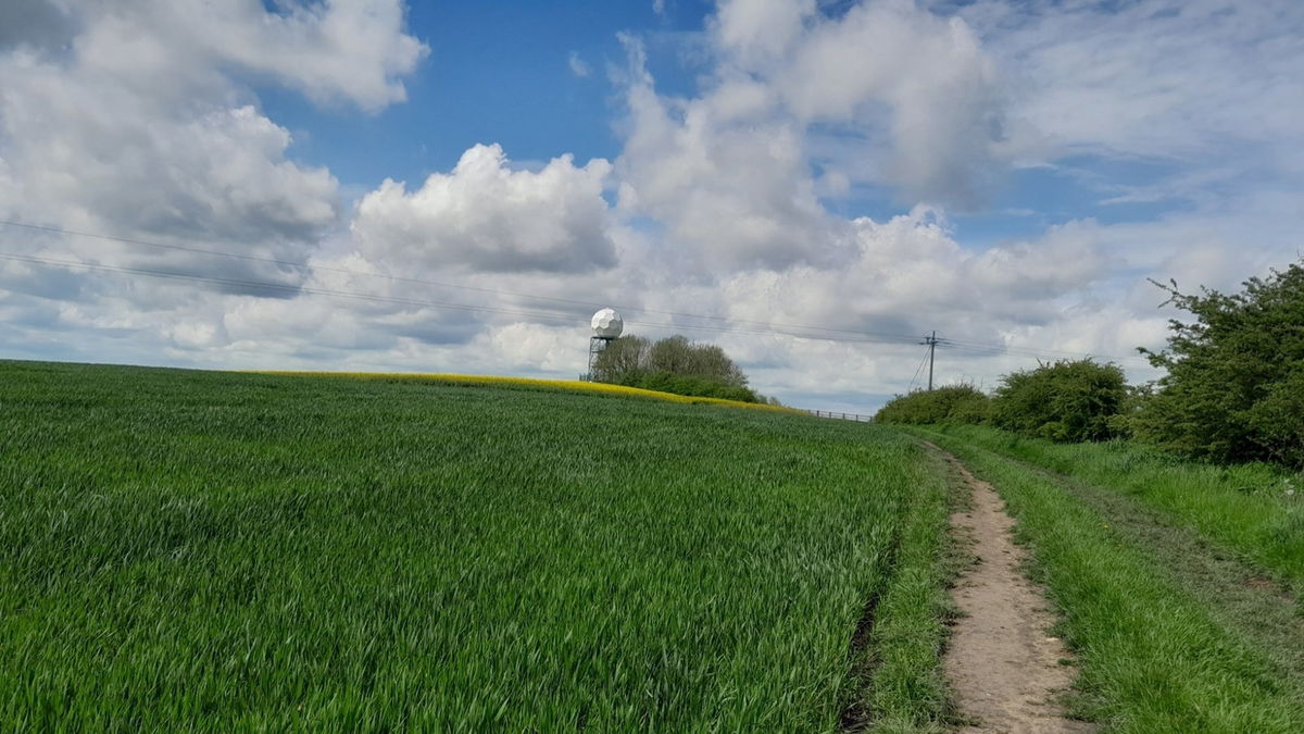
I always wondered what the golf ball was that I could see near where I live, so I went to find out. On my first excursion, I didn't use sat nav or maps and tried to follow roads and spot it as it can be seen for quite a distance around the area. I didn't get near it!
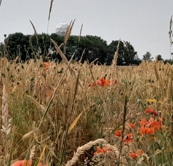
So next time I used an Ordnance Survey map and bingo! I parked down the hill in a layby and went to explore. I passed a covered reservoir, and there it was. It is High Moorsley Weather Radar Station.
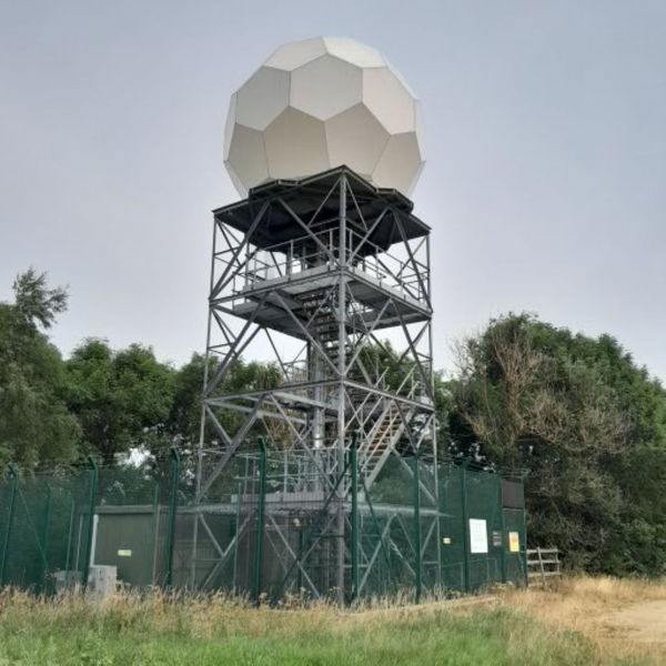
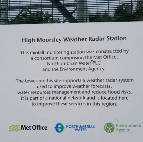
It opened in 2009 and was the first weather radar station in the North East, which is where we get our forecast from. It cost £10 million and is one of 15 that cover the UK. Its range is up to 150 miles.
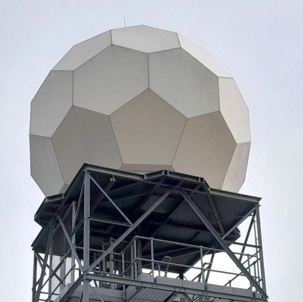
How does it work? I'm glad you asked. It uses microwaves and compares measurements, (There is more on the Met Office website for real enthusiasts). For those that like a bit of geometry the 'golf ball' shape is called a truncated icosahedron. Remember that for your next pub quiz!
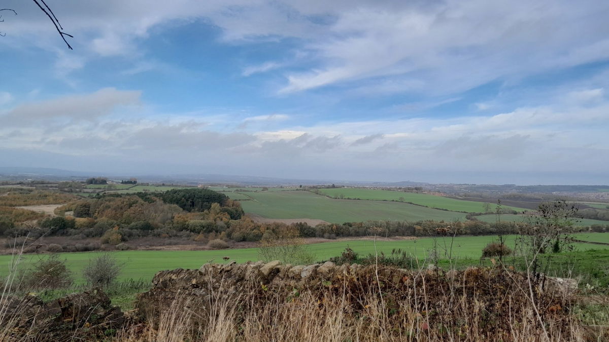
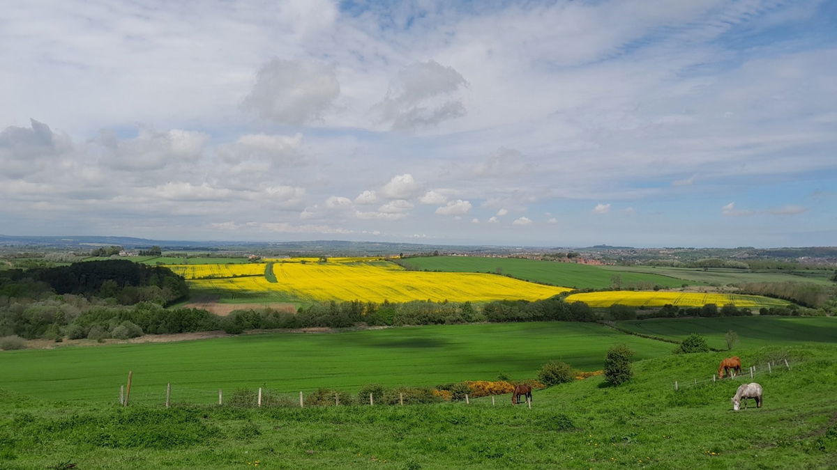
At the site, there is an Ordnance Survey triangulation point (163). It is the highest point in this Sunderland area. Yes, it is higher than the Penshaw Monument (trig point 136), which you can see, along with Durham Cathedral and the Angel Of The North
Be sure to admire the view on the north side of Moorsley Road too, and remember to take your binoculars!.
Get 3 points if you have visited this place. Already visited by 38 VIPs.
Login to bag this placeHow To Find High Moorsley Weather Radar Station
Where Is High Moorsley Weather Radar Station?
Lat / Long
54.803431, -1.474555
What three words
Where To Park For High Moorsley Weather Radar Station?
Lat / Long
54.807258, -1.475866
What three words
Parking is available in a layby just down the hill before the footpath that takes you to the radar station.
Contributed by Rosalind Parker
Thank you for reading. I hope it sparks your interest. It’s always a pleasure to get out and explore, whatever the weather. I enjoy uncovering little snippets of information, especially when they’re obscure, amusing, or meaningful. All photos were taken on a mobile phone.
More Places from Rosalind
More Places In Houghton-le-Spring
Find more fabulous places in Houghton-le-Spring, Tyne And Wear and if you know of a place we haven't listed, then let us know.

Hetton Bogs Nature Reserve
Landscape Houghton-le-Spring Tyne And WearA local nature reserve with a modern history of regeneration from marshland to bog due to the end of water mills.

Shifting Times
Art Houghton-le-Spring Tyne And WearA huge miner’s helmet and cap lamp hung on a peg rack created by Father and son Ray and Sam Lonsdale in homage to the area's mining heritage.

Elba Park
Landscape Houghton-le-Spring Tyne And Wear52 acre park near Houghton-le-Spring with a sculpture trail and plenty of wildlife.
More Landmarks
So this landmark wasn't enough and you want more? Don't worry we have you covered.

Osmotherley Market Cross And Barter Table
Landmark Osmotherley North YorkshireAn ancient market cross, the base dating from Medieval times, and a curious stone table once used as a pulpit for John Wesley to preach from.

Curry's Point
Landmark Whitley Bay Tyne And WearA plaque marking the site of a gibbet where Michael Curry was chained for murder.

Never Miss A Fabulous Place
If you are afraid of missing out on all the fabulous places we post, or just want to be the first to know, then sign up to the Fabulous North.
Each week we will email you all the brand new places that we visit.
Sign Up To Alerts

Find Us On Facebook
We post all our new places daily on our Facebook Groups page, so join the group today and be notified when we add a new place.
Join Our Facebook GroupHigh Moorsley Weather Radar Station was listed in Landmark // Tyne And Wear // Houghton-le-Spring