Seaton Sluice
Landscape In Seaton Valley, Northumberland
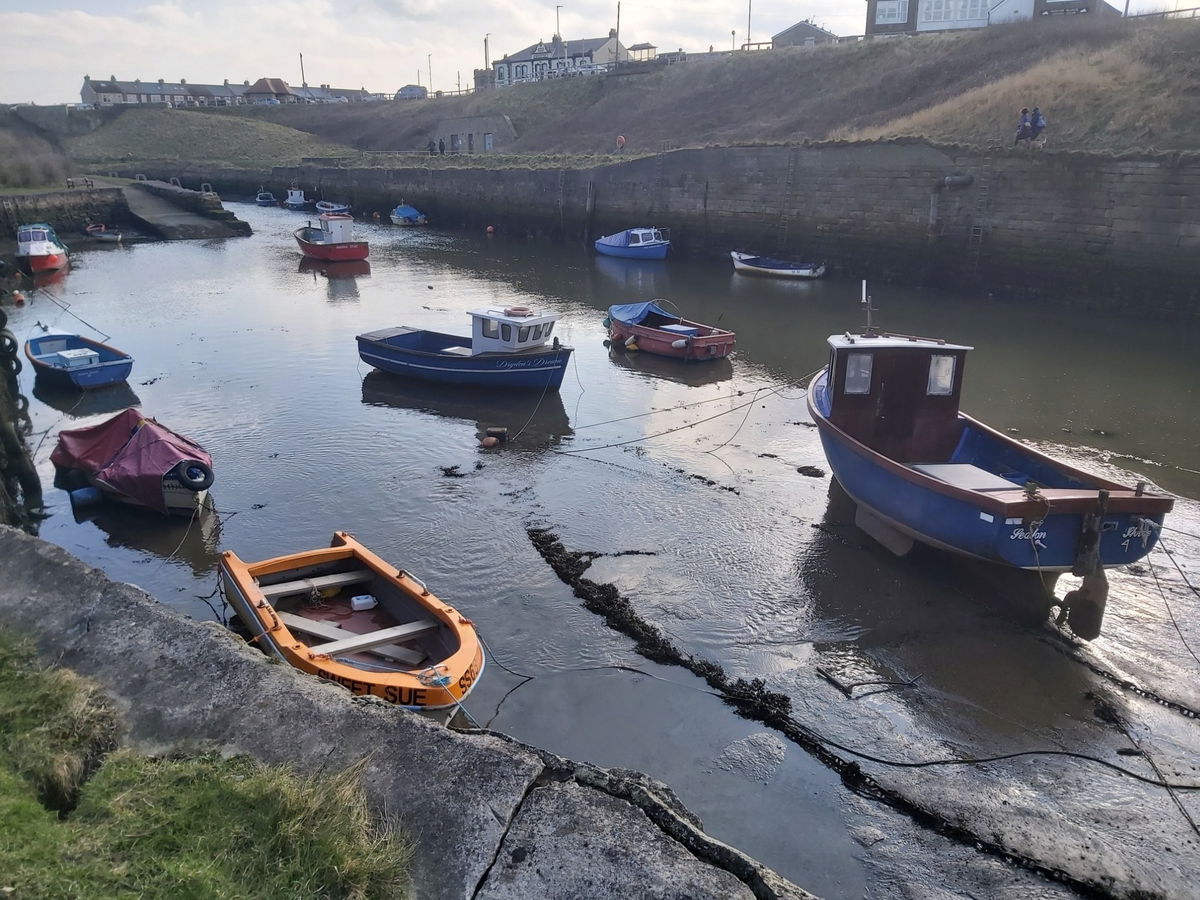
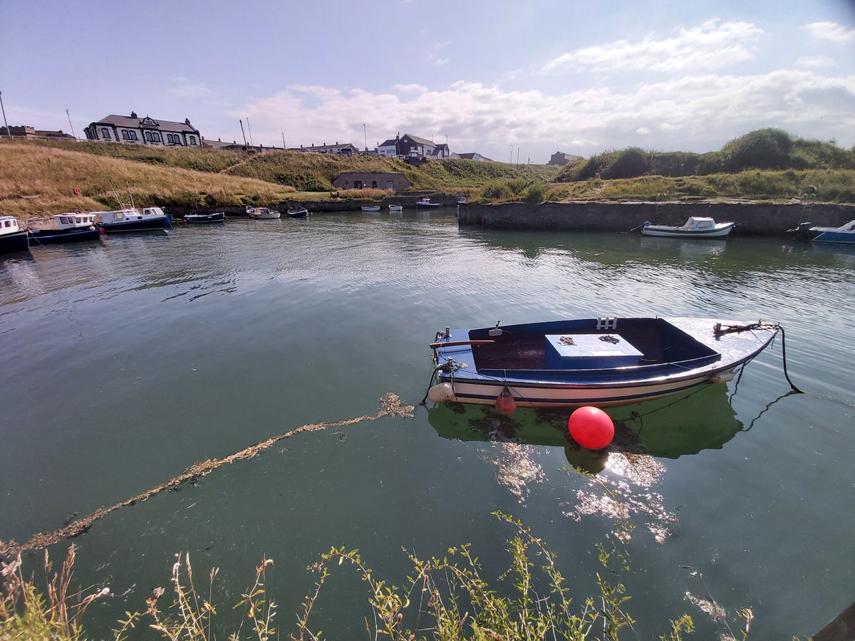
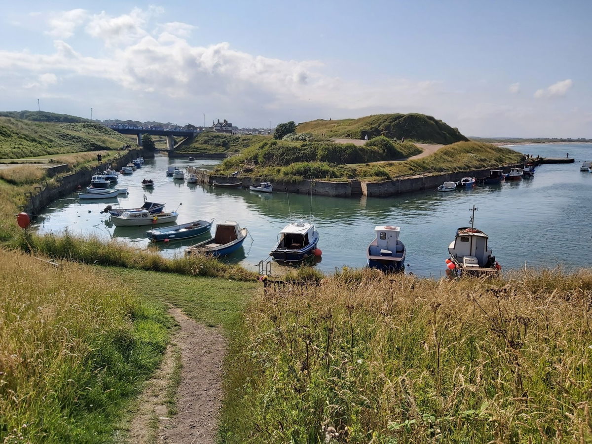
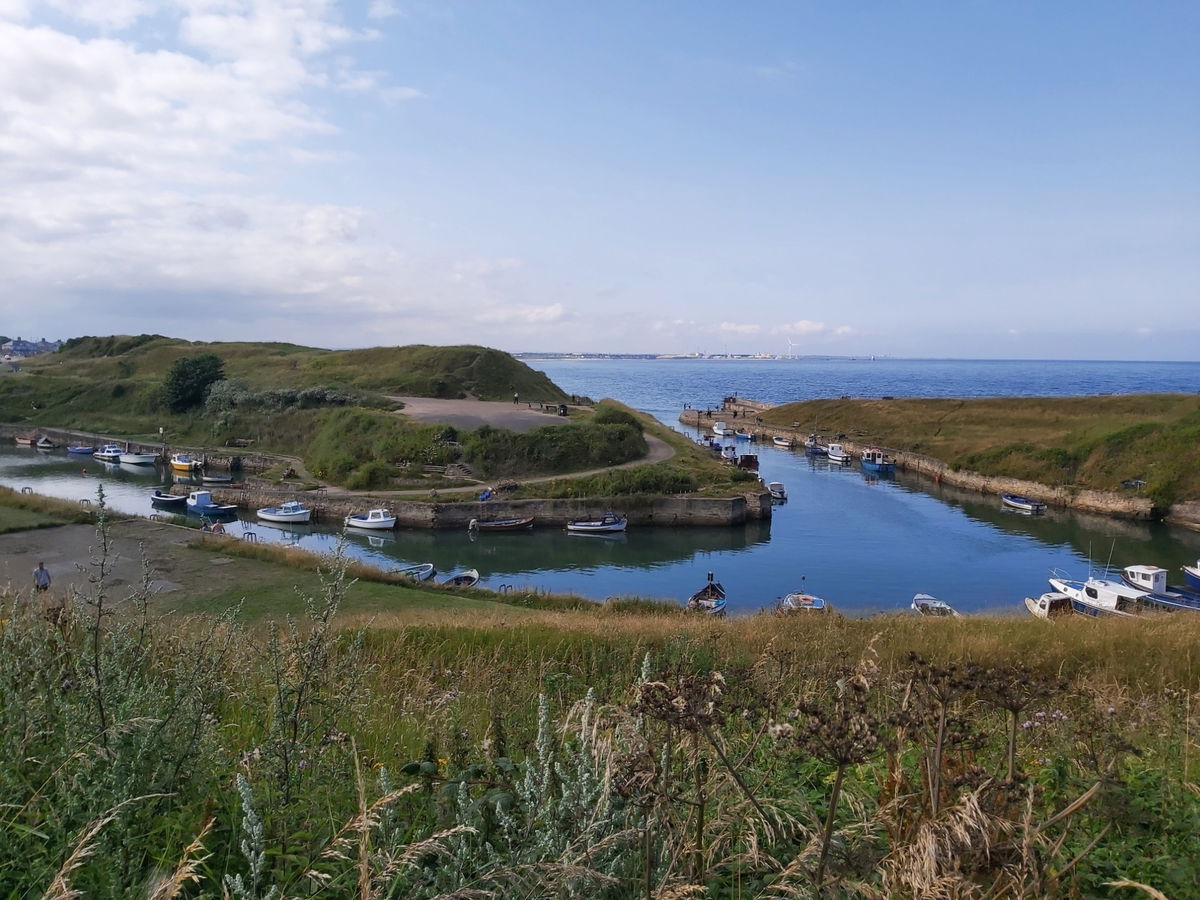
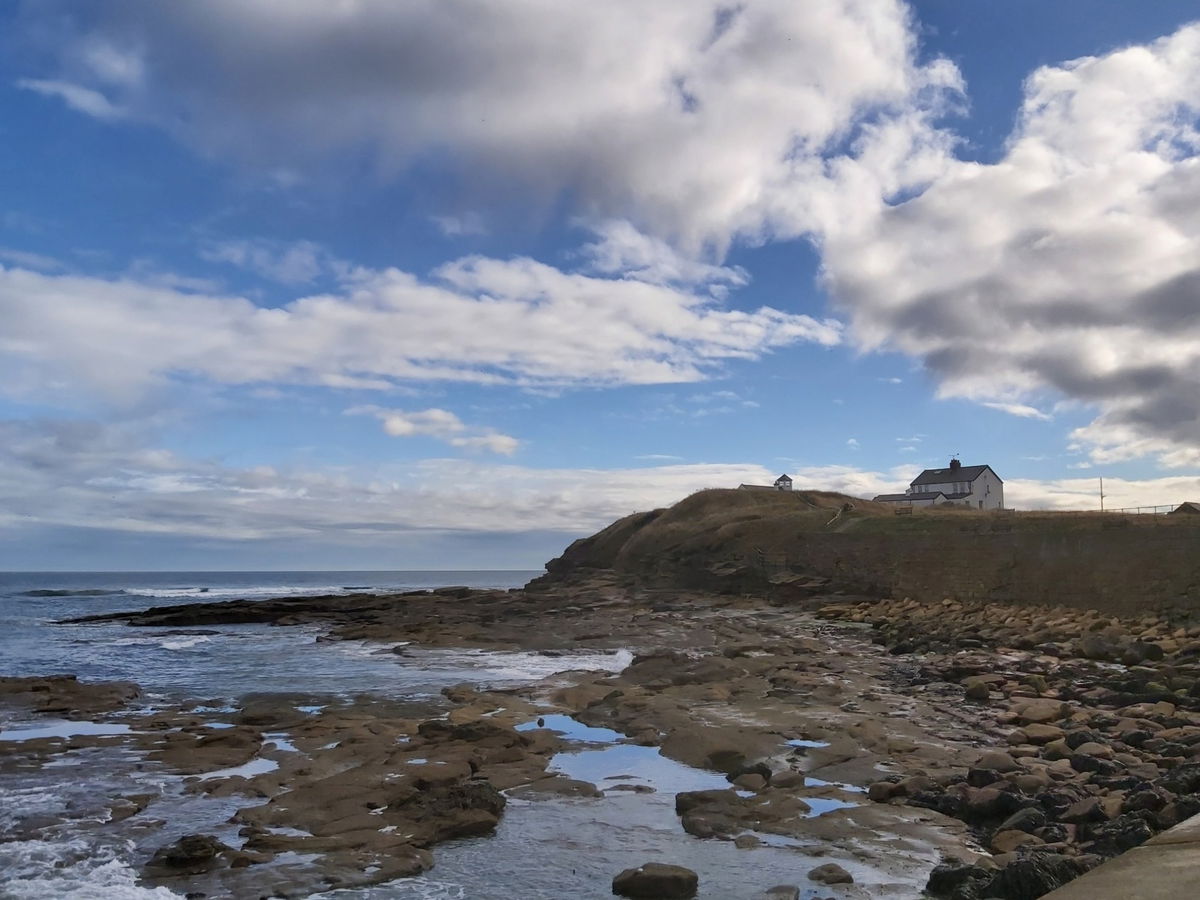
A small and picturesque harbour which used to export salt, coal and bottles.
Love this place? Become its champion with a short message, memory, dedication, or local business mention and share your connection to somewhere special.
Support the Fabulous North and champion this place for:
Usually £10
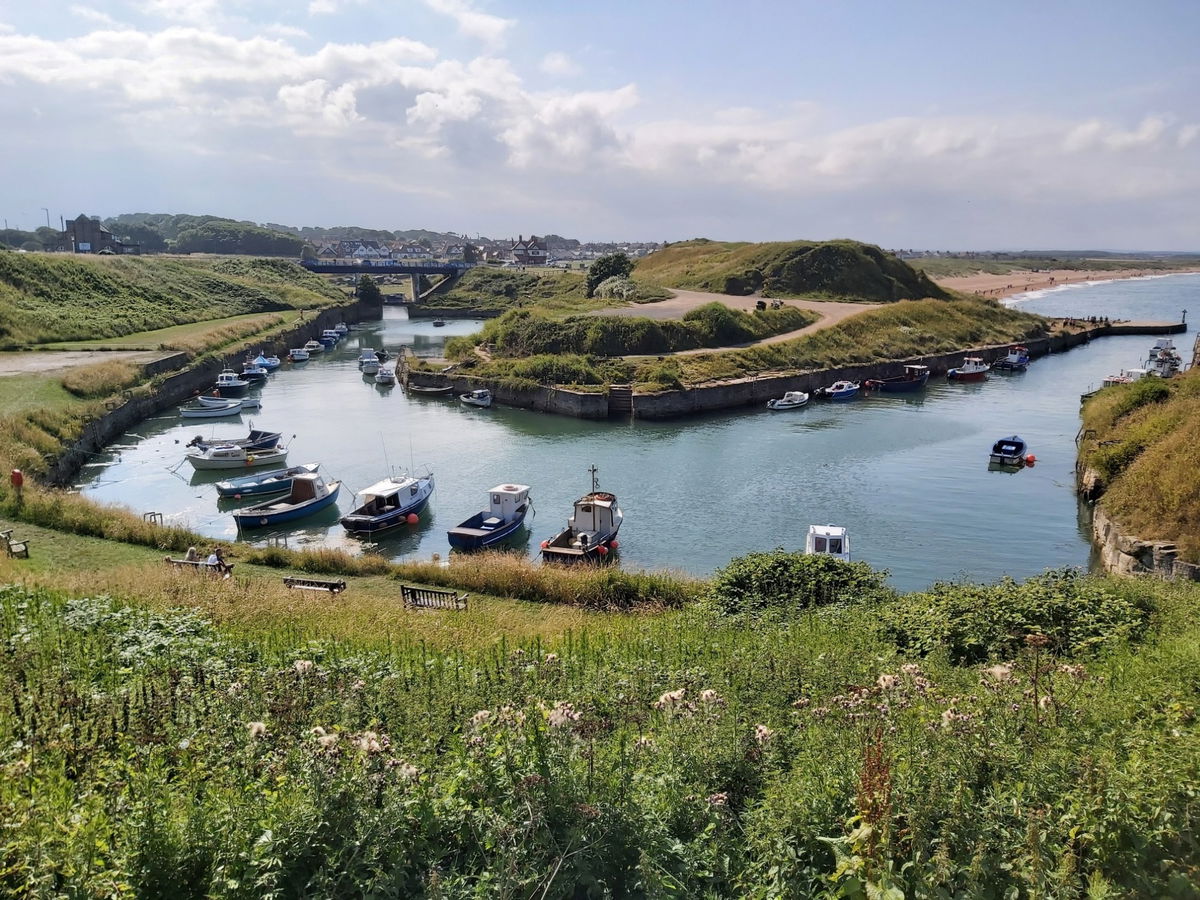
I can't imagine anyone from the North East not having visited Seaton Sluice at some time. Situated on the coast twixt Blyth and Whitley Bay this small harbour has been well used over the past 500 years.
We used to visit here regularly and my earliest memories were from the 80s where we would head down to play on the rocks, looking in the pools and watching the waves crash on the rocks. I also remember beating my older sister in a running race for the first time. I was 7 and it was a huge defining moment in my youth! (40+ years later and she still hasn't beaten me!)
We'll get into a bit of history and geography to let you know the happenings of the place. First thing to let know is that the word “Seaton” means “settlement by the sea” in Old English. Make a note for your next pub quiz!

At the start of the 12th century the land around here was owned by Hubert de Laval (as in the Delavals of Seaton Delaval Hall) and was the nephew of William the Conqueror. This area was renowned for making salt in the salt pans and the surrounding area and was such known as Hartley Pans.
Now if you're making salt in huge quantities, you're probably not going to be able to use it all on your Friday fish and chips and so it was transported to Blyth harbour for exporting. By 1550, someone had the great idea of exporting it direct from the small natural harbour at the sluice. In addition to salt the harbour was also used to export coal and was subsequently renamed to Hartley Haven.
Everything was dandy, but export was slowed because the harbour was prone to silting which drastically limited the access for ships. But not to worry as the clever Sir Ralph Delaval had a brainwave to build a pier with sluice gates, trapping the water in at high tide and then flushing the sand out at low tide. Thereafter the village became known as Seaton Sluice.
Sir Ralph also lined the stone pier with six cannons to deter privateers from approaching the harbour.
Although the harbour was well used, due to its narrowness and angle of entry, it was difficult to manoeuvre around, even for experienced mariners. Another Delaval called Sir John Hussey Delaval made further improvements to the harbour in the 1760s.
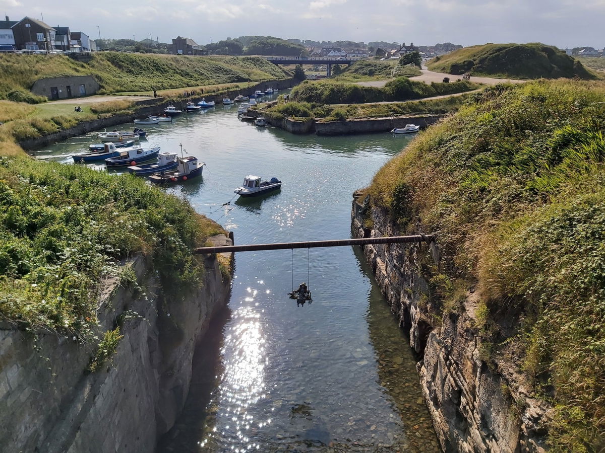
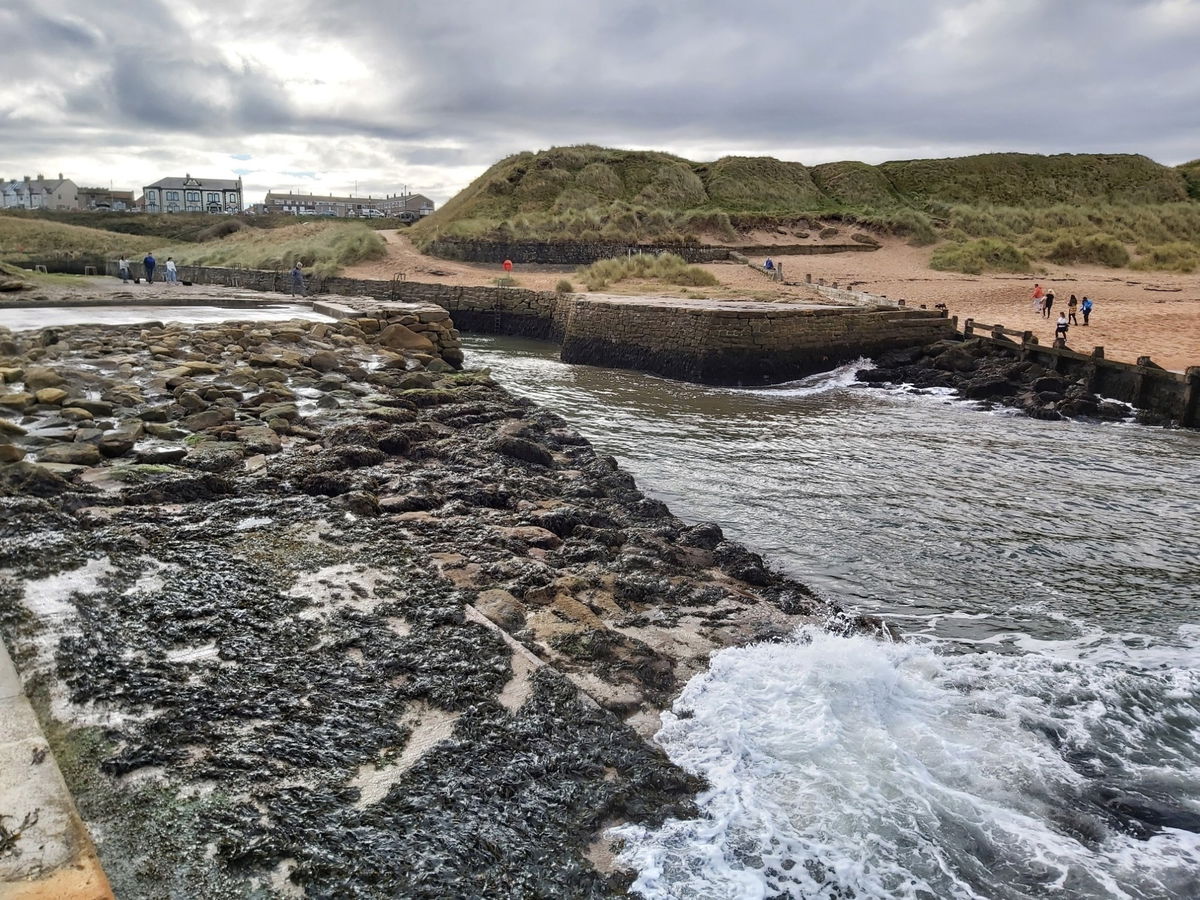
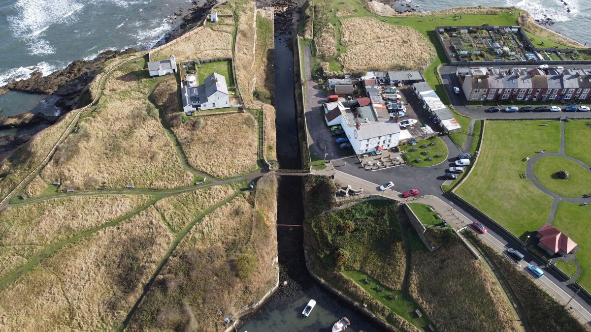
He blasted a channel straight out into the sea known as The Cut, measuring 270m long, 9m wide and 16m deep. The cut also had sluice gates at both ends meaning the water could be trapped regardless of the tide, allowing ships to be unloaded and loaded at any time of the day.

You can see at the entrance to the cut there are a build up of rocks. These were positioned there when the wooden staithes were removed in order to protect the harbour.
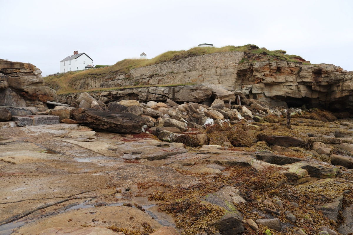
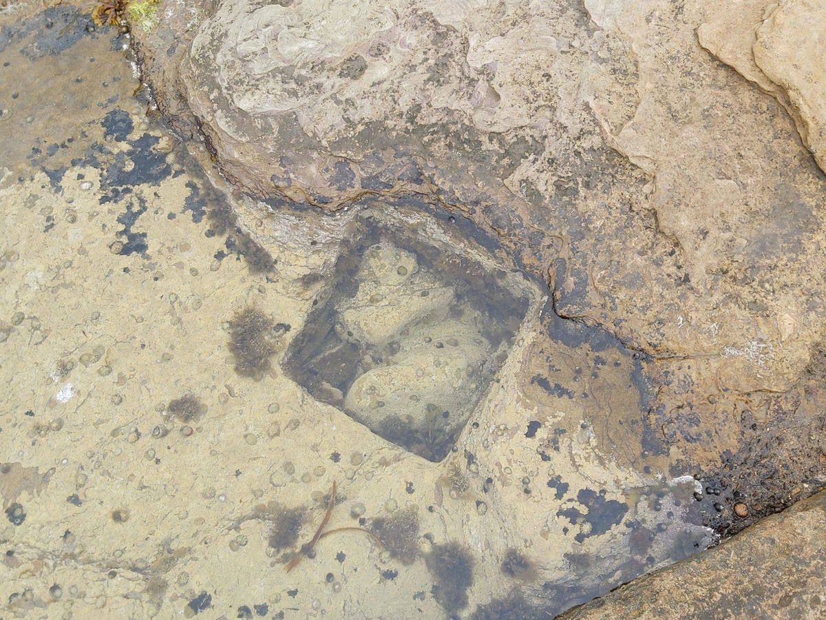
There are also a number of square holes in the bedrock that the staithes would have been set into. When the stone blocks of the pier moved with the sea they fell back into place. You can still see remains of some the timbers still set into the holes.
Thanks to Billy Embleton and Paul Appleby for this information.
There was also a column cut into the wall with a disc at the bottom. Maybe something to do with the sluice gates.

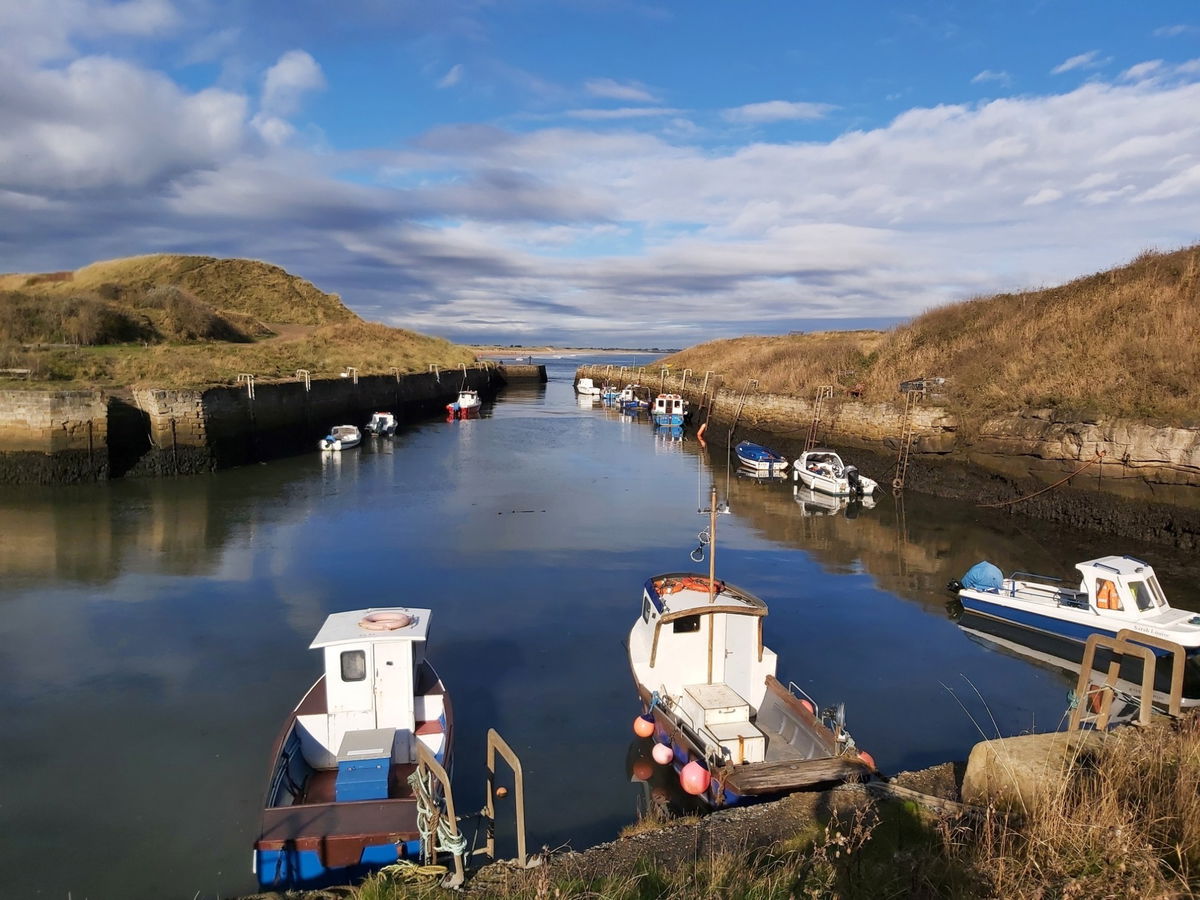
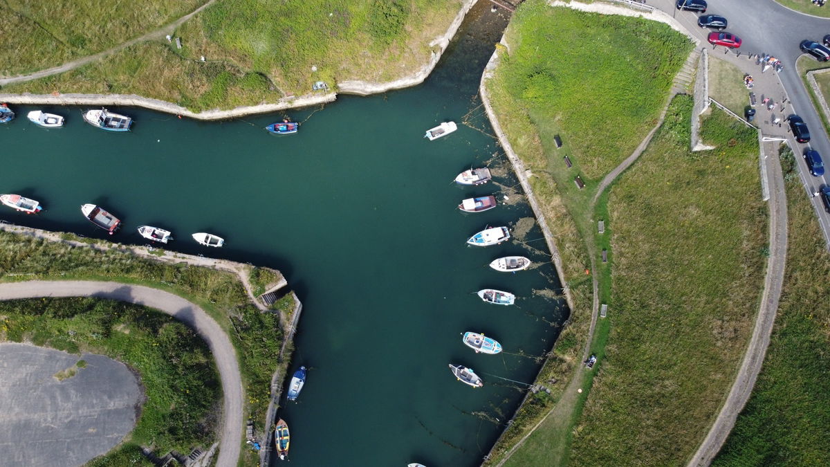
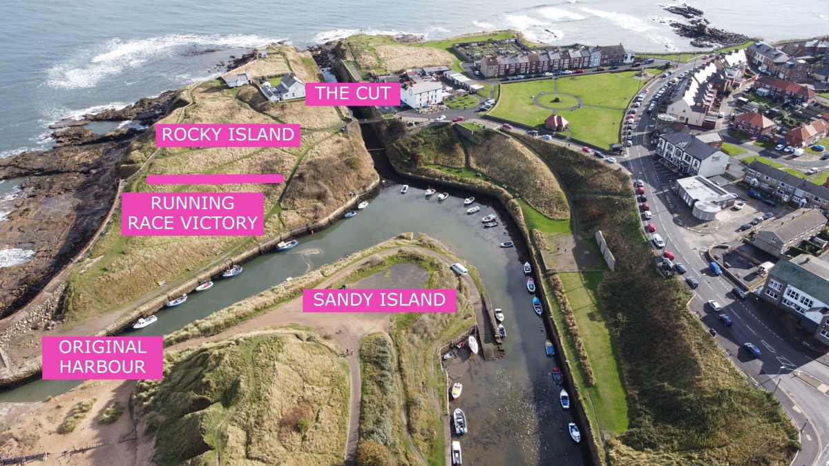
This new cut then separated part of the harbour into a small island called Rocky Island. Across the harbour there was a pile of ballast from ships entering the harbour and this became know as Sandy Island. A little footbridge was built to allow access to Rocky Island from the mainland and is still there now.
So with all that to digest, here is a map of the area with key information.
Although the cut was a great success, there were problems due to navigating its narrow path in stormy weathers with several bows being damaged. According to the Delaval papers, there are numerous accounts of ship repairs due to entering the cut in addition to frequent damage to the piers.
The width of the cut also didn't allow two ships to pass each other, so if a big ship couldn't leave the due to tide or weather, then it would block the other shipping.
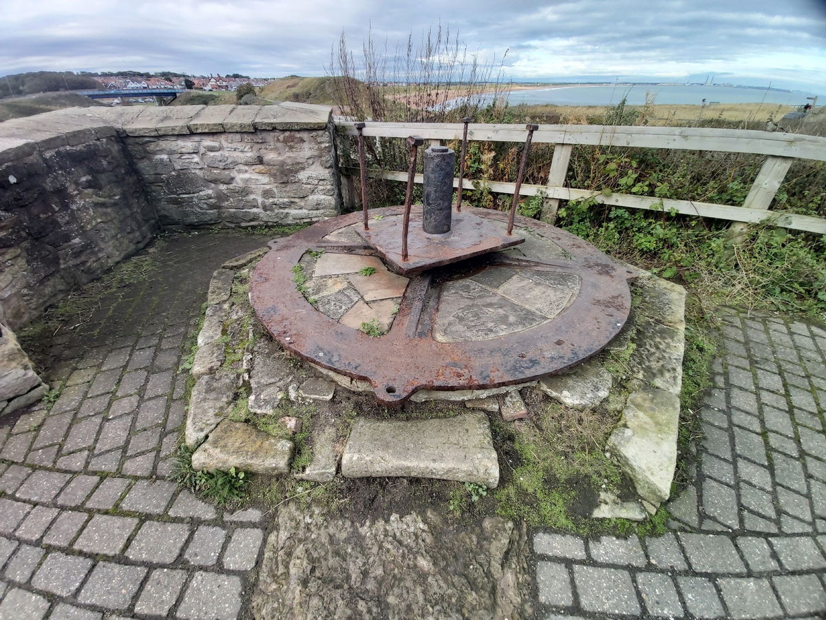
After The Cut was complete, in order to connect Rocky Island to the mainland, a wooden bridge was built. This would have been a swing bridge to allow tall-masted ships to enter the harbour. Below is the cast-iron pivot used to rotate the bridge.
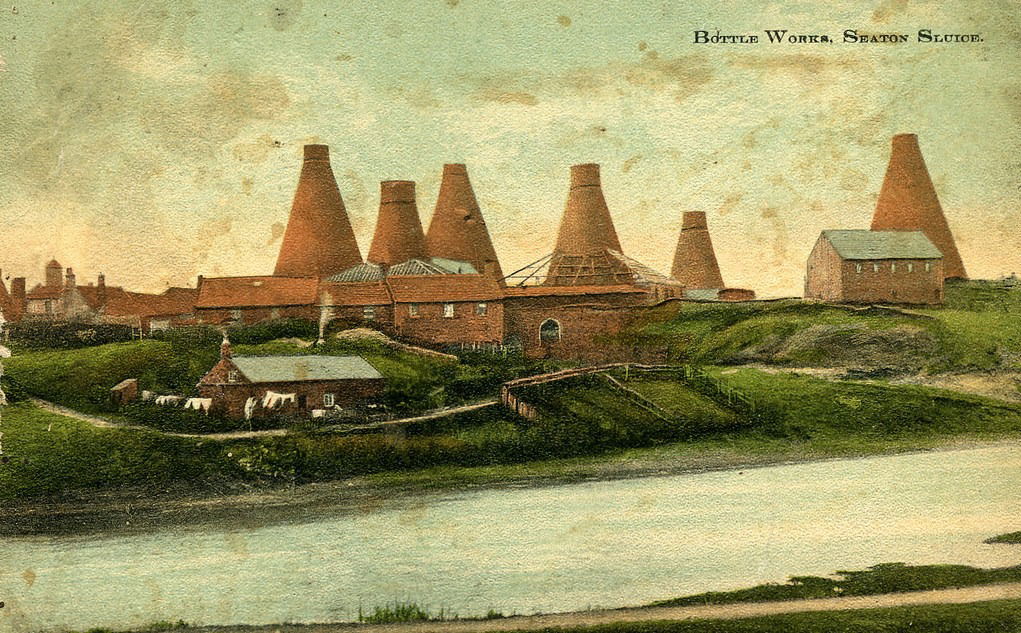
The Delaval family owned at least one coal mine, The Royal Hartley Bottleworks at Seaton Sluice and also the harbour and its success was entirely due to the entrepreneurial and engineering skills of the Delavals.
By the 1770s ships sailed out of the harbour carrying 80,000 tonnes of coal, 300 tons of salt and 1.75 million glass bottles (source - Wikipedia). However in 1798 a new tax put an end to the salt trade.
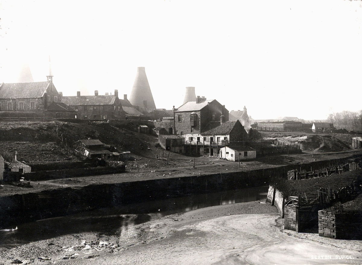
Another Delaval called Thomas Delaval was responsible for the creation of the bottleworks in 1763, occupying the land from the sluice up to the Delaval arms at the top of Earsdon. Thomas also brought in glass blowers from Hanover to teach the local men the glass trade.
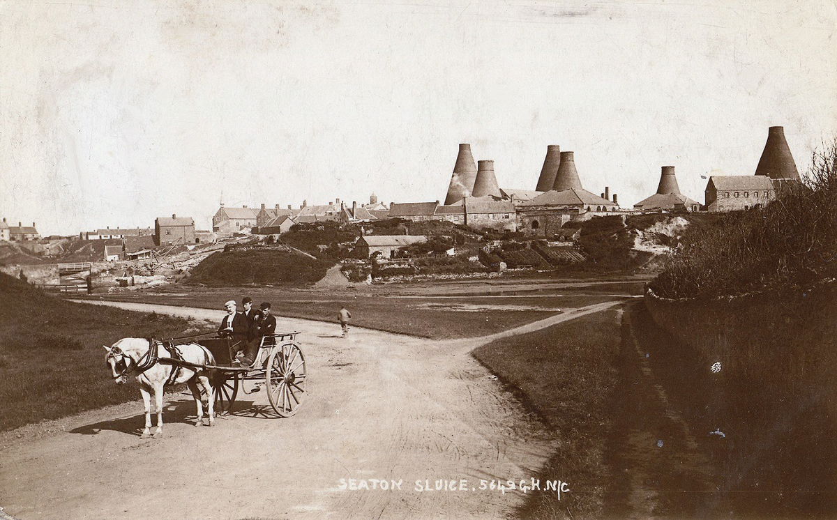
Six huge coned furnaces would have dominated the skyline here and they were all given names - Hartley, Charlotte, Gallaghan, Success, Waterford and Bias. But they were affectionately called The City.
At its peak it included the glass factory (which was the largest in the UK at the time), workers houses, a market place and most important a brewery. Another famous Geordie George Stephenson also chipped in and helped build an underground narrow gauge railway connecting the factory to the warehouse.
There were additional tunnels for connecting the factory to the river banks for slag tipping and another from the warehouse to the harbour for exporting the bottles.
Peak output in the late 18th century was a million bottles a year, however the glass works closed in 1870 with the last cargo of bottles heading for the Channel Islands. Some of the tunnels still survive now, but are currently unavailable to access. They were also used air raid shelters during World War II.
In the mid 19th century competition from larger ports including Blyth and the Tyne made it difficult for Seaton Sluice and they eventually closed down all shipping and the bottleworks. The Hartley pit disaster in 1862 also swiftly ended the coal trade from here.
Big thanks to Billy Embleton for providing the bottleworks photos and additional information.
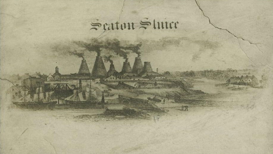
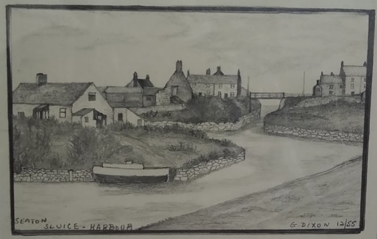
And just to give you an idea of what Seaton Sluice looked like back in the 1950s here is a drawing by my great grandfather-in-law. Those houses situated on Sandy Island and Rocky Island no longer exist as they were demolished in the 1960s.
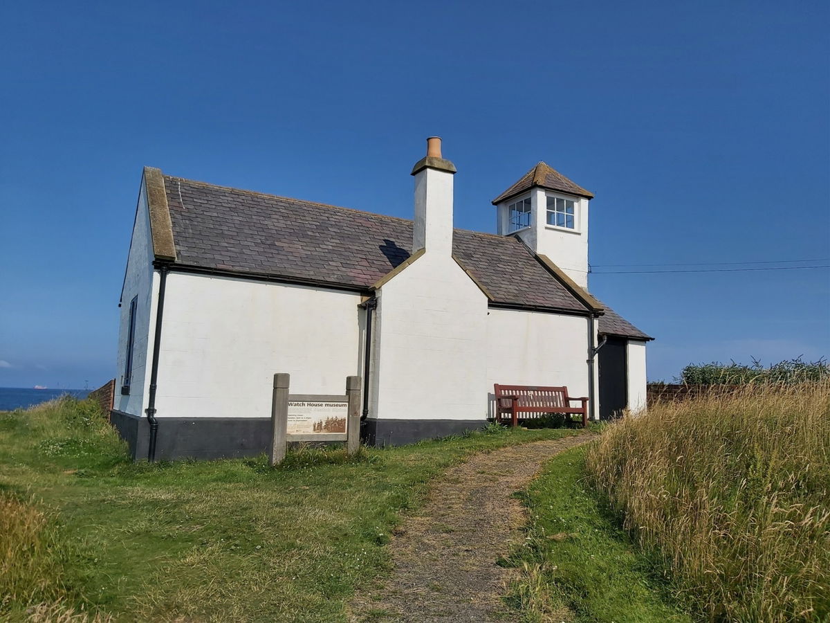
Perched up on Rocky Island you will also find the Watch House museum. Built in 1880 it was a volunteer life-saving company and made many notable rescues from the wrecks on the coast between Blyth and Whitley Bay.
The house served as a lookout, training base and social venue for over 100 years before it eventually closed in 1990.
Just to the right of the cut is The Kings Arms which is the oldest pub in the village. Constructed in the mid-eighteenth century as the overseer's house, it then later became a pub. They do a mean lime cordial!
But if you want a lovely Sunday lunch, then head into the Waterford Arms.
The information outside reads:
Susanna, Marchioness of Waterford and grand-daughter of Lord Delaval by his first marriage, inherited the bottle manufactory, the Copperas Works and the pub site in 1822 on the death of her mother, the scandalous Hussey Delaval, Countess Tyrconnel. The pub was built in 1899 to replace an earlier building and named in commemoration of Susanna..
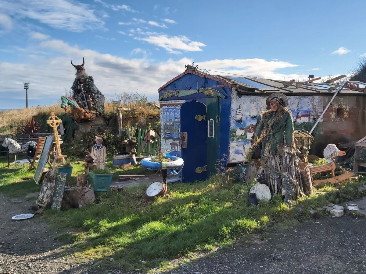
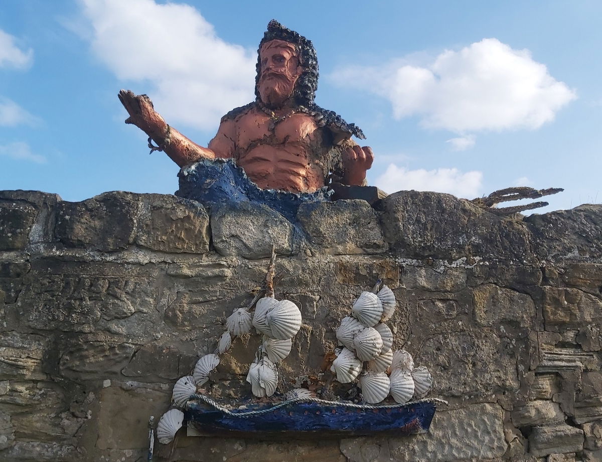
You may have also spied some local artwork around the sluice too by local artist Tom Newstead. Visit his studio behind the Kings Arms and look out for his Shanti Art dotted around nearby.
Visit Tom's website for more information.
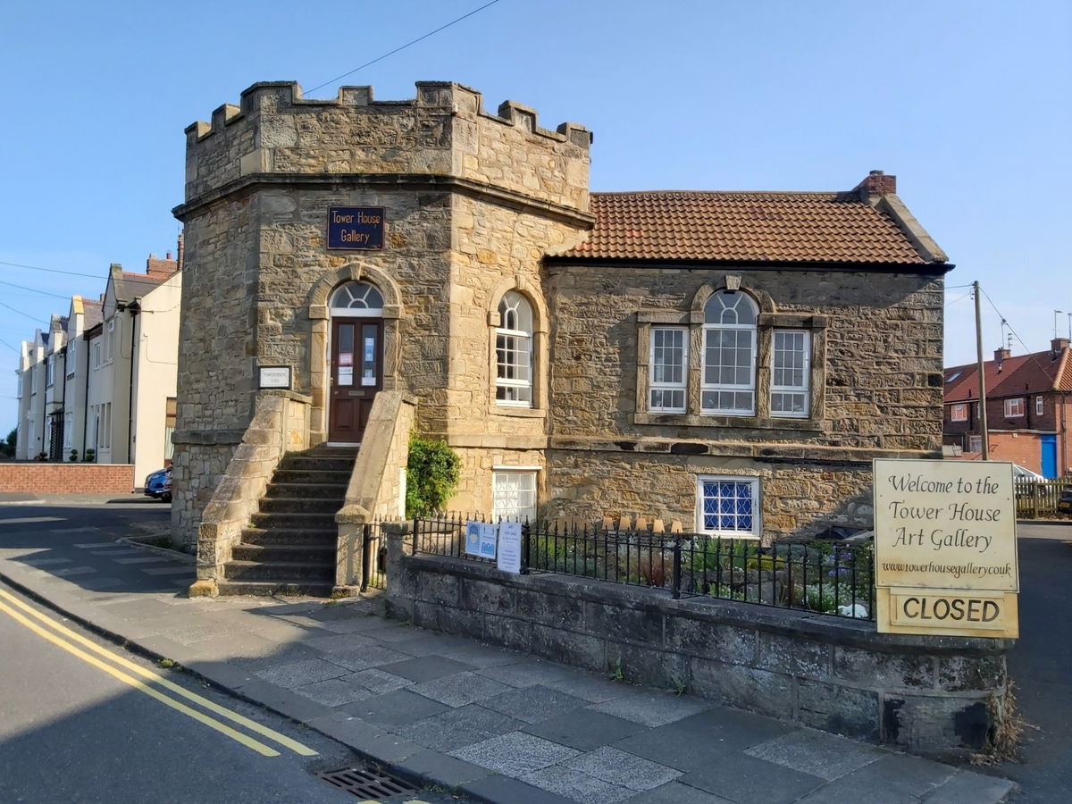
Right next to the harbour and Waterford Arms, is the Tower House or The Octagon. Built around 1720 this small castellated building was initially built as His Majesty's Revenue Office which would levy taxes on the salt and coal cargo leaving the harbour. It's fort like appearance would have been used to protect the large amounts of money stored there. It would later be used as a Harbour Office, then a reading room, but is now a private art gallery. It was rumoured to have been designed by Sir John Vanbrugh, who built Seaton Delaval Hall.
Just around the corner of the sluice, is Collywell Bay and sitting within that is a sandstone pinnacle known as Charlie's Garden (or Charley's Garden). It was named after Charles Dockwray who was a local villager as he cultivated the top of the rock (as you do!).
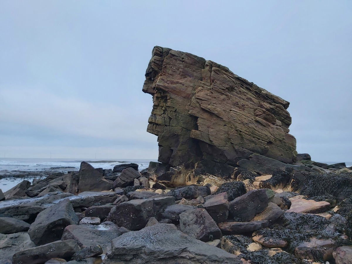
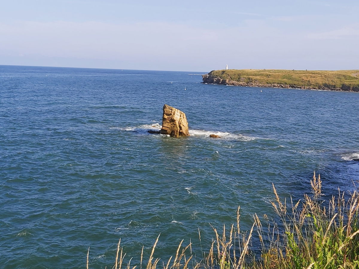
Obviously the rock was originally connected to the mainland before being eroded by the sea. We've created a post with loads more of pictures of Charlie's Garden.
And finally a lovely bit of video history of Seaton Sluice from Paul Appleby.
Get 2 points if you have visited this place. Already visited by 325 VIPs.
Login to bag this placeHow To Find Seaton Sluice
Where To Park For Seaton Sluice?
Loads of parking in the surrounding area.
Contributed by Simon Hawkins
Thanks for checking out this place on the Fabulous North! I do enjoy a wander out in to the countryside trying to find hidden gems that not many people know about. You can't beat a rogue pele tower up a remote hill, a mysterious stone circle or a stunning waterfall secluded in a forest.
More Places from Simon
More Places In Seaton Valley
Find more fabulous places in Seaton Valley, Northumberland and if you know of a place we haven't listed, then let us know.

Seaton Delaval Hall
Estate Seaton Valley NorthumberlandA beautiful grade I listed country house a mile from the coast, packed with glorious history!

Starlight Castle
Tower Seaton Valley NorthumberlandA tiny ruined castle just inland from Seaton Sluice.

Tower House
Building Seaton Valley NorthumberlandA castelled octagonal building in Seaton Sluice that was once a tax office, harbour master house and now a gallery.
More Landscapes
So this landscape wasn't enough and you want more? Don't worry we have you covered.

The Snook
Landscape Holy Island NorthumberlandThe peninsula part of Holy Island, made up of dunes, salt marshes, Snook House and Snook Tower

Hauxley Nature Reserve
Landscape Amble NorthumberlandA nature reserve at the northern end of Druridge Bay and one of the best wildlife spots in the north east.

Hepple Wilds
Landscape Harbottle NorthumberlandGuided tours of a rewilding project on the Hepple Estate with links to Hepple Gin.
Find Walks To Seaton Sluice
Find which walks will visit Seaton Sluice and plan your next adventure.

Seaton Sluice And Holywell Dene
9km (6 miles) Seaton Valley NorthumberlandCircular walk starting from Seaton Sluice, following Holywell Dene to Holywell Pond then onto the waggonways, before returning via the Avenue.
Never Miss A Fabulous Place
If you are afraid of missing out on all the fabulous places we post, or just want to be the first to know, then sign up to the Fabulous North.
Each week we will email you all the brand new places that we visit.
Sign Up To Alerts

Find Us On Facebook
We post all our new places daily on our Facebook Groups page, so join the group today and be notified when we add a new place.
Join Our Facebook GroupSeaton Sluice was listed in Landscape // Northumberland // Seaton Valley