Low Burnhall. Walk
Durham, County Durham
An uplifting perambulation of 168 acres with natural joy, and a dozen or so elements to arouse curiosity.
Distance - 5km (3 miles)
Ascent - 104m
Duration - Approx 1 hour
Terrain - Limestone grit and grass paths.
Parking - There is free parking at entrance to the site. View Parking Map
View Route On OS Map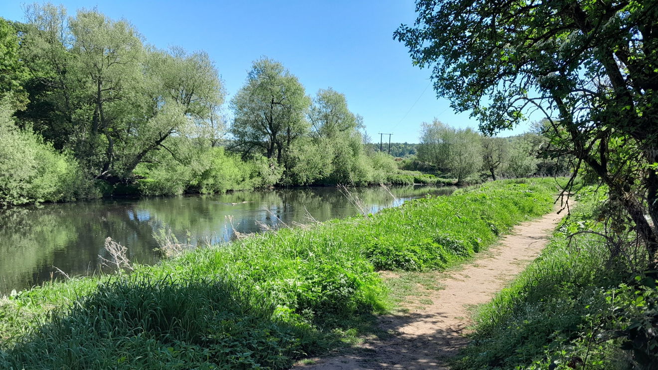
Spoiler alert! Although this area is managed by The Woodland Trust, Low Burnhall is not all mature woodland, yet. This is a relatively new nature reserve with many well-maintained paths, which are quite wide, so you feel like you are in theopen. I suggest taking a photo of the reserve map on the notice board near the carpark.
I chose this route to take in most of the sculptures/installations, and visited in theSpring, especially since it was dry.
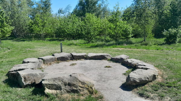
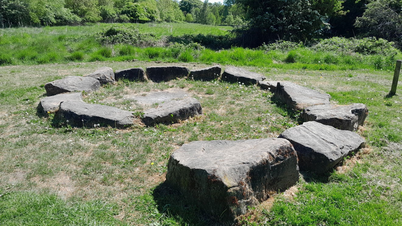
I took a lime path lined with the beautiful May blossom. My first expectation for the first installation was for a Stonehenge-type structure, as it is called Stone Circle. It was, in reality, low stone boulders that I guess encourage a posse to sit around and tell tales of folklore.
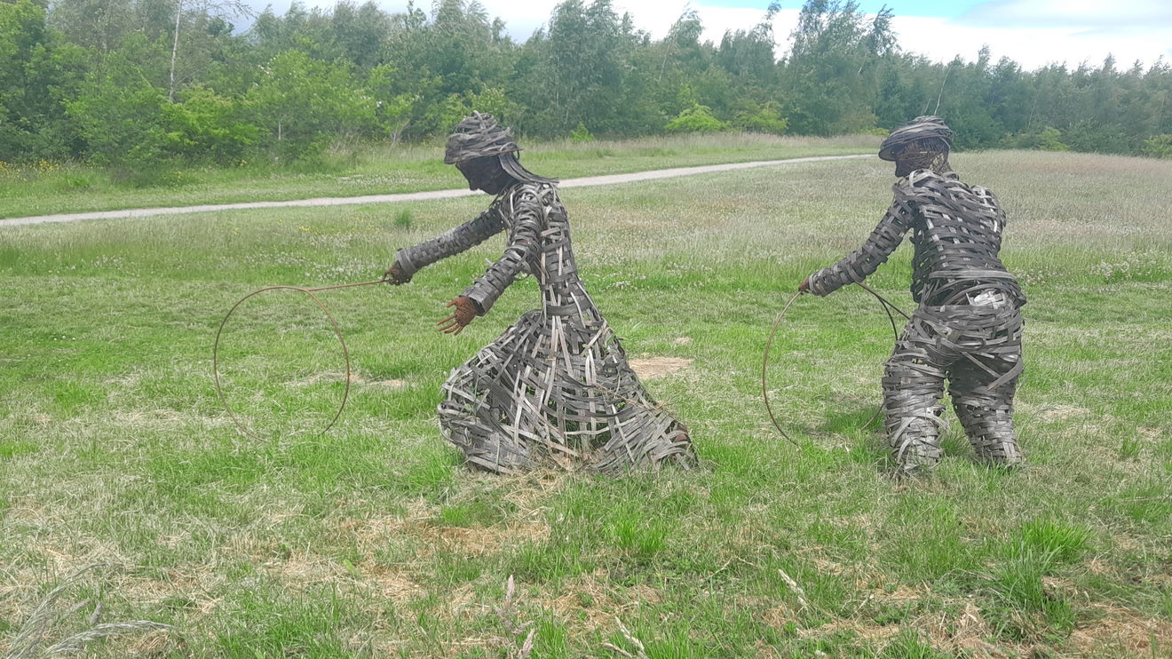
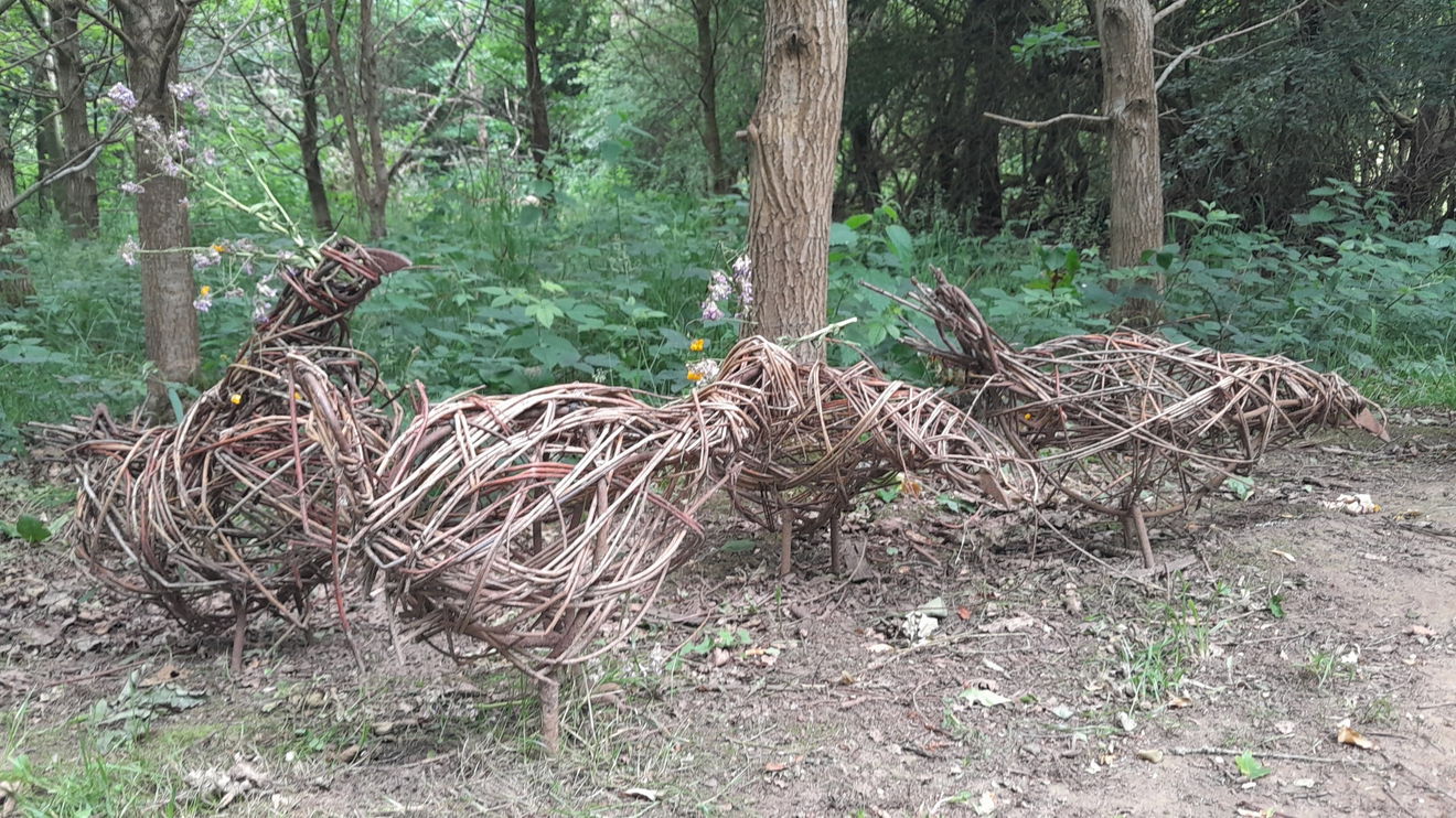
Continuing on, it wasn't far till I glimpsed the Wicker Miners' children silhouetted against the backdrop of Croxdale and Hett Civil Parish. The Wicker children playing hoops are tall for their age.
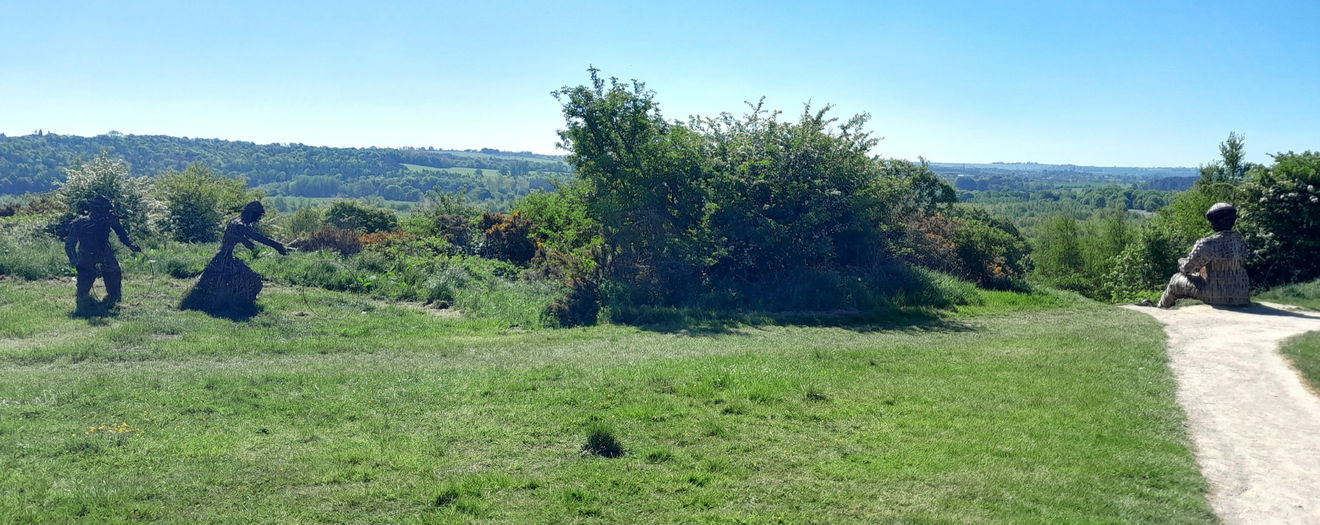
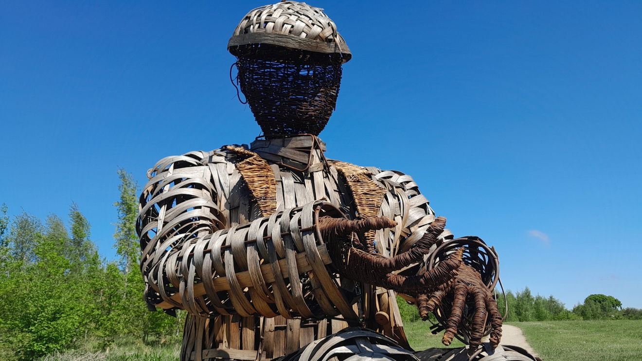
Nearby, the Wicker Miner is enjoying the view. His jacket buttons give us a subtle idea of the artist.
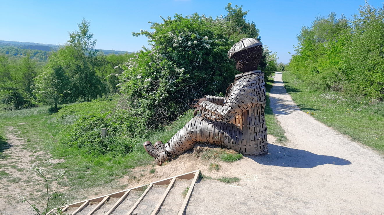
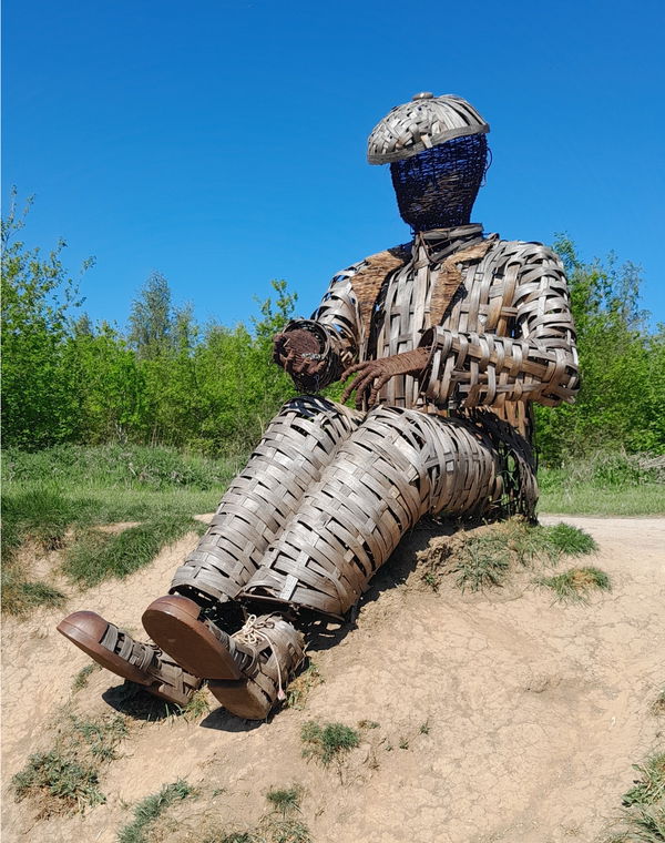
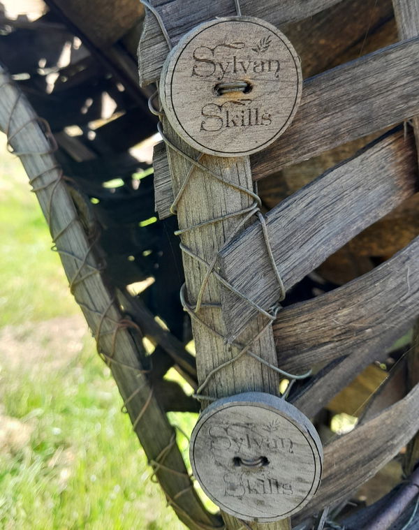
Created by Ruth Thompson and Anna Turnbull under the name Sylvan Skills.
George the miner sits overlooking the River Wear near Durham. Commissioned by the Woodland Trust, he was constructed from oak strips on a metal frame for strength and durability. It's a fabulous feeling to know how many people love him; we see his photo popping up on social media frequently, and the local running club have adopted him as a mascot! Working in partnership with Anna Turnbull (Biteabout Arts), it took us four days to complete him in-situ.
Sylvan Skills
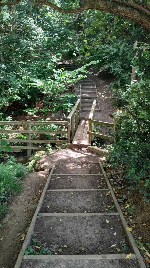
Take the steps down beside George and head south until a left turn, which will lead you north-east. It feels like you are heading back in the direction you came from. However, you swing around right to an area of juvenile trees, and even go through a bit of it. I managed to end up in a nice clover field and went to the end and turned right, where I went to investigate Saltwell Gill. This unfortunately has the record for Top of the Poops when I researched about it, as much sewage had been discharged into it. I can say it didn't look or smell of effluence.
The footbridge leads on to Pinnock Hill, which is featured in the 4 hillocks and a Ridge Walk Outside Durham.
Turn back and head left and south, which swoops around and then back up to a Stone Spiral. I'm not sure you would call it spiral if asked what it was without knowing. Most likely, give a nod to Alan Shearer and the wearing of the number 9 shirt!
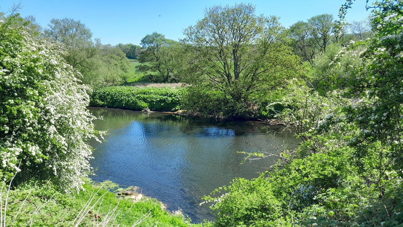
With your back to the stone spiral, take the route on the right heading south and to the River Wear. You don't see the river for a stretch, but there are glimpses. You will be following this for a while. There is only one tricky bit where you see a gate, but don't go through it, instead follow the river, enjoying the vistas.
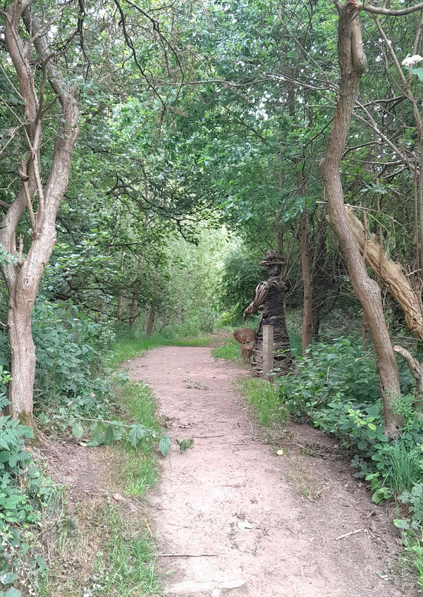
As you get to the south east corner of Low Burnhall Woods, you should see a wicker lady attending her chucks.
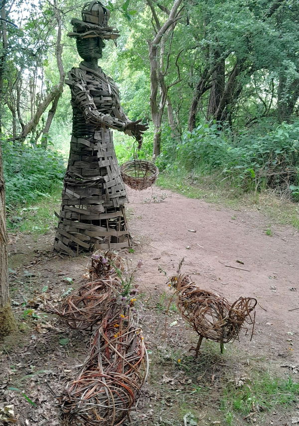
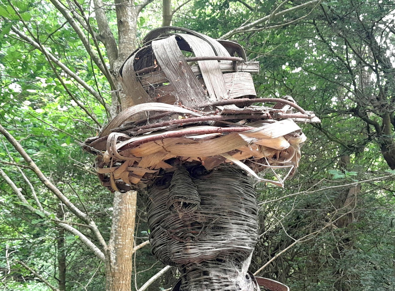
This is the Wicker Miner's Wife, and she has lived here since 2012. She is a tall lady of 15 feet and created by Sylvan Skills and Biteabout Arts. There are several styles and techniques in her creation, using willow, oak, holly, and blackthorn. It was completed over a two-week period by Ruth and Anna. Be sure to look into her eyes, and what do you see? Cleverly made eh!
She has not yet collected the eggs laid by her 4 hens.
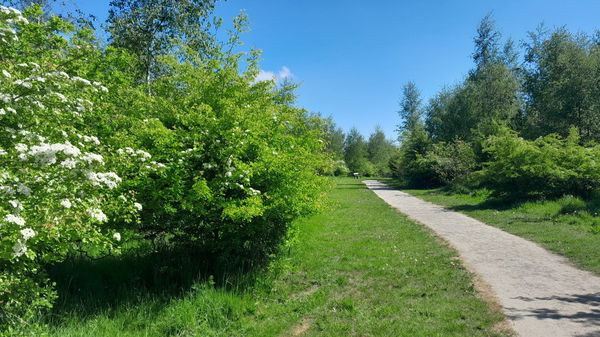
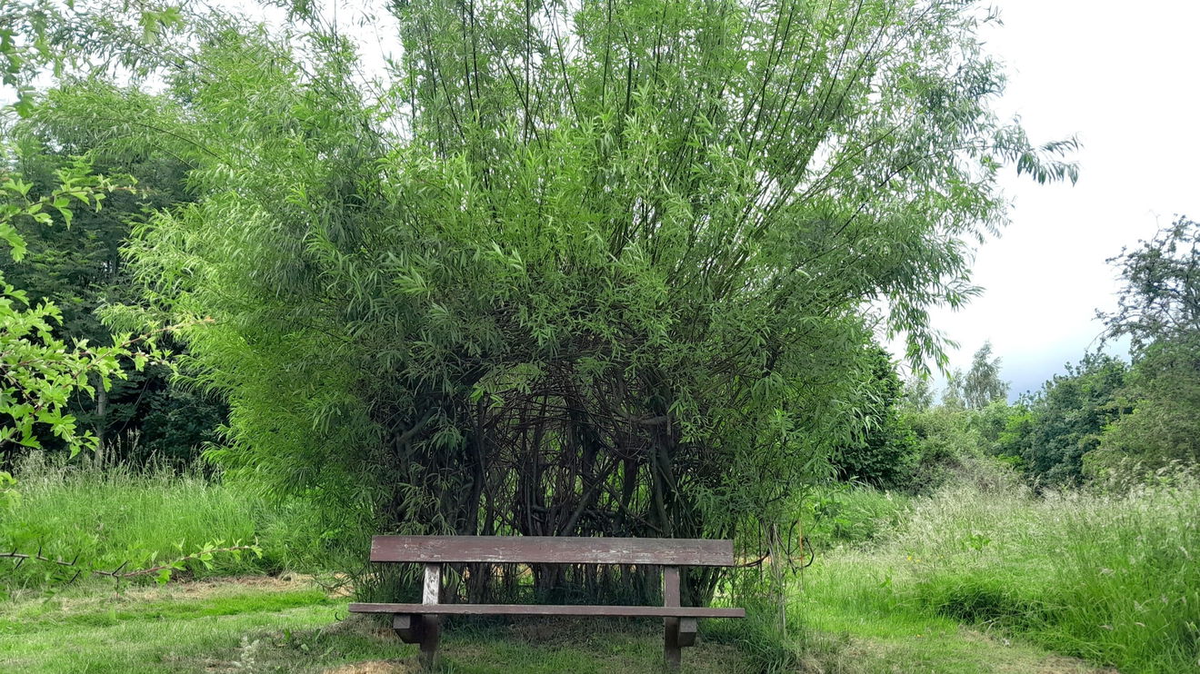
I turn back and head left/west, which is the right-hand path in the photo. We're off to the Willow Arbour.
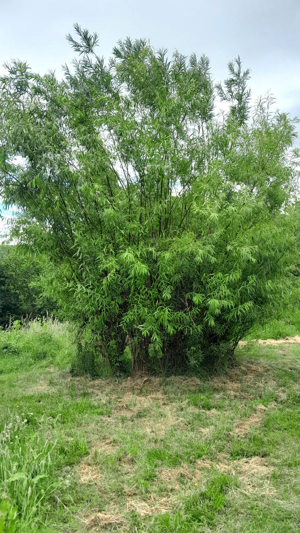
As I was the happy wanderer, it got me thinking about the use of willow here, and I thought it was not naturally growing here, when I came across a Willow bush/tree. Without knowing, you can easily dismiss this as just a tree, but there is a bench around the other side, and voilà, an arbour!
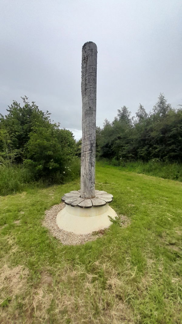
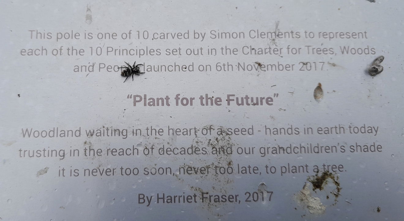
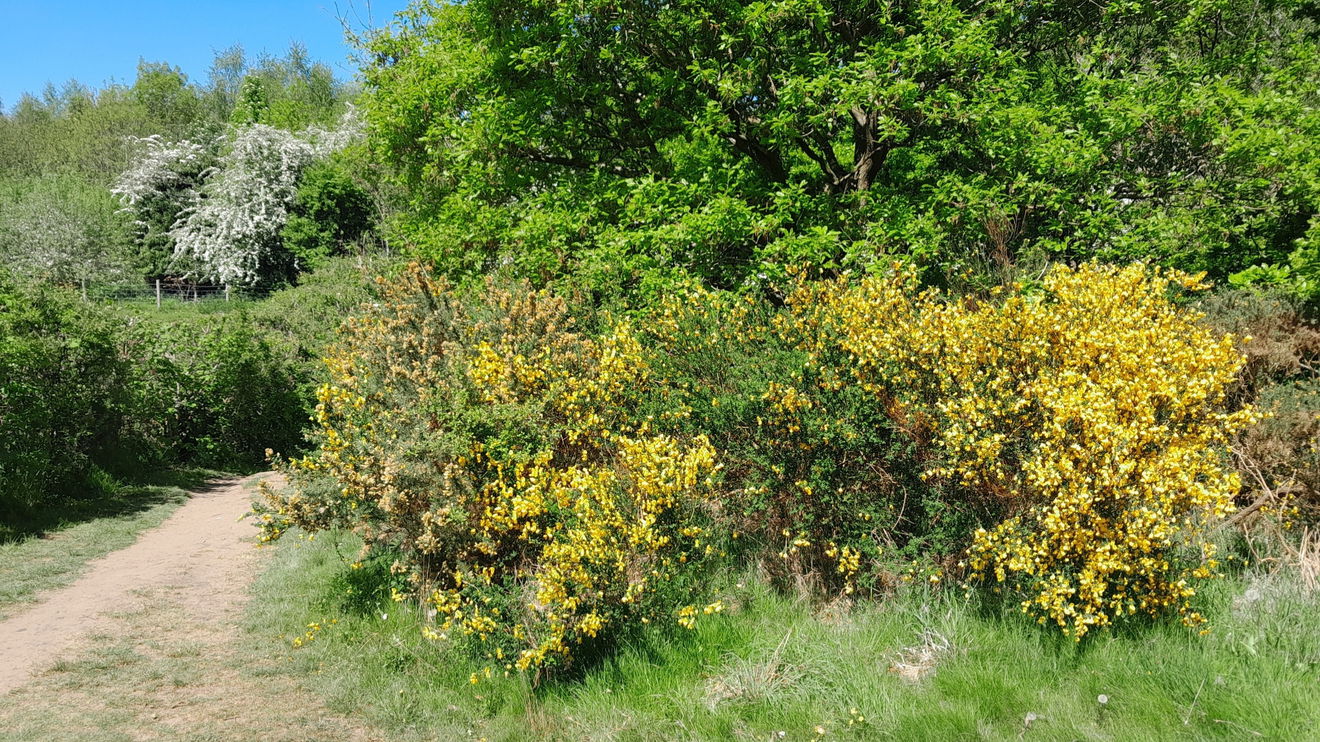
Continuing westerly, I came upon the next structure, which reminded me of a sink plunger! It is called Plant for the Future. The metal plate gave details while a spider posed.
Then head North East to the observation point (as it states on the map), or for many, a bird hide.
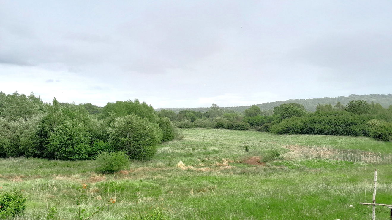
It has started to drizzle, so I snuck inside and had a lovely 10 minutes watching the light rain come down against a background of verdant trees. The main vista was over pleasing marshland. The only bird I saw was a stonechat. Back to the walk and with your back to the hide, take a northerly direction or the 2 o'clock path.
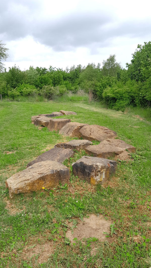
I was heading for the Stepping Stones, which looked like a giant mythological snake awaiting a suspect.
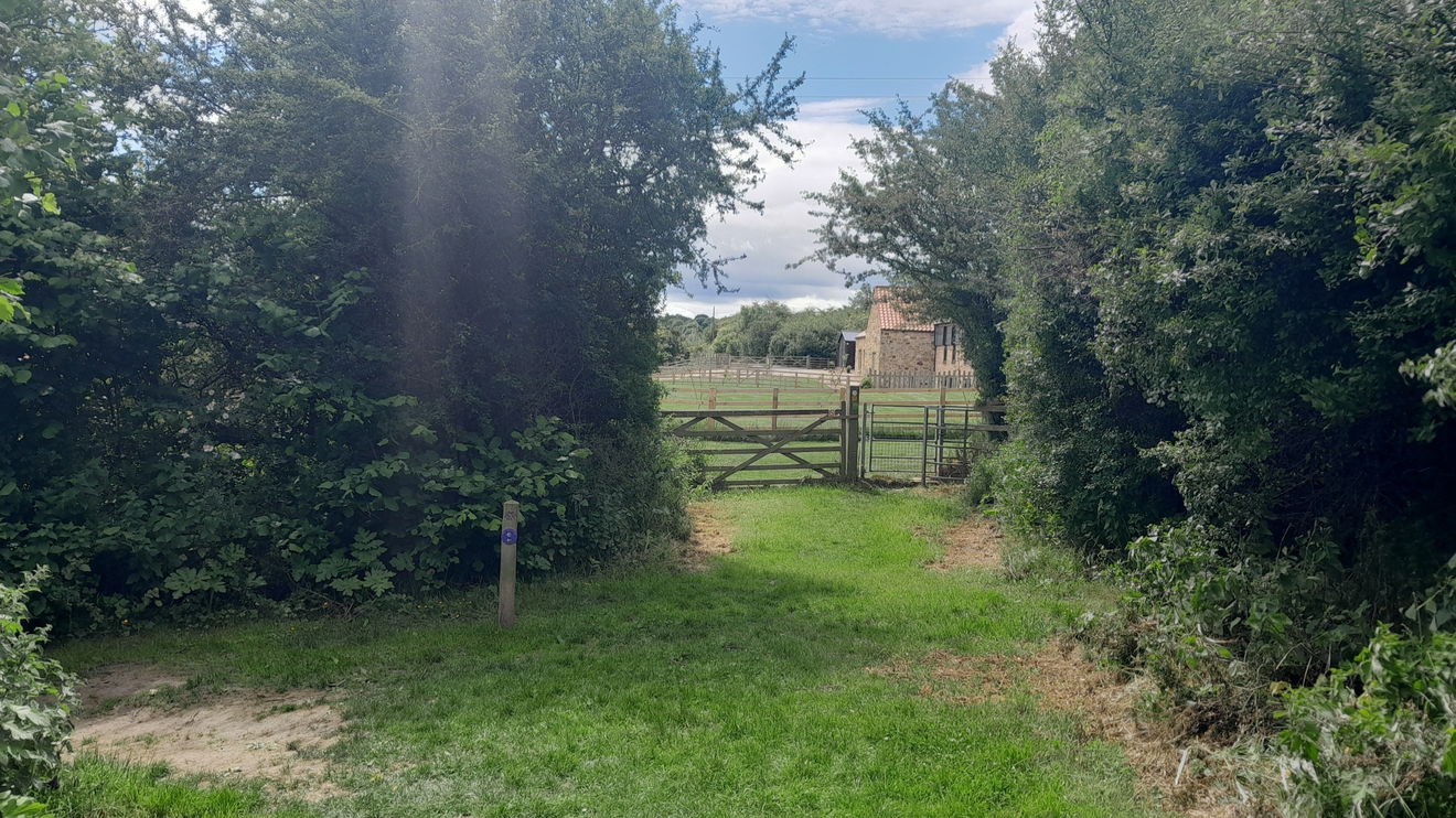
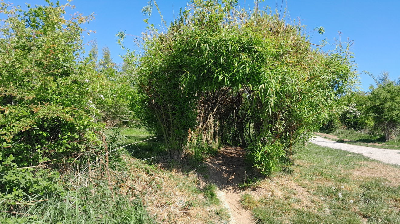
It is then to the left/northwest direction crossing over the tarmac lane, and choosing your pathway to the Willow Tunnel. You go under the high-voltage electricnetwork. To make it easier for myself, I opted to keep closer to the A167 and then take the path on the right by the kissing gate.
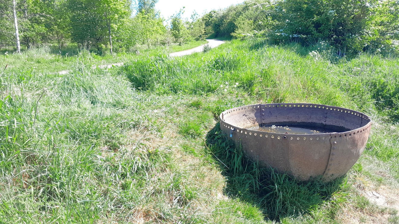
As I got there, I didn't spot the Willow Tunnel at first because I saw what I believe is a cast iron Boiler End, probably left/found from industry in the 19th century. Croxdale Coal Pit was in the area back then. Take a look at the riveted plate technology. It may have been more recently used as a cattle feeder/water trough.
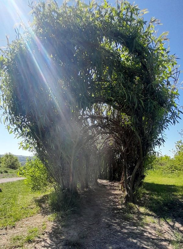
Of course, it's a must to go through the tunnel and I had a beam of sunlight too.
Low Burnhall sits between the 17th-century Croxdale Hall, the seat of the Salvin family, and Burn Hall, which dates from 1834 and was also once owned by the same family. The woodland was part of the Burn Hall Estate until 1926, when the hall was sold to a Roman Catholic mission. The land was then used for a variety of industries and some areas were used for agriculture. We bought Low Burnhall Farm at auction in 2008. Over two years, we planted almost 95,000 native trees across 61 hectares of the site. This buffers and extends the existing ancient woodland.
The Woodland Trust
It's then a head north and back to thecar park.
Nearby is The Story at Mount Oswald, where there is free parking, free admission to the museum, and facilities including toilets and a café.
Where to Park For Low Burnhall Nature Reserve
Where To Park For Low Burnhall Nature Reserve?
What three words
There is free parking at entrance to the site.
Contributed by Rosalind Parker
Thank you for reading. I hope it sparks your interest. It’s always a pleasure to get out and explore, whatever the weather. I enjoy uncovering little snippets of information, especially when they’re obscure, amusing, or meaningful. All photos were taken on a mobile phone.
More Walks from Rosalind
More Places In Durham
Find more fabulous places in Durham, County Durham and if you know of a place we haven't listed, then let us know.

Heritage Blues (The Pitman)
Statue Durham County DurhamA Miner kneeling testing the air with his safety lamp, by Ray Lonsdale.
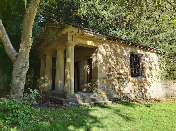
The Count's House
Building Durham County DurhamA Grecian style summerhouse on the banks of the River Wear named after a Polish entertainer.
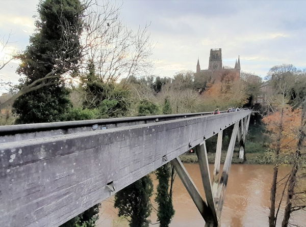
Kingsgate Footbridge
Bridge Durham County DurhamModernist footbridge completed without using scaffolding in 1963

Find Us On Facebook
We post all our new places daily on our Facebook Groups page, so join the group today and be notified when we add a new place.
Join Our Facebook Group