Blackhall Rocks
Landscape In Hartlepool, County Durham
Dramatic landscape and panoramic views of the coast. Stone art with science, history and mythology.
Love this place? Become its champion with a short message, memory, dedication, or local business mention and share your connection to somewhere special.
Support the Fabulous North and champion this place for:
Usually £10
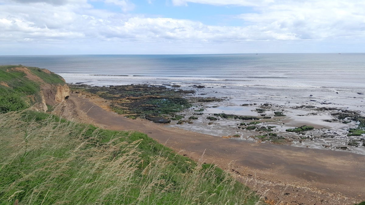
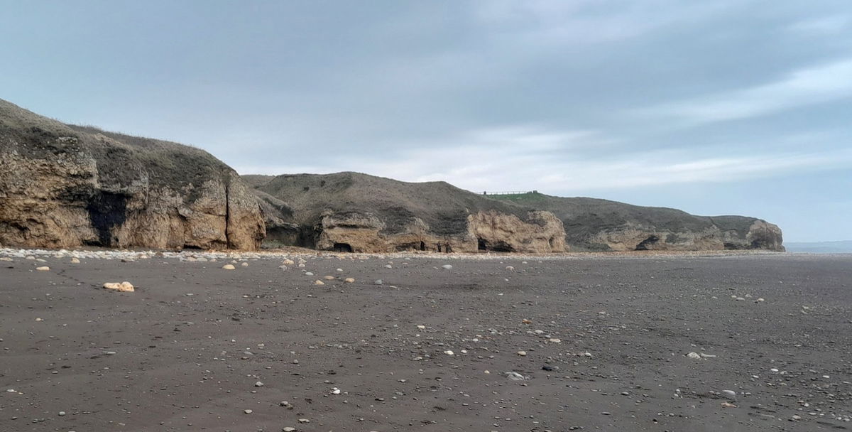
If you frequent the coast up north, visit Blackhall Rocks near Hartlepool which is packed full of history.
This part of the coast like Blast Beach, Easington, and Horden suffered from vast amounts of coal spoil being tipped over the Magnesian Limestone cliffs. Thanks to the Turning the Tide (TTT) project it is now a haven of flora and fauna, both on the coast and in the sea. The project started in 1997 and was completed in 2002. The photo shows who championed it. TTT involved clearing up the coastline by removing vast amounts of coal waste, regenerating areas by giving them back to nature, and making a coastal heritage path.

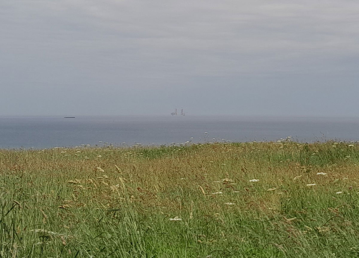
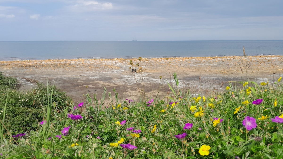
In July 2023 on the horizon, there was a super huge vessel. This is the 'Voltaire' which is a jack-up ship for a windfarm at Doggers Bank, 80 miles out towards German and Dutch Waters.
Much of the information here I gathered from wonderful enlightening conversations with geologist, historian, and the artist in residence Hedley Mason (more to follow) which I am grateful for his sharing.
I set off from the carpark in a south-easterly direction to walk along the Heritage Coast, which 92% of the country's Magnesian limestone is in the northeast and especially County Durham, so, yes it is special. The cliff area is not salty and there is little or no soil. How do you know it's not salty? Because halophytes (plants that grow in salty conditions) are not growing.
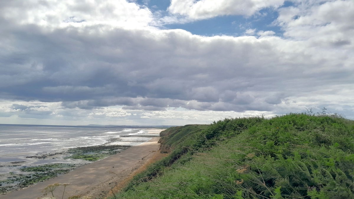
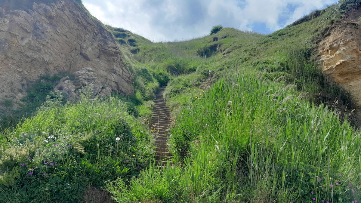
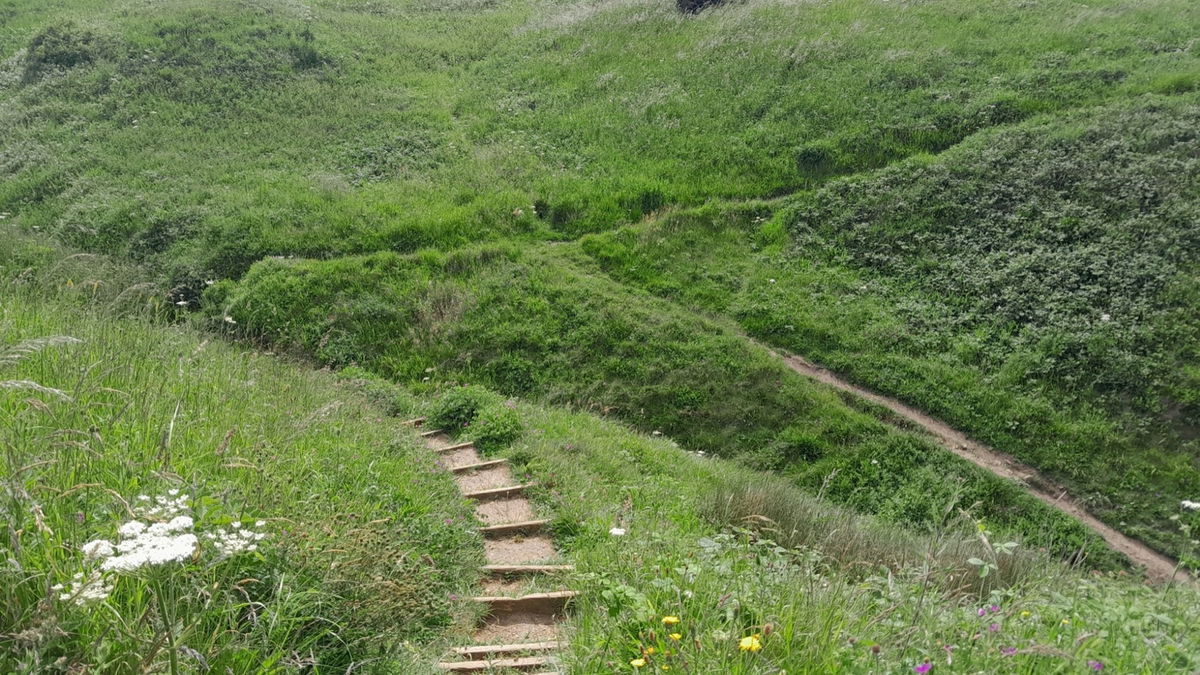
You may hear and or see a train nearby. The coastal railway line was completed in 1905 after some spectacular viaducts were erected over the Denes at Castle Eden and Hawthorn. I followed stone steps down to the beach. It was a pleasing vista looking back up at them.
This history starts with the lead mining in the 18th Century Hedley Mason has been in one of the tunnels and says it curves as they follow the vein of the lead.
There are rumours the cave tunnels could lead to Hardwick Hall (not the one in Derbyshire) 1½ miles away, but the tunnel has now collapsed and so it is unverified. Hedley also said the tunnel was going the wrong way for Hardwick Hall and sloped downwards, and there would not have been much air.
Another old wives tale is that smuggling and fishing activities used the chambers. Breathing may have been a problem with tides flooding the caves though.
Today this part of the beach has the badge for the largest caves along this coast.
There are postcards from Victorian times as Blackhall Rocks beach was a mini tourist resort.
Blackhall Colliery was nearby and was one of 4 collieries, the others being, Horden, Easington and Dawdon. The first mine was sunk here in 1909.
Blackhall Colliery got its name from a nearby farm. A tenuous link suggested that the owner of the Colliery was Daniel Hall and because coal was black they named it Blackhall. Certainly, parts of the beach and rocks are black.
There were huts, and bell tents along the back of the beach under the cliffs, especially during the depressions of the 1920's and 1930's. this included pit sinkers, miners, fishermen, and those destitute.
There was a food source here of shellfish and in the Denes rabbits and deer. There are also indications of shelters made in the caves.

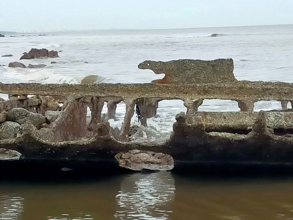
I have Kaz Harrison to thank for pointing out the shipwreck that can be seen at certain times. Kaz said
"Kasko was a steel, 628 ton, two-masted, Swedish-registered steamship and in February 1920 while en-route from Gothenburg to the Tees in thick-fog and heavy seas it was stranded on Black Hall Rocks. The crew took to a boat and reached the shore safely but, despite repeated efforts to pull the ship clear, it stayed fast on the rocks and eventually broke up. It lies in pieces in shallow water at NZ475389 and parts of the boiler and some ribs can often be seen. [Mostly from Ron Young's "The Comprehensive Guide to Shipwrecks of the North East Coast Vol 2" 2001 ISBN 0 7524 1750 9]"
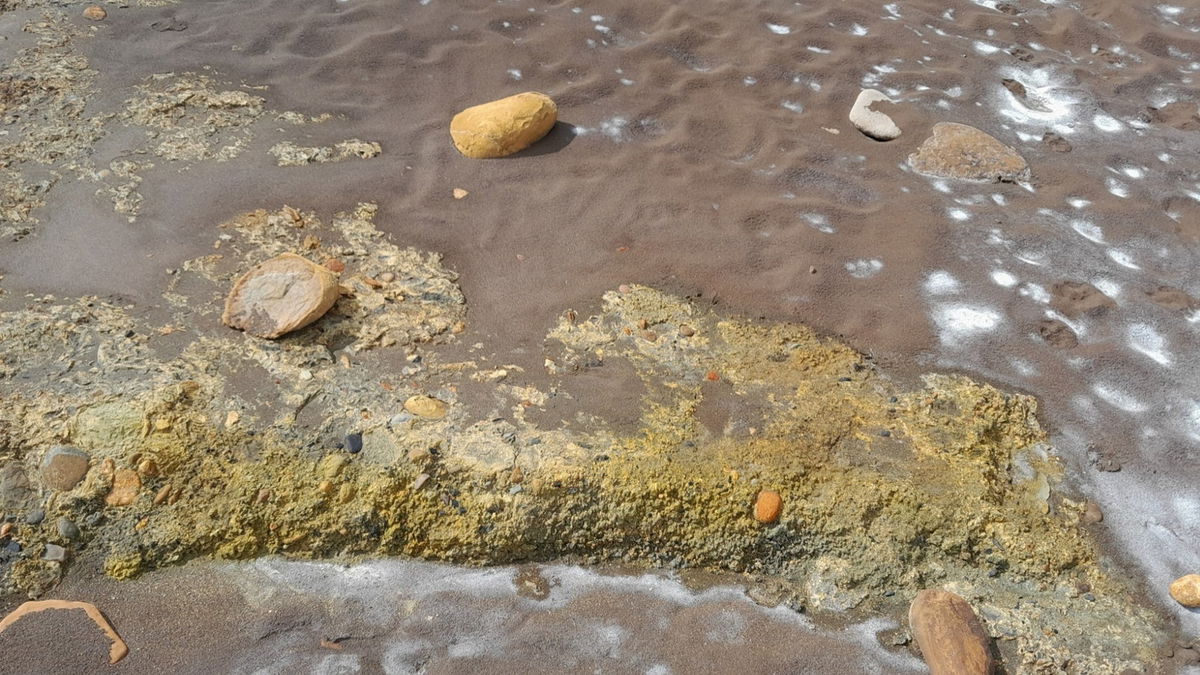
As you walk along the beach there are salt and iron deposits. The yellow stuff is iron sulphate from pyrite as it breaks down. So yes, you may get the whiff of rotten eggs.
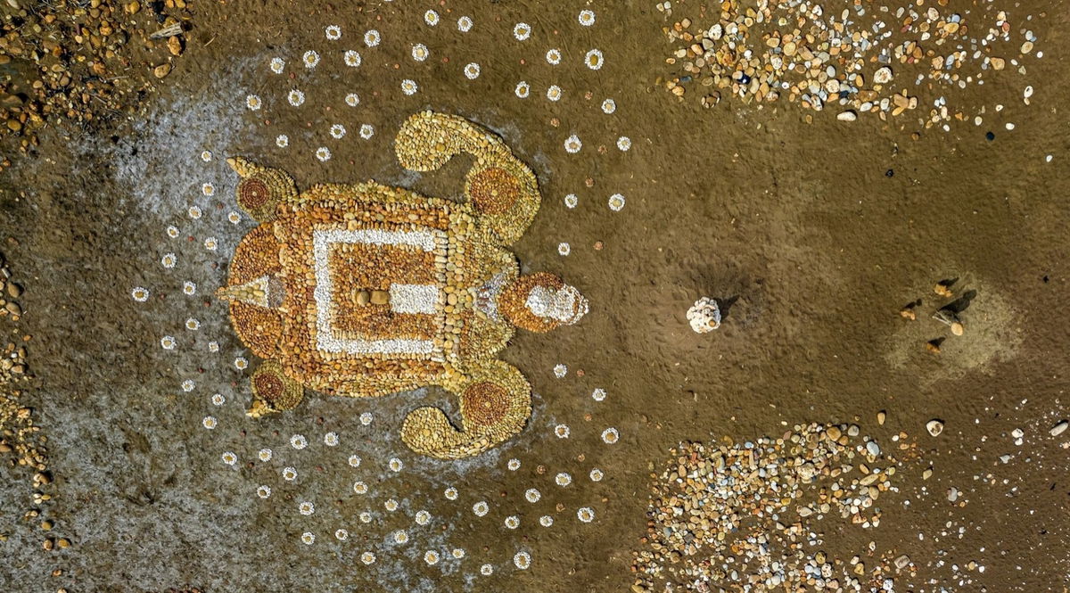
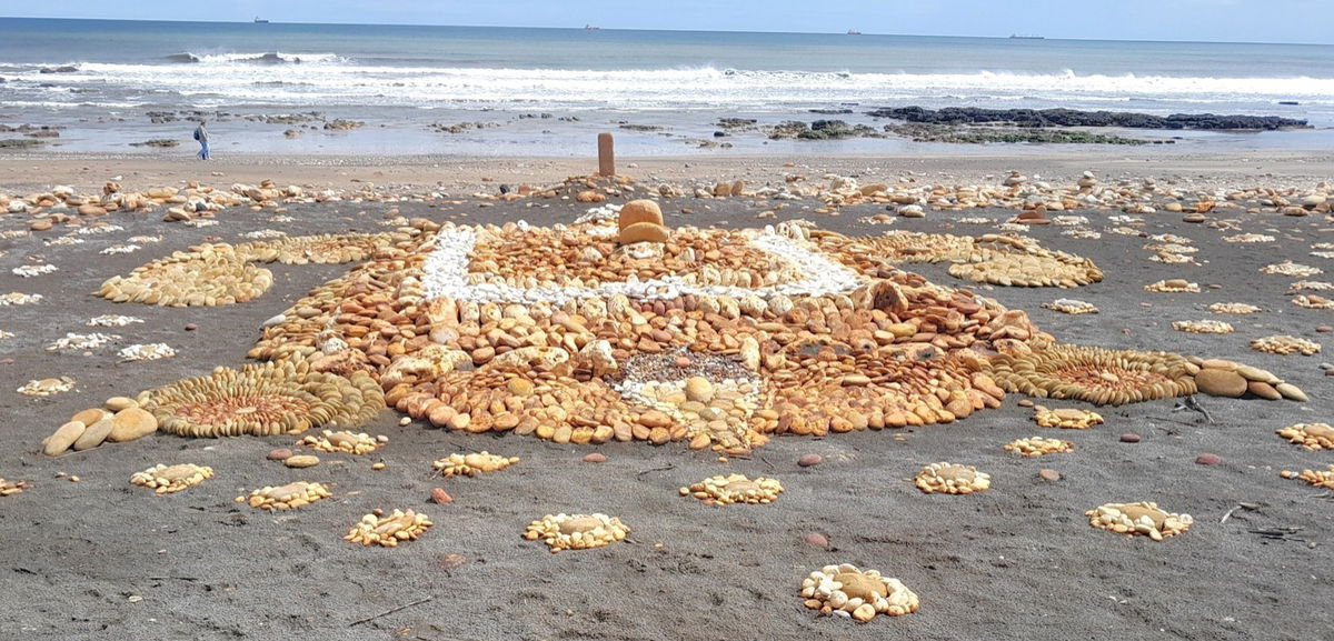
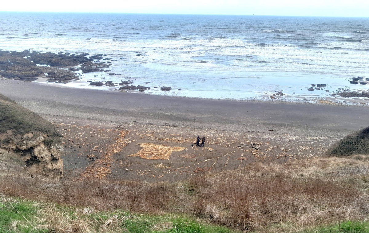
In 2023, there was Tommy the Turtle/Kells stone art. This was the work of artist-in-residence Hedley Mason. It is a creation involving science, history, commemoration, thought provocation, surrealism, and a lot of stone shifting!

The work started here around 2020 where the first layer is buried which is a Keltic /Anglo-Saxon habit. Hedley then created this work which he originally called Kells due to Keltic connections. There was Salvador Dali inspired surrealism of different layers in this case a further 3 squared-off tiers above the sand. The round swirling stones laid at angles on the flippers are a nod to the book of Kells.
To some, there is a Greenman on the tail (photo courtesy of Hedley Mason).
Part of the later work is for King Charles, look for the E going to a C. The overhead shot is courtesy of Hedley.
The whole project is also an experiment/demonstration of tidal and coastal protection.
There is knobbly (Hedley's technical term) bolder flint used and Hedley specifically used this to demonstrate how it can help coastal defenses against erosion. Watch on a high tide.
Why do we need it? Well, Mr Mason explained the nearby marshes are being eroded by an alarming rate. You can see from google earth the marshland was approximately 55 meters back from the Pit Ledge, now in 2023, it is approximately 35 meters. The marshland is so important as it is a great carbon dioxide sequester.
When I asked Hedley about the tide reshaping his work, he said this was the best bit for him, watching it reform. The patterns that can form as in whirlpools around the rocks are fascinating to watch. This Happened over the Autumn of 2023.
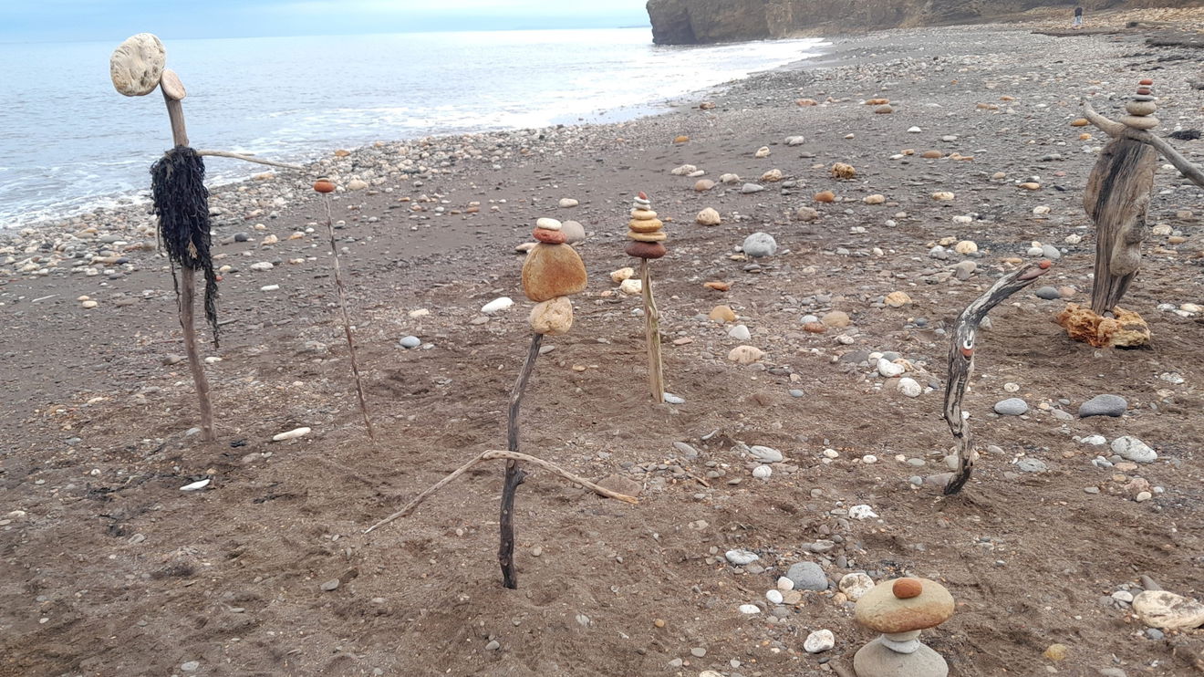
Hedley was back with some new creations in November 2024. These characters were all part of a Samhain festival. Look up the creative myth on Facebook called Caer's of Castle Ioden by Hedley Mason
You will come to a point called Deadmans Bank which has steps and a slope up/down to/from the beach. As there were a lot of shipwrecks, it is believed this is where the bodies were brought ashore to go to the close by mortuary.
The arrow points to the north.
The 1971 film 'Get Carter had the final scene shot here. A gritty drama up there with the best. It stars Michael Caine and is based on the One Armed Bandit Murder which happened at South Hetton. There are no signs of the flights (buckets on the conveyor) now.
Some of the waste on the beach could be attributed to the trucks that used to drive right into the water for labourers to reclaim coal that could be burnt. Hedley said amongst others (iron and steel works) it was sold to the power stations of which Horden had one.
Unfortunately, there had been a hobby of dumping vehicles in the low tide. In 2019 one 4x4 had a tank of diesel which killed a lot of the marine life around. It took the persistence of several people to get it removed. Local and county councils tried to pin the responsibility on the Crown Estates who said they only manage the gap between mean low tide and mean high tide. The 4x4 was outside this!
This beach runs northwest/southeast and makes it an excellent destination for watching the Aurora Borealis as there is less light pollution here. I have no photos yet, so watch this space!
I made my way to Blue House Gill and up some steep steps with no handrail. The gill was a verdant sea.
Durham Wildlife Trust has a reserve around here.
You are now heading in the direction back to the carpark. I chose to follow along the cliff top and marveled at the range of wildfowers all in their summer glory.
There are some more steps just off the beaten track which I couldn't resist.
Here is Tommy the Turtle from above in the Summer of 2023.
Please check tide times as you will need low tide to do this as a round walk, or to go in the caves.
Due to coastal erosion take great care if you choose to go down or up the stone steps.
You can stay at the top and admire the view and walk along the heritage footpath.
Get 2 points if you have visited this place. Already visited by 125 VIPs.
Login to bag this placeHow To Find Blackhall Rocks
Where Is Blackhall Rocks?
Lat / Long
54.746618, -1.271604
What three words
Where To Park For Blackhall Rocks?
Lat / Long
54.741551, -1.269455
What three words
Free parking onsite.
Contributed by Rosalind Parker
Thank you for reading. I hope it sparks your interest. It’s always a pleasure to get out and explore, whatever the weather. I enjoy uncovering little snippets of information, especially when they’re obscure, amusing, or meaningful. All photos were taken on a mobile phone.
More Places from Rosalind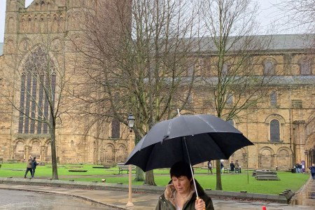
More Places In Hartlepool
Find more fabulous places in Hartlepool, County Durham and if you know of a place we haven't listed, then let us know.

Andy Capp Statue
Statue Hartlepool County DurhamFigure of newspaper cartoon character Andy Capp cast in bronze.

Steetley Pier
Landmark Hartlepool County DurhamA 2,000 foot long pier built in the 1960's to pipe sea water for the magnesia treatment works.

The National Museum Of The Royal Navy Hartlepool
Museum Hartlepool County DurhamAll that would have been dock life around the 18th century and complete with one of The Admiralties Frigates, The HMS Trincomalee.
More Landscapes
So this landscape wasn't enough and you want more? Don't worry we have you covered.

Gosforth Nature Reserve
Landscape Gosforth Tyne And WearA nature reserve set within Gosforth Park where you can see birds, otters, deer and much more.

Torness Nuclear Power Station Walkway
Landscape Dunbar BordersAn unusual two story concrete walkway that runs around the perimeter of Torness Nuclear Power Station and includes a fenced off pier.

Northumberland Park
Landscape Tynemouth Tyne And WearA traditional Victorian Park packed with features sitting between Tynemouth and North Shields.
Never Miss A Fabulous Place
If you are afraid of missing out on all the fabulous places we post, or just want to be the first to know, then sign up to the Fabulous North.
Each week we will email you all the brand new places that we visit.
Sign Up To Alerts

Find Us On Facebook
We post all our new places daily on our Facebook Groups page, so join the group today and be notified when we add a new place.
Join Our Facebook GroupBlackhall Rocks was listed in Landscape // County Durham // Hartlepool